Experience suggests it doesn’t matter so much how you got here, as what you do after youarrive.
~Lois McMaster Bujold
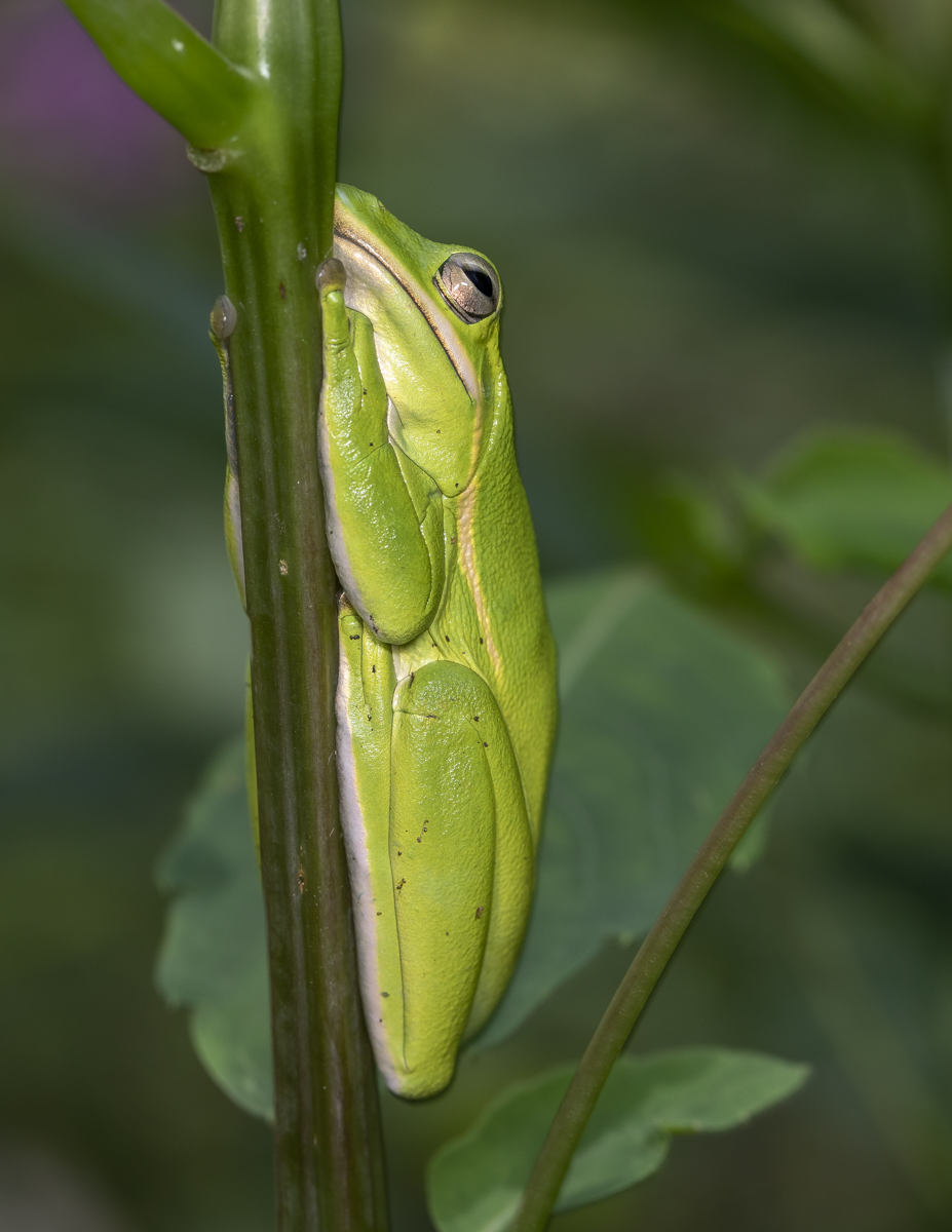
Green Treefrog backlit on leaf (click photos to enlarge)
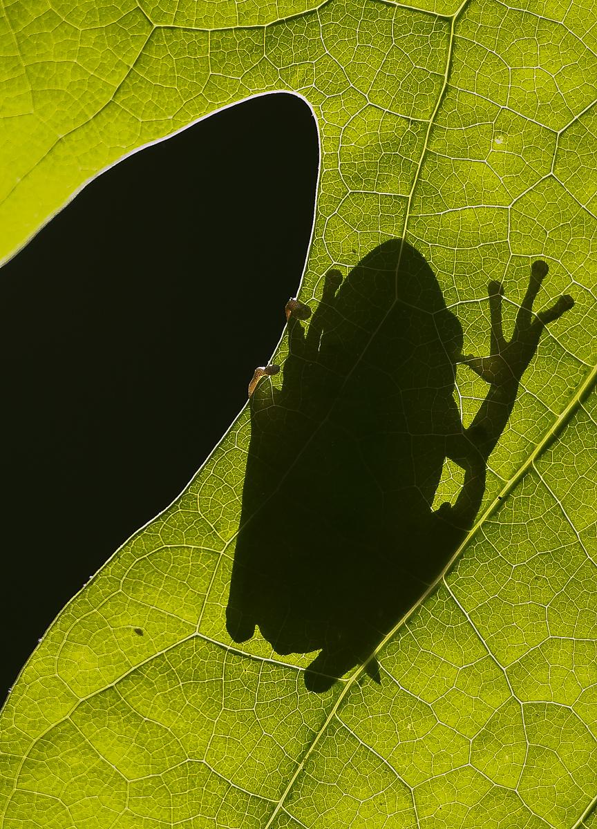
I took this photo of a Green Treefrog (Hyla cinerea) in May of 2006. I was walking around the yard looking for insects to photograph and stumbled upon this frog, backlit on a Tulip Poplar leaf. It was the first individual of this species I had ever seen on our property. I had seen many of these beautiful frogs on my travels in the Coastal Plain, but they were not common in the Piedmont back then. If my memory is accurate, this photo provided evidence for a new county record for this species in the database of amphibian distribution for the state maintained by the NC Museum of Natural Sciences, my employer at that time. They seem to have greatly expanded their range in recent years and are now fairly common in many suitable habitats in our area.
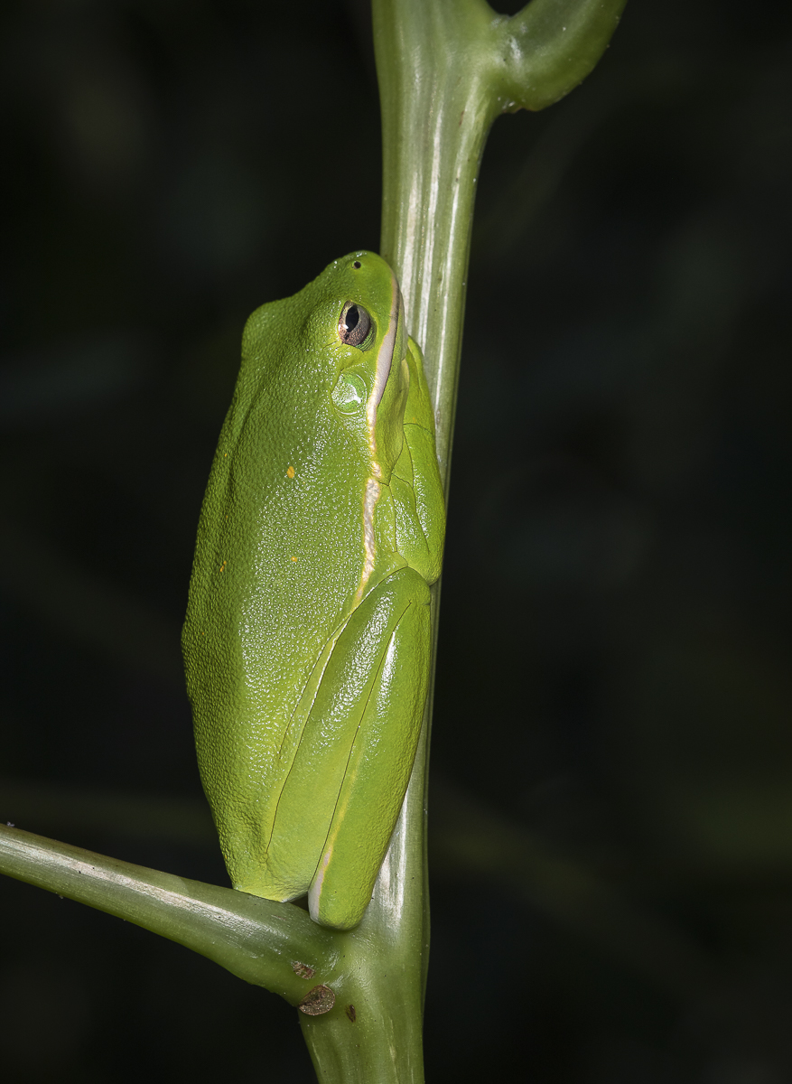
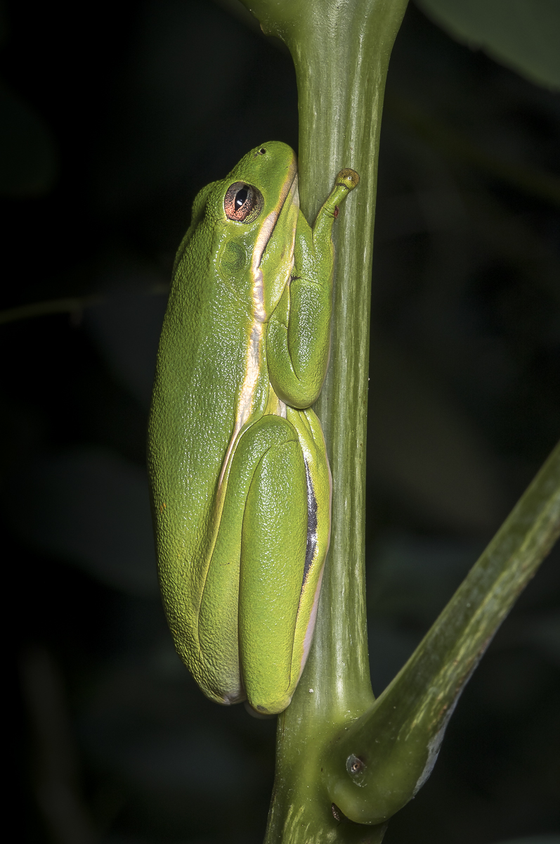
Over the years since, I have seen a Green Treefrog in the yard from time to time, but never more than a single one in any one season (and many years, none at all). I began to wonder if we just had one really old animal that had somehow found our little open spot in the woods on top of a hill (but since I assume most frogs of this size typically live only a few years, I started doubting that theory). Then, last year, there were two in the yard for a couple of months, regularly seen perched on the stems of Jewelweed in their stoic hunched pose. And again, this summer, we have seen two individuals, until yesterday, when I found three of them perched on plants just outside our front windows.
Green Treefrog on Beautyberry leafTreefrog #2, hanging out on a Jewelweed stem, where it blends in very wellTreefrog #3, hunkered down on a Jewelweed stem
So here is the mystery…where are these guys coming from and where are they breeding? Though we have a couple of small water gardens that provide habitat for several species (Green Frogs, Bullfrogs, Cope’s Gray Treefrogs, Eastern Narrowmouth Toads, Spring Peepers) we have never heard a Green Treefrog calling in our yard or anywhere in the neighborhood for that matter. I think I remember hearing some once at Jordan Lake, a few miles from our house, but you would think if they are breeding here that we would have heard that distinctive nasal queenk, queenk (or hey baby, hey baby) call at least once. As I write this, there are two perched within sight, one on a Jewelweed stem, the other on the same leaf of a Beautyberry shrub that it has been on the past three days (this is the one that has perched on our dining room window for several days recently). Other than our water gardens, the closest water is our intermittent stream down the hill and another water garden on a neighbor’s property a quarter of a mile from our house (he hasn’t seen or heard these frogs there). And yet, here they are, seeming content and doing what treefrogs do (except calling). I’m going to continue to keep track of them, assuming I can even identify individual frogs by the number and arrangement of the gold flecks on the dorsal surface (I think these remain constant?).
These guys are just so cool
So goes the life of people that live in the woods…you wander and ponder about your natural neighbors, hoping to gain some insight into how the world works, but enjoying their presence even if it all remains a mystery.
It’s the horns of a dilemma, no question about it.
~Steven Jeffrey
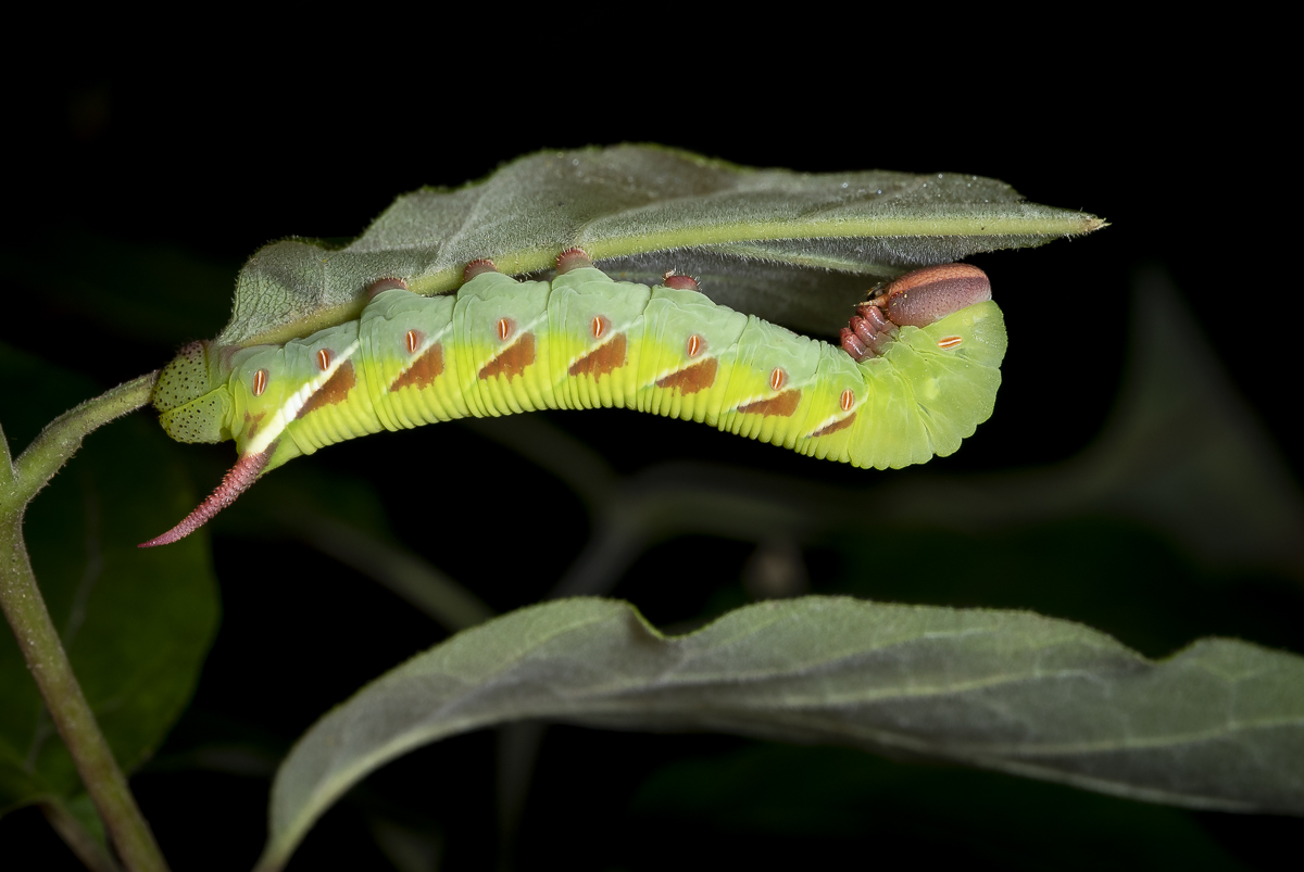
Melissa needed a few caterpillars for a teacher workshop this week, so I went out the other night with our UV flashlight to scan the vegetation around the house. A reminder that many species of caterpillars glow under UV light at night, making them much easier to spot. It was slim pickings but I did see one sphinx moth larva (aka horn worm, due to the presence of a spike on the posterior end). It had just molted so I didn’t want to disturb it. Its size and behavior (feeding on the underside of a leaf) gave the impression of a Walnut Sphinx caterpillar, a species I have found several times in our yard. Plus, when I glanced at the host plant and saw the compound leaves, I assumed it was a hickory, one of the hosts of Walnut Sphinx larvae. I noted the location and headed inside, hoping the caterpillar would still be there in the morning.
A beautiful sphinx moth caterpillar on the underside of a leaf (click photos to enlarge)
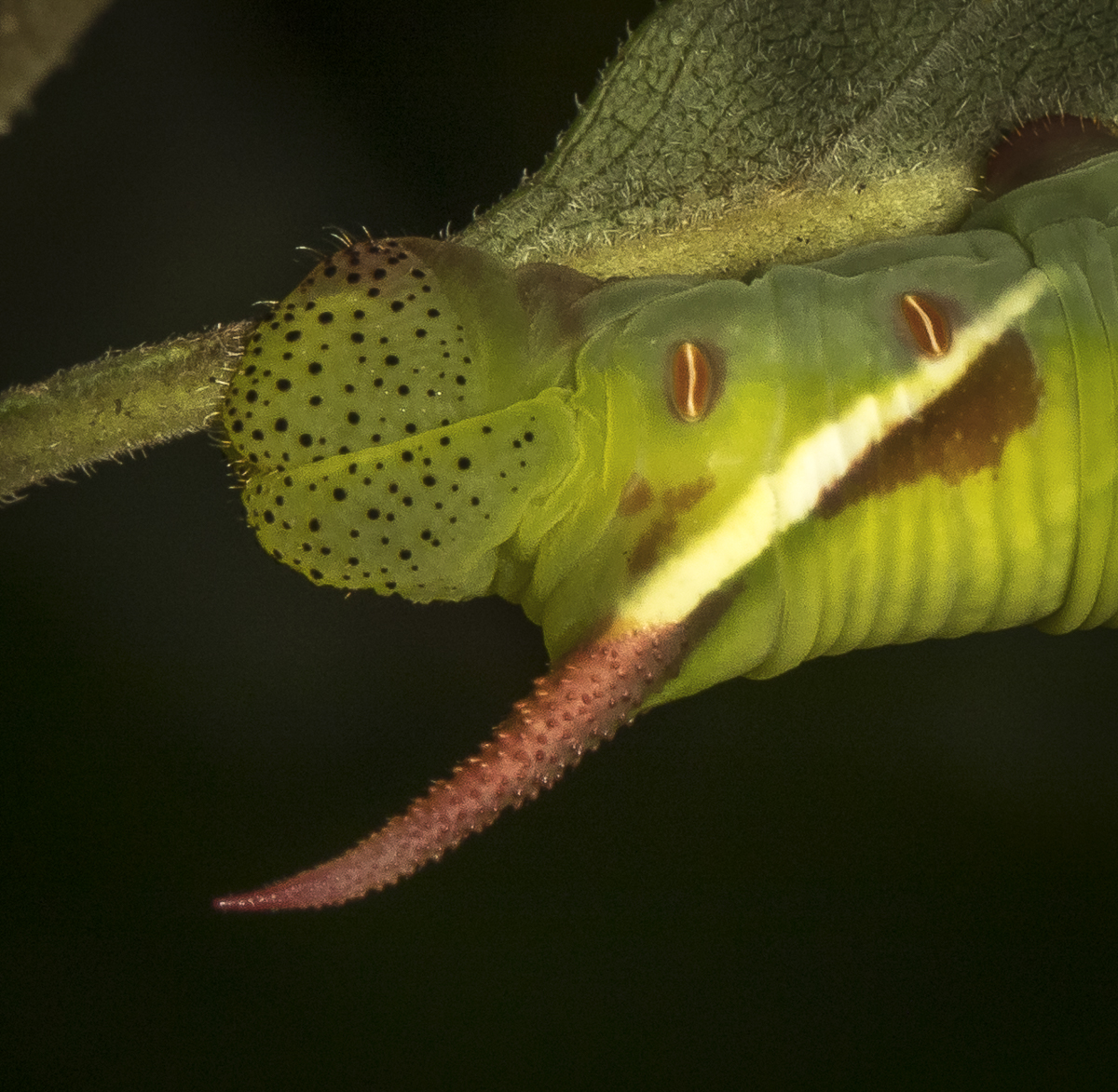
When I went out the next day to retrieve it, I saw that the sapling was not a hickory, but an ash, and that the larva was not a Walnut Sphinx…but, what is it? I had not paid close attention to detail in the glow of the UV light and the pattern and colors were not yet evident in the freshly molted caterpillar. I took a few quick photos and went inside to search my well-worn copy of Wagner’s Caterpillars of Eastern North America. There are six species of horn worm larvae that feed on ash so it made the search a bit easier. None of the images matched the bold pinkish splotches along the sides of my caterpillar, but reading the descriptions helped me decide that this beauty is a Waved Sphinx caterpillar, Ceratomia undulosa. They are quite variable as larvae, with most being green overall, others pink and yellow, or some combination.
The black dots on the anal plate and the textured pink horn are diagnostic of a Waved Sphinx larva
But they all tend to have the textured pinkish horn and black dots on the anal plate (the hardened area on the top of the last abdominal segment). A quick search online (BugGuide.net) showed the diversity of this species’ caterpillar colors and confirmed this variation for a Waved Sphinx larva. I am guessing this is a 4th instar, so it has some growing to do before its final stage. Just goes to show, never assume you know what you are seeing without paying attention to the details. But, no matter the name, it is a stunning caterpillar and a joy to discover just outside our home in the woods.
Stare hard at the hummingbird, in the summer rain, shaking the water-sparks from its wings…
~ Mary Oliver
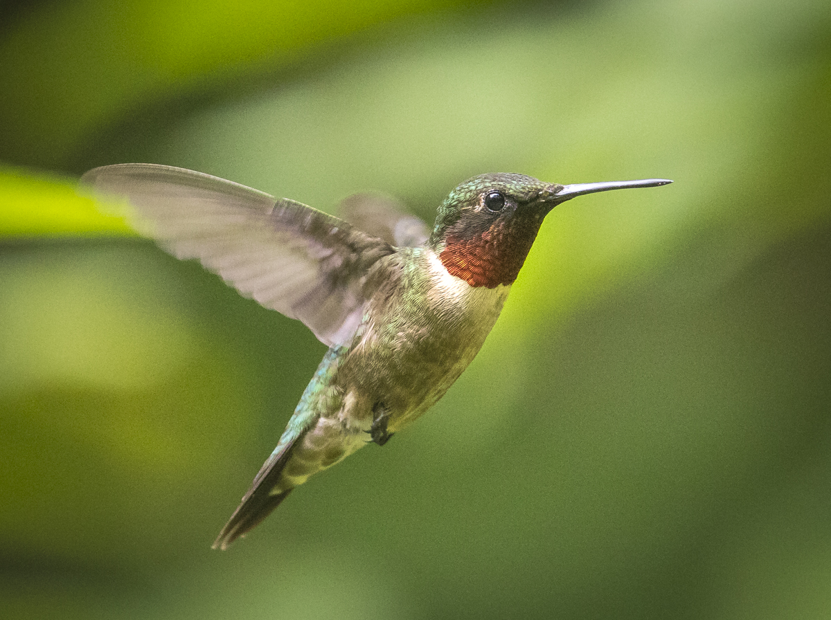
With a thunderstorm kicking up outside and rain (much needed rain) starting to fall, I sit inside watching the yard missiles go at each other at the four feeders we have scattered around the house. It still baffles me how their daily energy budget balances out in their favor with all the zest and fury that they exhibit for most of the day. The calmest feedings occur when I am outside near one of the feeders, apparently keeping at least one of the bejeweled jets at bay (although this doesn’t always hold true). They also tend to dine unbothered when they sneak into the yard vegetation and partake of sips of nectar from the lone surviving Cardinal Flower (a favorite of the yard bunnies I’m afraid) or the abundant Jewelweed. We have plenty of the latter growing just outside our kitchen/sun-room window. I love this up close jungle because it allows me to watch our hummingbirds as they deftly maneuver through the tangle in search of the bright orange flowers. It also gives us a great view of the many butterflies and other insects that visit the nearby Joe-Pye-Weed and Ironweed. The recent appearance of a pair of Green Treefrogs clinging to the look-alike plant stems is an added bonus.
A female Ruby-throated Hummingbird takes refuge in a shrub near one of our feeders (click photos to enlarge)One of three male hummingbirds that have staked a claim to our yardThat darned background stick…would have been nice if this male had landed a bit off to one side or another
My favorite encounter with our yard missiles happened a couple of weeks ago when I went out to bring in a feeder for a cleaning and refill. The hummers frequently zoom close when I am putting up or taking down feeders, but this time, as I grabbed the feeder and lifted it off the hook, a hummingbird landed on it and started feeding. It was an immature male and it occasionally glanced my way as I stood there with bird at arm’s length. They usually only stay a few seconds at a feeder, but this one kept on, so I slowly pulled the bird and tube closer. I finally had it about 8 inches from my face! What an incredible sight. They are so tiny and so beautiful up close. He finally streaked off (my arm thanked him) when another adult male came in for a challenge but veered off when it realized there was a new hanger for the feeder.
A heavy crop to show the delicate beauty of the bright red feathers of the male’s gorget (iridescent throat feathers)
While that was a special moment, my mom told me this week about one that tops it. She loves to sit on her front porch in the evening and watch the hummingbirds as they contest the air space around her feeder. She happened to glance down and saw that one had landed on her knee and was just taking it all in. She said it sat there for several seconds until she gently moved her leg and it zoomed off. Here’s hoping we all get such special moments with these flying jewels before they head south in the coming weeks.
The significance and joy in my science comes in those occasional moments of discovering something new…
~Henry F. Schaefer, III
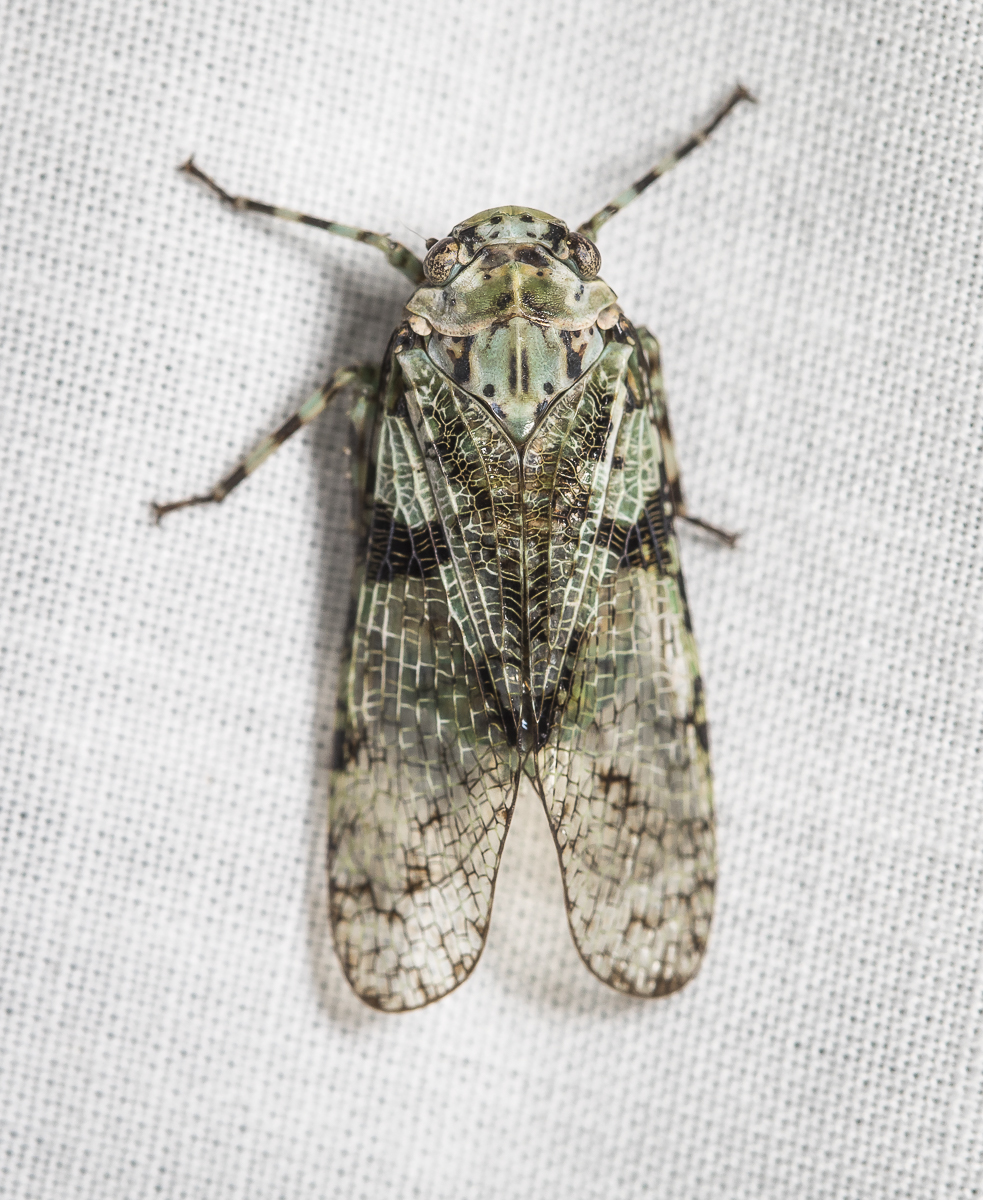
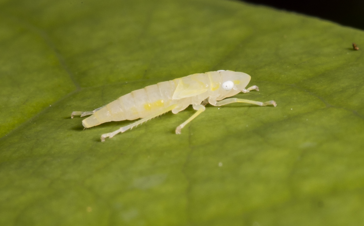
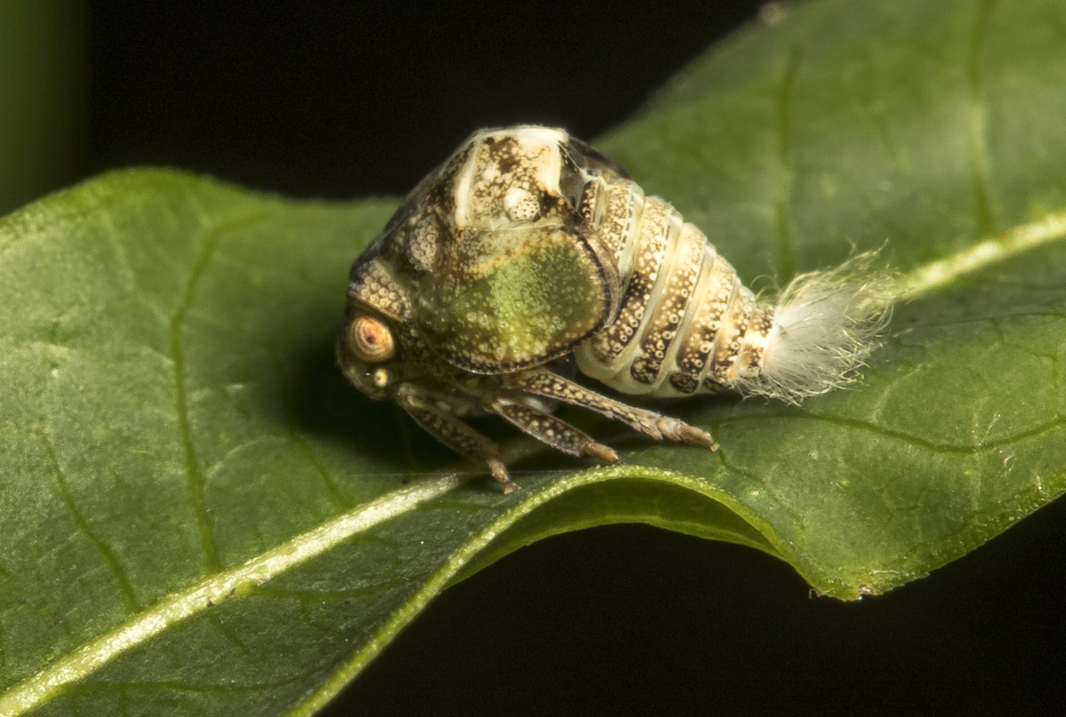
Last night we had friends over for pizza and beer and …mothing (wait, what?, you mean you don’t have people over and put out a moth light when it is 90 degrees and 95% humidity?). We had some good moths, including a couple of large Tulip Tree Silk Moths and at least three Rhinoceros Beetles. But, my favorite find of the night was a strange creature that I can’t remember ever seeing before. When Melissa first saw it, she exclaimed, I’m not even sure which group of insects it belongs to…it looks like a tiny cicada. Well, that was certainly a good description.
Our strange visitor to the moth sheet last night
It does, indeed, have the body shape of a mini-cicada and is about an inch in length. The coloration reminded us of tree lichens. When I first approached it with the macro lens, it jumped, leading us to believe it was some sort of weird planthopper. The SEEK app identified it as a type of Fulgorid Planthopper (i.e. a planthopper in the family Fulgoridae). This morning I went to my laptop and searched the very helpful web site, Hoppers of North Carolina, browsed the Family Photo Gallery link and found a photo resembling our mystery critter. The heading for the matching image is Calyptoproctus marmoratus – No Common Name. The description says it is uncommon to rare, found in deciduous forests from VA to FL (it as been recorded in fewer than 20 of our state’s 100 counties). Searching online didn’t yield much more information other than little is known about its feeding habits or general life history. One scientific paper I found showed it being found in several museum and university insect collections and that almost all were collected at night when attracted to lights. It is always satisfying to see something new and wonder about where and how it lives. The No Common Name add-on to the nomenclature though seems unfit for such an interesting creature. I offer these possible solutions – Lichen-colored Mini-Cicada or perhaps the Lichen Cicadalet. I’m open to other suggestions in the comments. Keep looking out there, there is more to discover and ponder.
The night still twinkles with fireflies but the day’s heat lingers and the air has a dusty August scent, the smell of languid Summer.
~Hal Borland
We are definitely in the Dog Days of Summer, the heat and humidity making me rethink my desire to be out and about in the afternoon. But, it only takes a short walk to find beauty and mystery surviving, no, thriving, in the heat. Below are some scenes from the summer here in the woods.
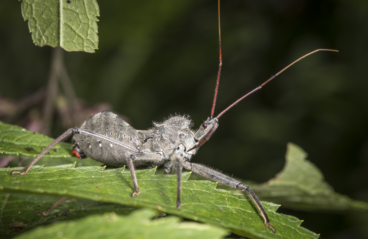
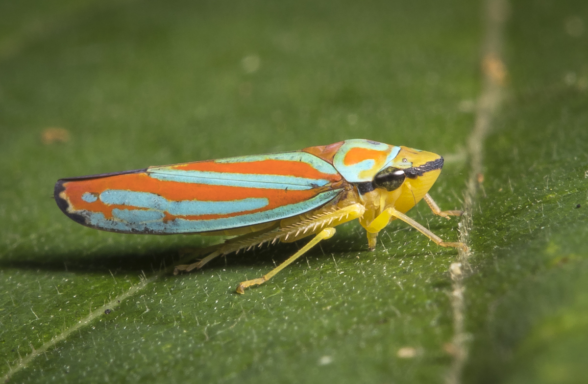
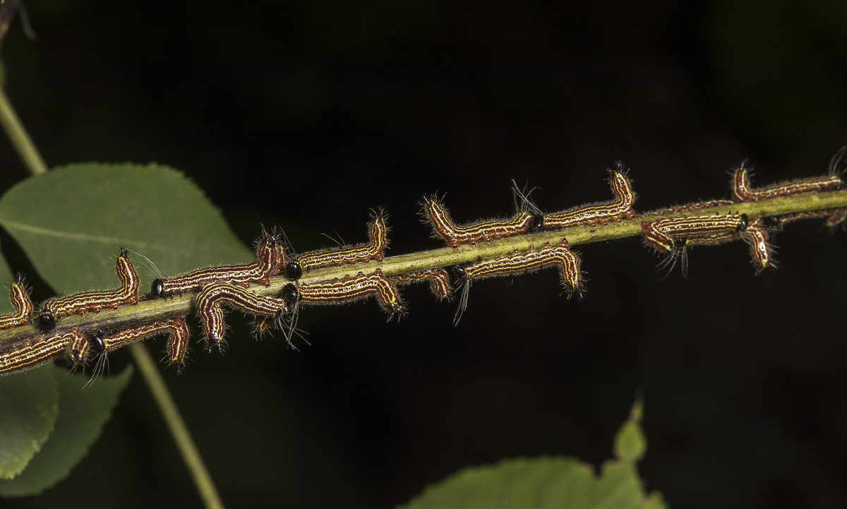
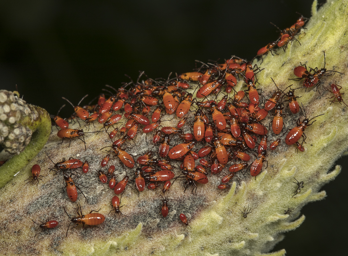
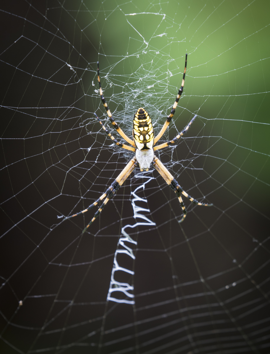
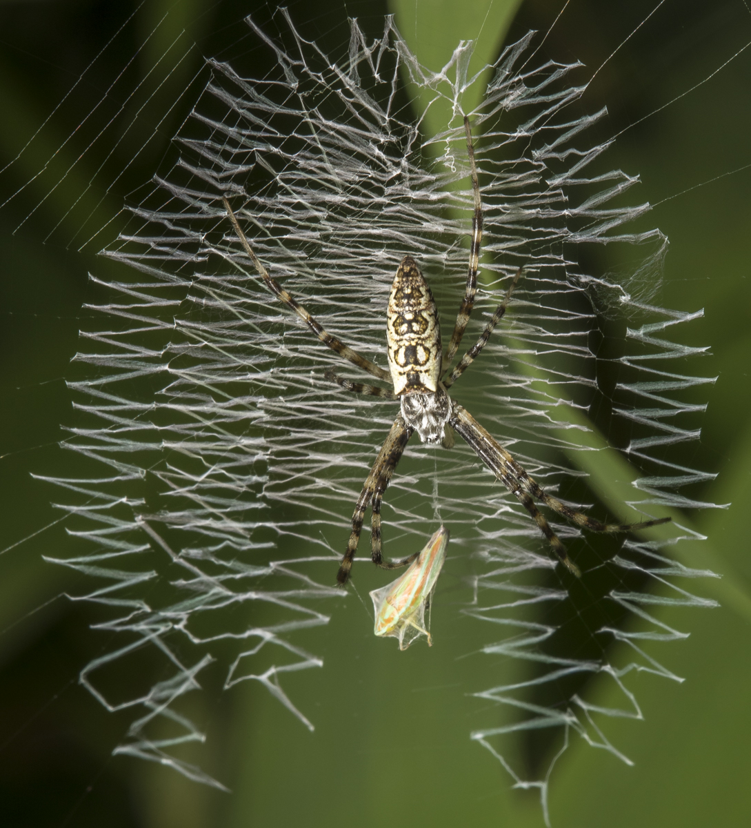
Virginia Creeper Sphinx (aka Hog Sphinx), Darapsa myron (click photos to enlarge)I captured, transported, and released this sphinx moth here in the woods after finding it at our bank in Pittsboro, lured under the walkway by the lights at night. Urban (really, any) lights are a common cause for the demise of many a moth.A formidable-looking Wheel Bug, Arilus cristatus. This is a large member of the group of insects called Assassin Bugs, due to their predatory behavior. They grab prey (other insects) with their raptorial front legs, pierce them with that large rostrum (reddish beak under the head), inject a toxin with digestive enzymes, and then ingest the contents.Red-banded Leafhopper, Graphocephala coccinea.These tiny (~7mm) insects feed on the sap of leaves and can spread a bacterium that causes leaf scorch disease (Pierce’s disease) on some species of plants. They are excellent hoppers, with some believed to jump up to 40x their body length (a 6 ft human of equal ability could jump 240 feet!).A dark morph female Eastern Tiger Swallowtail, Papilio glaucus. Females of this species can be either black or yellow.A male Eastern Tiger Swallowtail. Note that females (see picture above) are more colorful than males, having more blue along the hind wings.A group of Datana sp. caterpillars in their defensive posture (they exude distasteful chemicals from both ends)Datana sp. larvae typically are gregarious through most of their life stages. I guess if one tastes bad, a whole bunch must be a better deterrent.Another bad-tasting bunch-o’-bugs – nymphs of Large Milkweed Bugs, Oncopeltus fasciatus. I photographed a mating pair of adults on this milkweed plant on July 22 and this photo was taken on August 7. This species feeds on milkweed seeds by injecting saliva into the seed using their long rostrum, which predigests the seed so they can suck the contents back up. Female Yellow Garden Spider, Argiope aurantia. She has grown considerably since I last photographed her on July 22.And she has acquired a suitor. This male Yellow Garden Spider is in a web right behind that of the much larger female (you can see the tips of her legs on the left side of the photo)One of our more unusual-looking spiders, the bizarre Spined Micrathena, Micrathena gracilis. Females have a large bulbous abdomen adorned with spines. They are quite common in our woods in late summer.Another armored spider, the Spiny Orbweaver, Gasteracantha cancriformis. Females have a rotund body that is white to yellow in color. The abdomen is surrounded by six stout spines that can be red or black. Their webs have tufts of silk along some strands, supposedly making them visible to birds which will avoid flying through them (and me, to avoid getting them on my face with all the other spider webs along our trails).
…the light of July and August is the day’s dazzle, hot light, with the season’s dust slowly accumulating and making the sky we see a giant silvered reflector.
~Hal Borland
Last Friday was probably the hottest day of this summer thus far. So, naturally, I decided to head to the Pungo Unit of Pocosin Lakes NWR in search of bears, butterflies, and anything else I could find. Back in the old days, extreme heat would keep most people indoors, but things are different now, and as I drove into the refuge, I encountered a couple of cars already scoping things out. I also saw a turkey and a bear within my first 5 minutes on the refuge, so I figured it was going to be a good day.
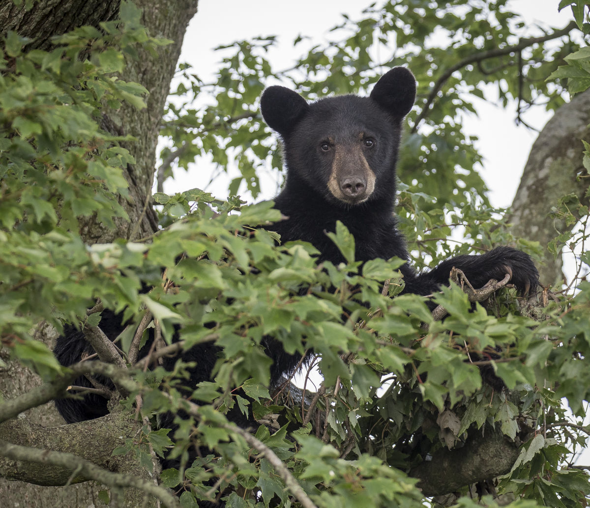
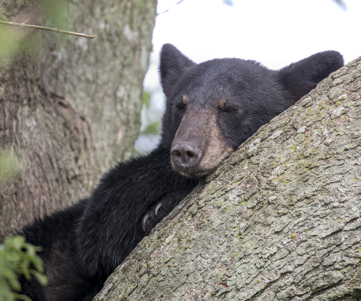
Ten minutes later, I spotted a young bear in a tree where I have seen bears twice before, I stopped and stuck a camera out the window and he raised his head to check me out.
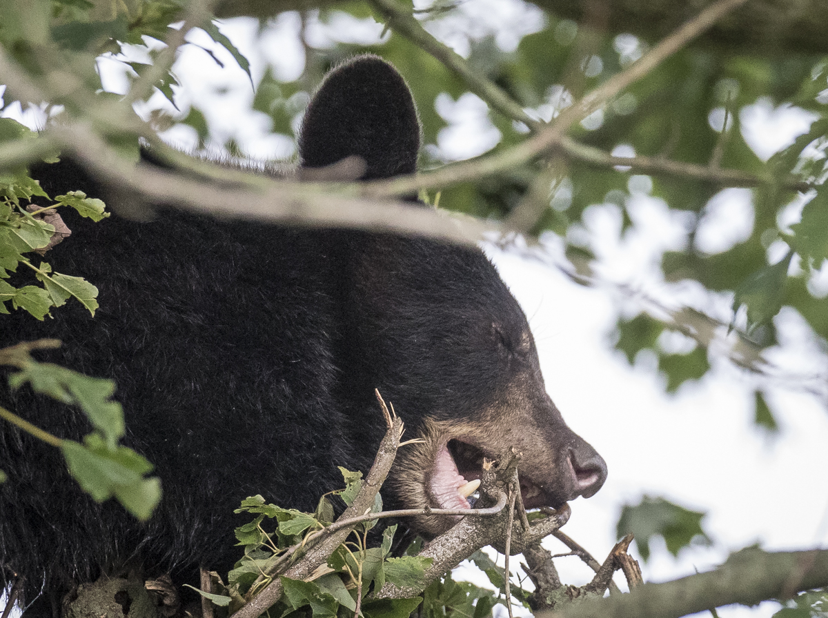
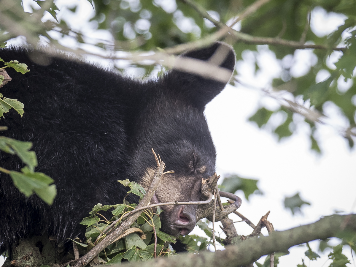
The second bear of the morning was lounging in a tree along one of the refuge roads. It raised its head to glance my way when the truck stopped (click photos to enlarge)As I watched, he settled down and started chewing on some small branches and breaking them…This must be how a bear “fluffs its pillow” in the tree branches. It put its head down in the space where the branches were removed and seemed to take a nap.
I spent about 15 minutes with this tolerant bear and then moved on so as not to attract a crowd. The bear was sleeping peacefully when I left.
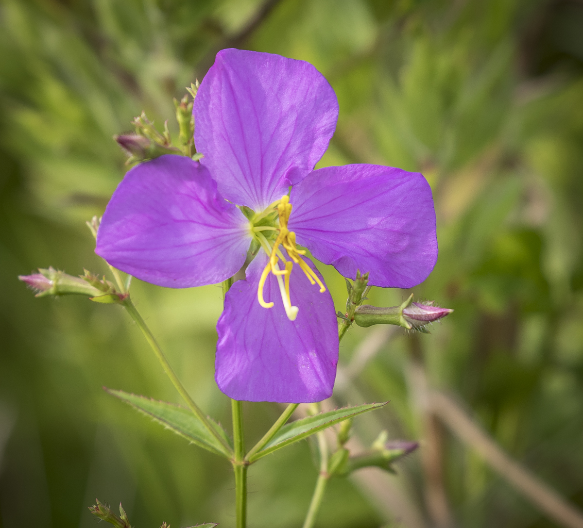
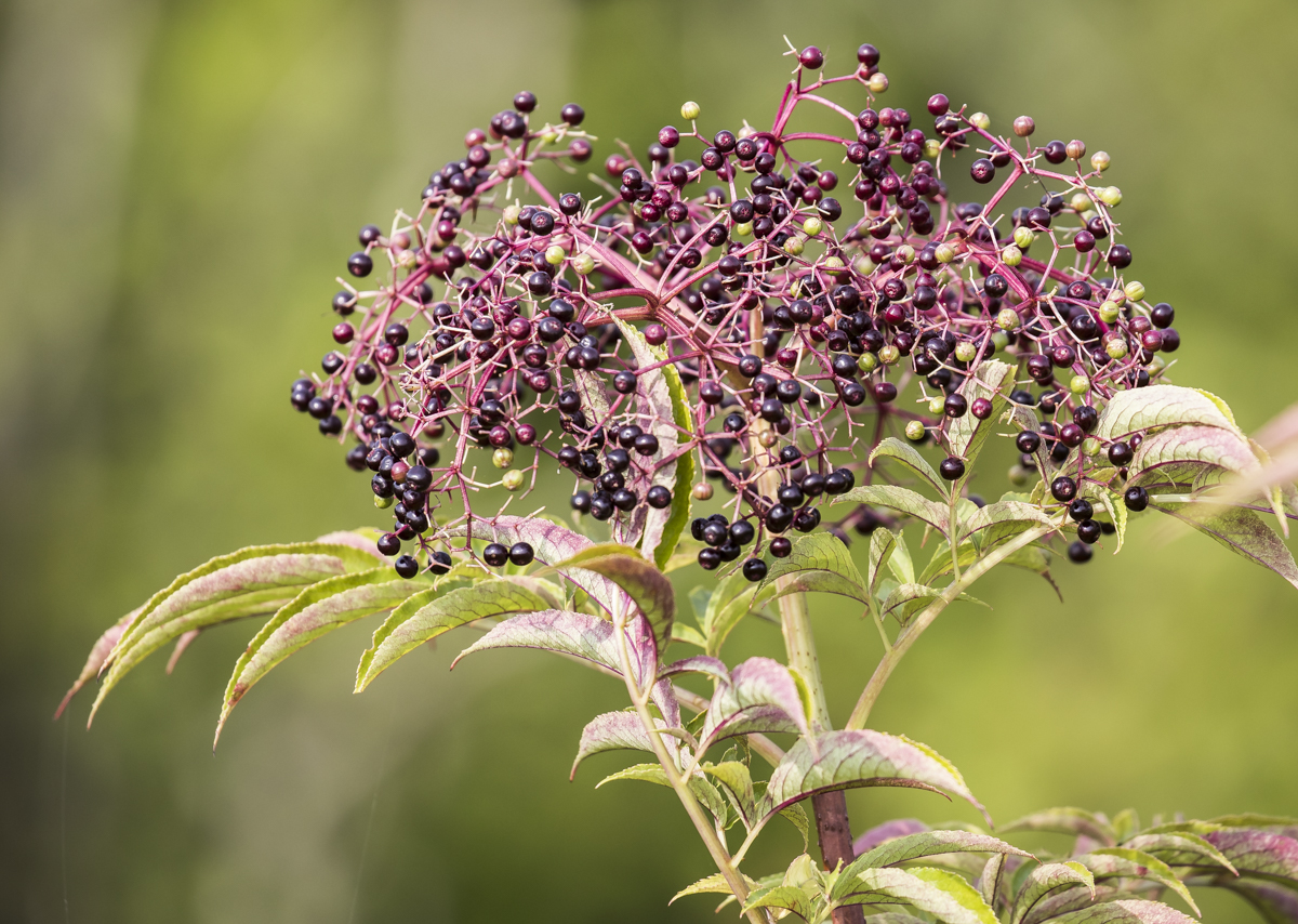
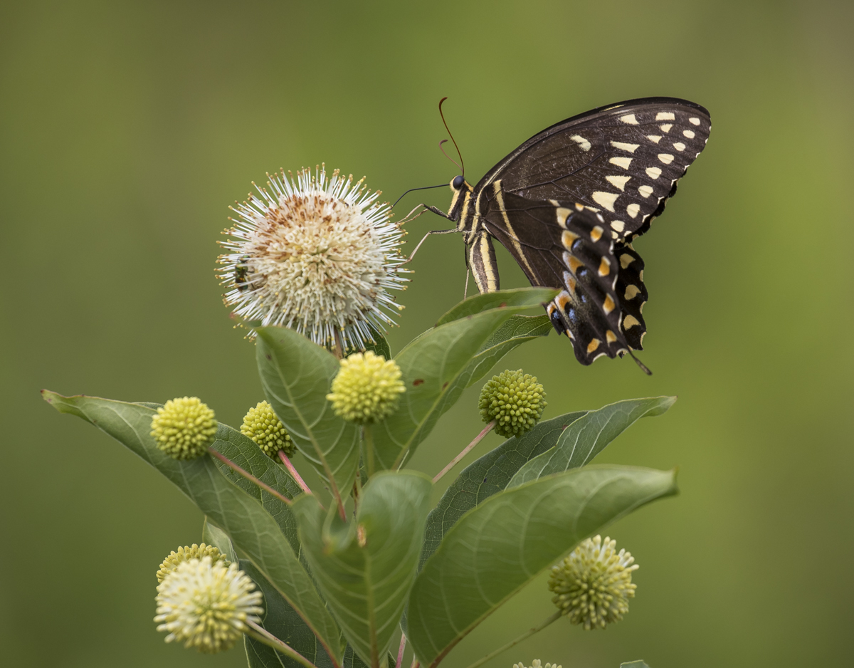
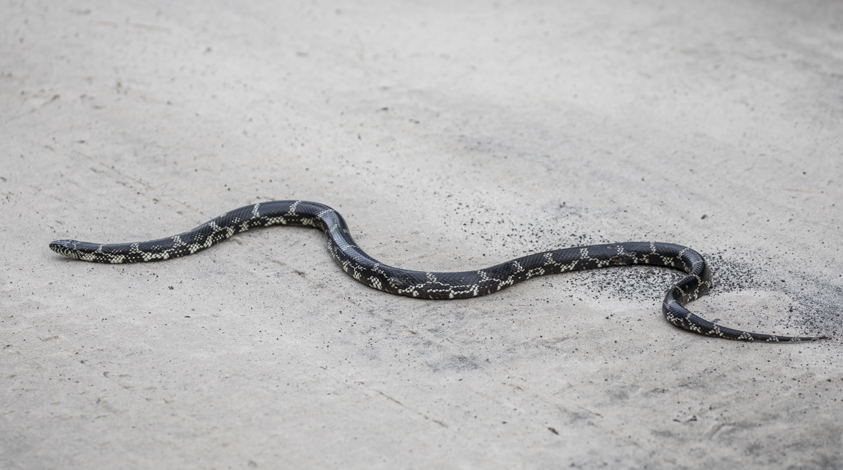
Meadow Beauty (Rhexia sp.) was an abundant bloom along the roadsidesElderberry (Sambucus canadensis) was also very common along the canals and roads. The Buttonbush flowers (Cephalanthus occidentalis) attract numerous pollinators, including this Palamedes Swallowtail and what I think is a Cuckoo Wasp of some sort.This beautiful Eastern Kingsnake started slithering away as I approached (another reason to drive slow on refuge roads).Eastern Kingsnakes feed on a variety of prey including lizards, frogs, rodents, birds, and other snakes. They are resistant to pit viper venom and readily eat cottonmouths, copperheads, and rattlesnakes.
I spent most of the morning slowly cruising the refuge roads. In addition to the kingsnake, I saw a Black Racer and what i am pretty sure was a Canebrake Rattlesnake. It got into the thick brush before I was close enough to be sure, but when something looks like a thick branch crawling across the road from a distance, it’s most likely a rattlesnake. Unfortunately, South Lake Road remains closed (it has been that way all year I think), so one of my favorite areas remains inaccessible by vehicle.
I drove back around to the bear tree over an hour after my first encounter and the sleepy bruin had moved down the branch a bit with its rear end braced against the trunk and was looking pretty relaxed. Once again, I didn’t stay long so as not to disturb.
The bear seemed pleased with this perch
As I often do on these day trips, I headed over to Mattamuskeet NWR mid-day to see if anything was going on there. To be honest, there wasn’t much happening. I saw a few songbirds, a couple of waders, and lots of invertebrates. I got out and walked two short trails and was rewarded with some beautiful spiders.
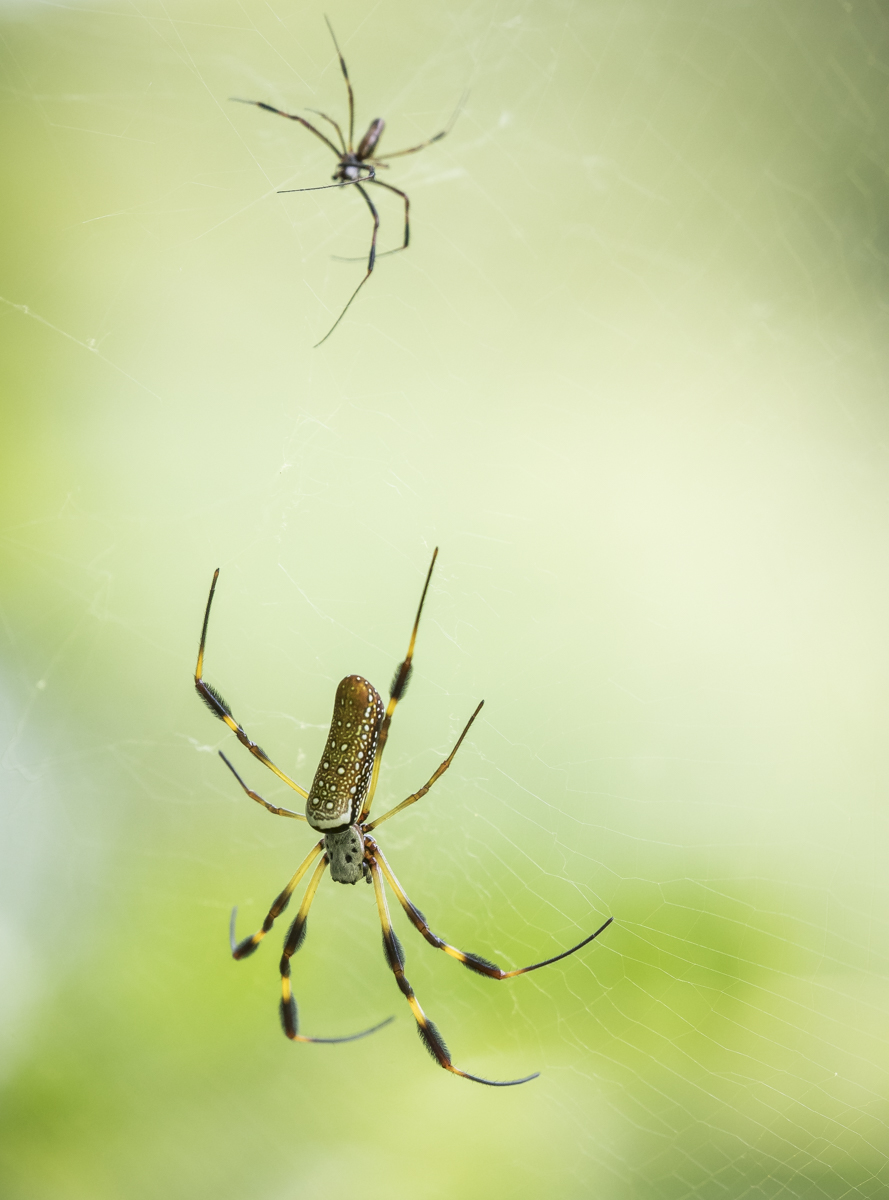
I saw several Black and Yellow Argiope spiders (aka Yellow Garden Spiders, Argiope aurantia) sitting upside down in their distinctive websTwo magnificent Golden Orb Weaver spiders in a web stretched across a six-foot pathway. The smaller one is the male, and he must be very careful when approaching the much larger female for a chance at an arachnid date. These huge spiders have expanded their range northward and are now quite common at Lake Mattamuskeet.
I drove back via the long series of gravel roads that pass through the part of Pocosin Lakes NWR that stretches from Hwy 94 to the south shore of Lake Phelps. You never know what you might encounter. Today’s finds included a couple of bears, some turkeys, and an abundance of dragonflies along the miles of canals that line the roads.
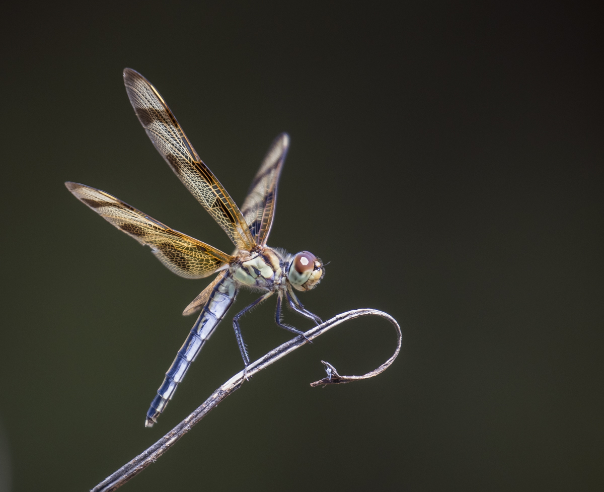
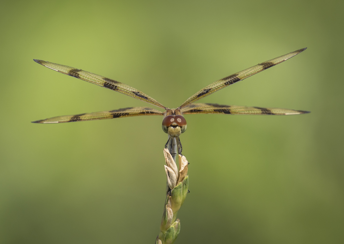
This Halloween Pennant dragonfly had a heck of a time holding on to this dried grass tip in the gusty windsAnother dragonfly, in a moment of calm air, spread its wings and looked ready to pounce on any passing winged insectsThis Golden-winged Skimmer always managed to land in a spot with a busy background of jumbled grasses
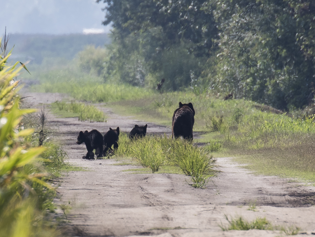
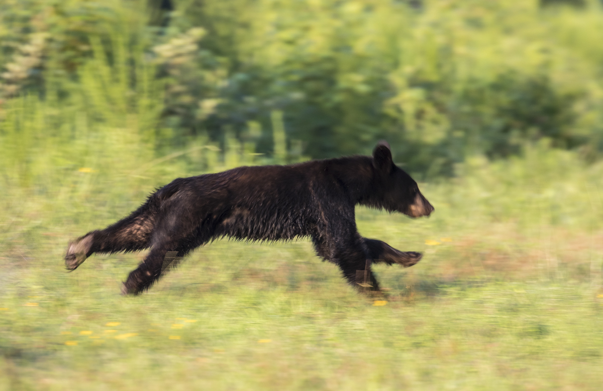
By mid-afternoon I was back on the Pungo Unit and spotted a mother bear with three cubs of the year ambling down a side road. As much as I love seeing the new cubs, I decided to let her and her youngsters have some quiet time without a human pursuing them, so I just took a couple of long distance photos and watched as they finally turned into the woods.
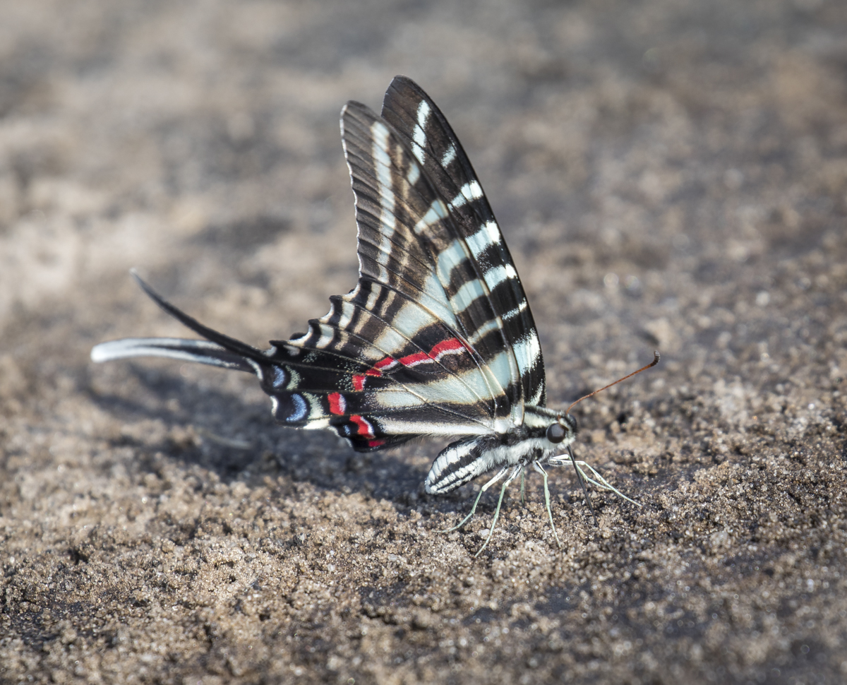
A sow and her young cubs strolling along a road in 92 degree heatA young (probably 2 or 3 year old) bear out in a soybean field on the refugeWhile watching a bear out in a field, I was distracted by this striking Zebra Swallowtail that landed next to me
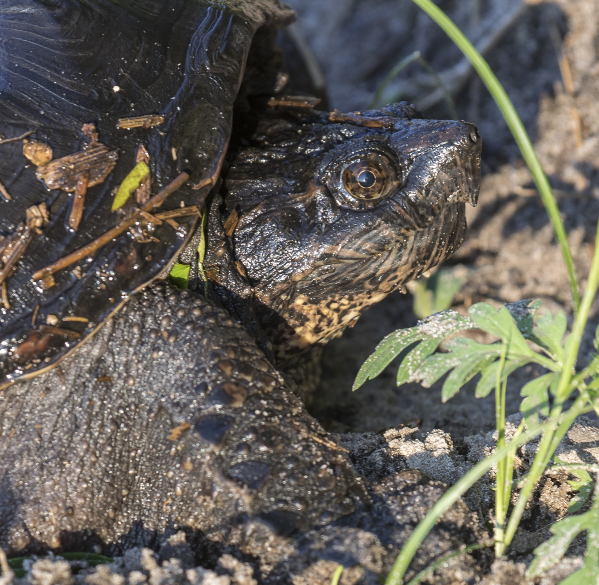
There were still cars and people on “Bear Road”, so I headed over to what I call “New Bear Road” for a little solitary saunter. I saw my first bear of the day on this road and it is usually good for a sighting or two. I walked down the road a ways and spotted a mid-sized Snapping Turtle crawling from the canal into the woods. They are so prehistoric-looking, and this one expressed its displeasure at my presence by raising up the hind part of its body in a defensive posture and looking at me in a less than welcoming manner as I waked past.
Such a sweet face… I saw my first Monarch Butterfly of the fall season along the edge of the road
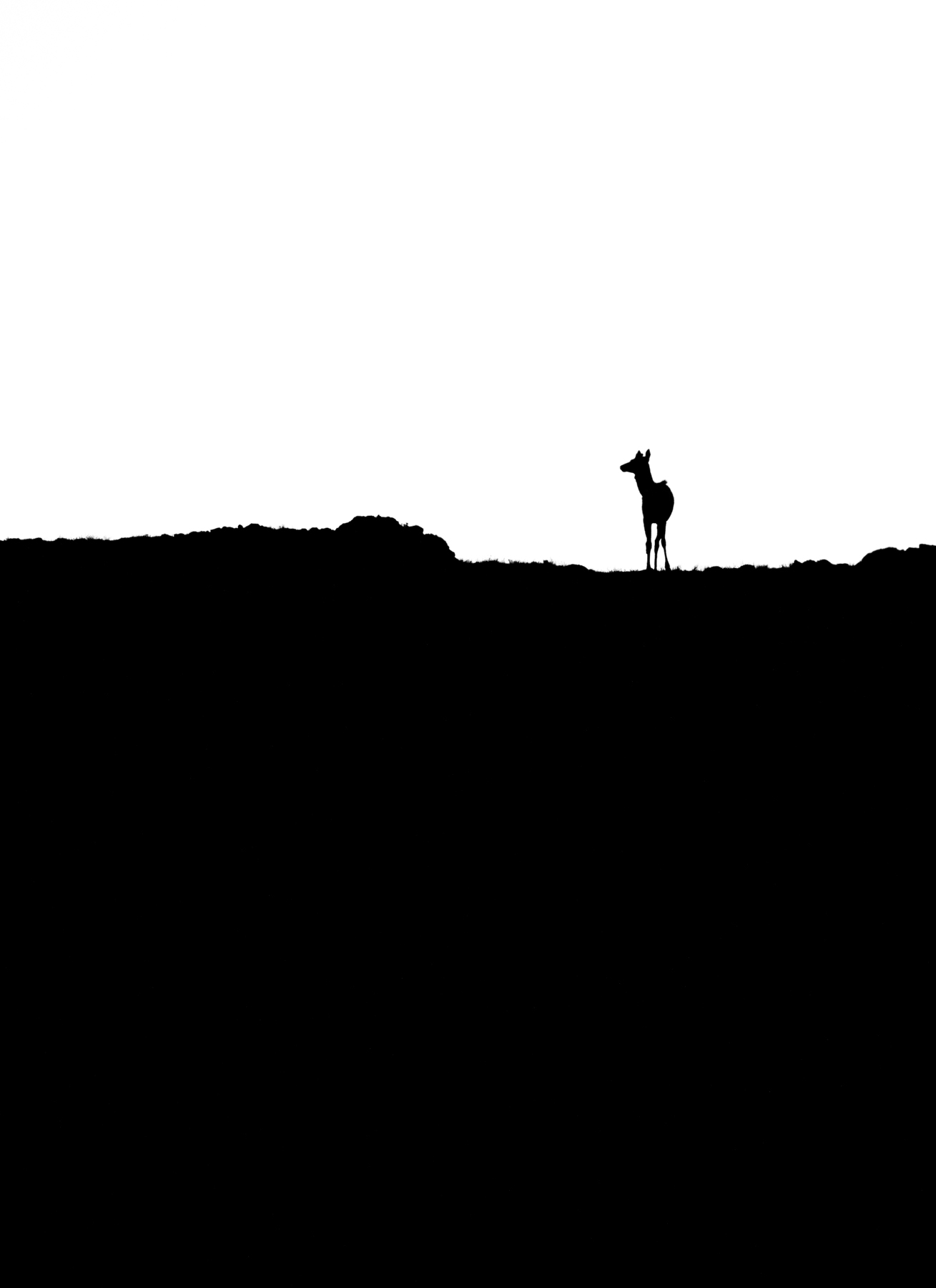
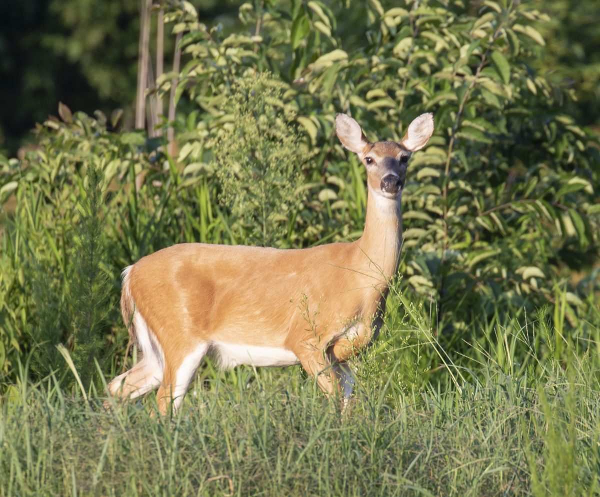
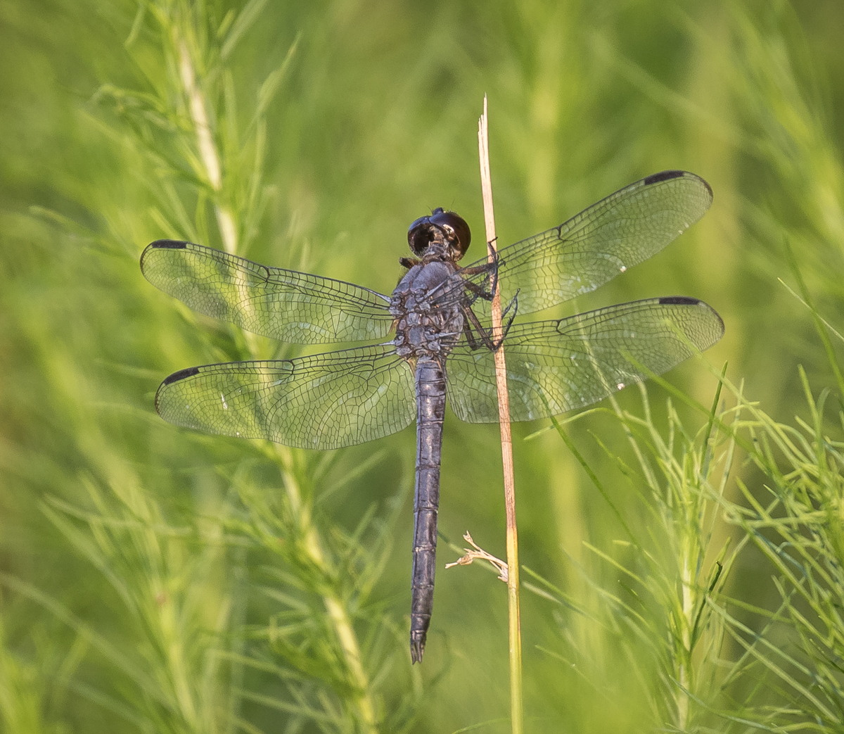
I walked down close to where another road joins and sat down along the edge of the woods, hoping something might travel this juncture. It was hot, very hot, and I sat there with sweat dripping off my forehead and listening to the chorus of insects buzzing all around me. Soon, a bear crossed far down the road and into the woods. Then, a deer came walking down the other road and paused to look at that strange blob sitting at the edge of the trees. It gave a few cautious stiff-legged steps, and stopped to make sure I hadn’t moved. It finally made its way into the woods, no doubt satisfied I was just some slow, ugly bear.
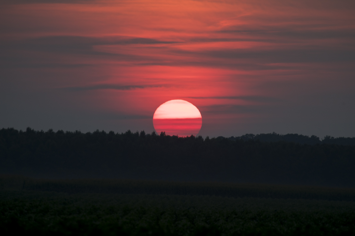
A White-tailed deer on alert when it spotted me sitting at the edge of the woodsA Slaty Skimmer kept me company while I waited, flitting all around me, but returning to the same dried stem to perchMy last bear of the day was this one that ran across at the juncture of the two grassy roads, I think it had been spooked by someone on an electric bicycle (one of several I have seen on the refuge this past year) far down the road that joined New Bear RoadA hazy, big sky sunset was a great way to end a good day
It had been a hot day, but a good one. I ended up driving more than I had intended, but my favorite times were those just sitting and watching the wildlife, from bears (my count for the day was 18) to dragonflies. As always, I left feeling grateful for our public lands and all that they provide to the wildlife, plants, and all of the human visitors that need that connection to the wild.
Surprise is the greatest gift which life can grant us.
~Boris Pasternak
The heat of summer seems to have slowed the activity around the trail cameras in our woods, but sometimes, amid all the images of squirrels, raccoons, and wind blown leafy branches, there is is a jewel that really makes me appreciate the 24-hour a day presence of those eyes on the trees.
This first one is from a while back and is a very quick clip showing one of the opossums that uses the root ball den site carrying some leaves back to the ‘possum hole with its tail. Who among us couldn’t use an extra hand now and then?
A Virginia Opossum carrying leaves in its tightly curled tail
One of the things I have been surprised by recently is the lack of trail camera images of deer fawns. I have been seeing them along the roads here in the neighborhood for a few months, but they have not been recorded on a trail camera until this week.
Doe and fawn mosey by the Raccoon den tree
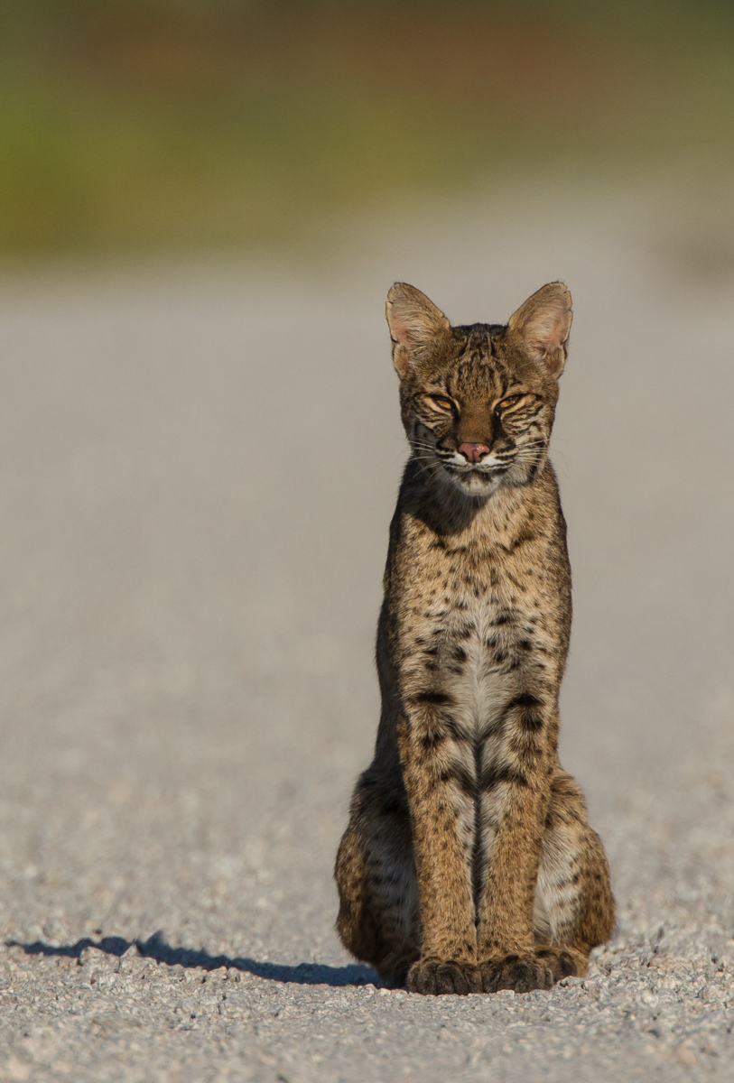
This next one is the video that I have been waiting for…a Bobcat in our woods! The video is cropped a little so it is not as sharp as some, but this is a clip of a nice-sized Bobcat walking down the now dry stream bed in our woods. I have long hoped to see one here in the neighborhood. We have plenty of woods and potential prey, and being near the Haw River corridor, there is ample habitat for these majestic animals.
Bobcat walking down the creek bottom one morning last week
I have admired the mystique of these secretive wild cats for many years. My first sighting was probably back when I worked for NC State Parks and I spotted a Bobcat and her kittens walking down the road at Goose Creek State Park. Since then, I have seen them mainly at wildlife refuges in our Coastal Plain – Alligator River, Mattamuskeet, and at Pocosin Lakes NWR. Most have been quick glimpses of one as it slinked off into the vegetation. Only a few have been recorded with a camera. Here is a brief list of some of those photographed encounters…
A distant view of a Red Wolf (right) tucking its tail and scurrying by a Bobcat at Pocosin Lakes NWR. The wolf was trotting down the road when it encountered the Bobcat in the brush, which assumed the typical cat pose of arched back. The wolf moved to the other side of the road, keeping an eye on the feline as it went past, and then hurried on down the road.A pre-dawn encounter on a Christmas Bird Count at Pocosin Lakes…a Bobcat carrying a Snow Goose. When we stopped the car, the Bobcat dropped to the ground and crawled across the field to a wind row of trees and disappeared.I went to the other end of the windrow, assuming the Bobcat would go down and cross onto the woods. As I stood there, some birds flushed out of the trees in the wind row, and then I saw it, sitting there in the thick brush staring at me. I’m not sure how long it had been there, and just as quickly, it disappeared.I had just photographed a bear across a canal at Pocosin Lakes and was going to do a three-point turn and go the opposite way on the road. When I looked in my rear view mirror, a Bobcat was in the road behind me! I spent several minutes watching this beautiful animal as it eased on down the road and into the woods. More photos on this sighting can be seen here.
Note the white patches on the back of the ear in the photo above. Look at the video clip again and you can clearly see these distinctive white marks on the back of the ears. My only other Bobcat sighting in the Piedmont was one at Mason Farm Biological Reserve in Chapel Hill many years ago. When I returned to the parking lot I saw what looked like a large cat sitting in the adjacent field. It was looking away from me and I saw those white patches and it was then that I knew it was a Bobcat!
My most memorable encounter was when Melissa and I spotted a Bobcat walking down a road at Pocosin Lakes one hot September afternoon. It went into the brush when we drove toward it. We went a little farther, parked, and got out and sat behind the car and waited. The Bobcat finally came back out and walked up, sat down, and looked at us for a bit before walking off into the thick pocosin vegetation…magical! More on this encounter in a previous post.
Though I have been lucky to witness Bobcats in the wild several times, there is something extra special about knowing there was one in our woods. I just hope one day I will be lucky enough to see one for myself in our personal refuge.
If you take care of the small things, the big things take care of themselves.
~Emily Dickinson
I’ve been wandering around the yard again, camera in hand, looking for the little things that might be living alongside us. The heat of summer tends to make a lot of the big things (like me) a bit less energetic. But this is the time for the smaller life forms to excel, to achieve their life purpose, before the cold weather returns. There are a lot of familiar neighbors out there, and always something new to see as well, be it a different species, a different life stage, or some interesting behavior. All it takes is a little time and a slow meander through the greenery. Here are a few of the latest little things that make life in the woods so interesting…
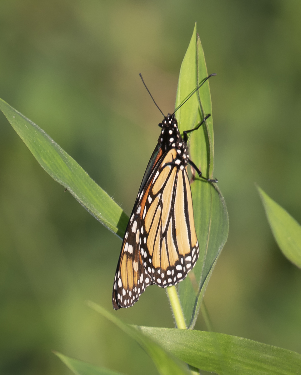
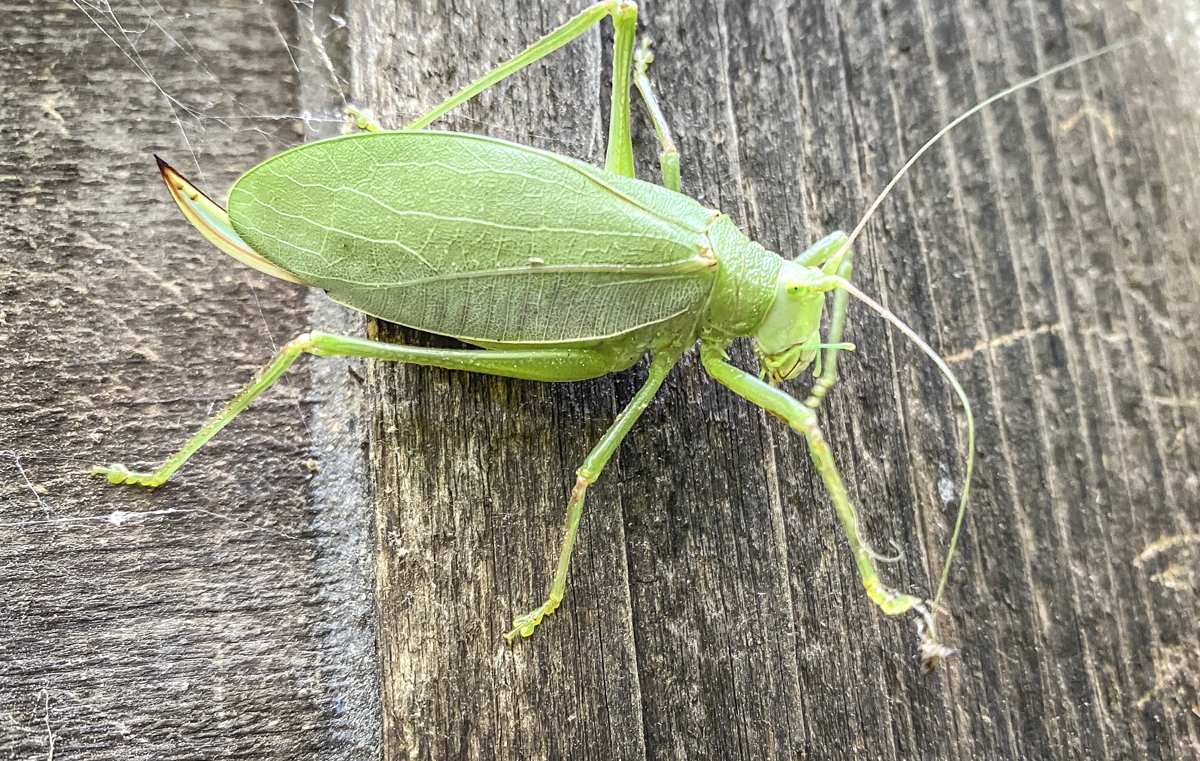
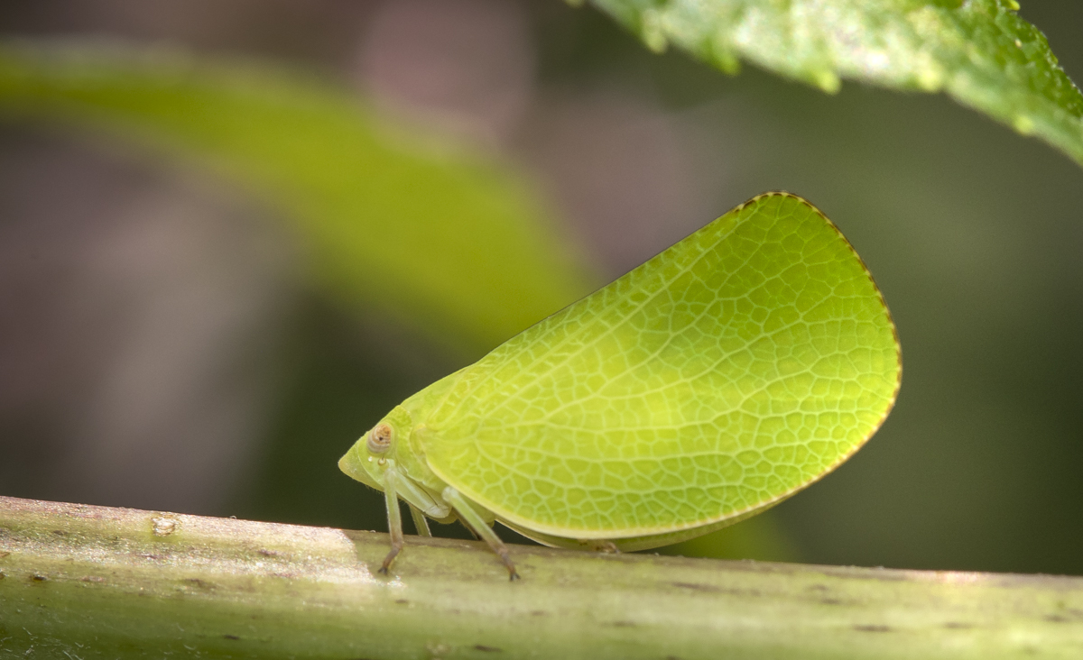
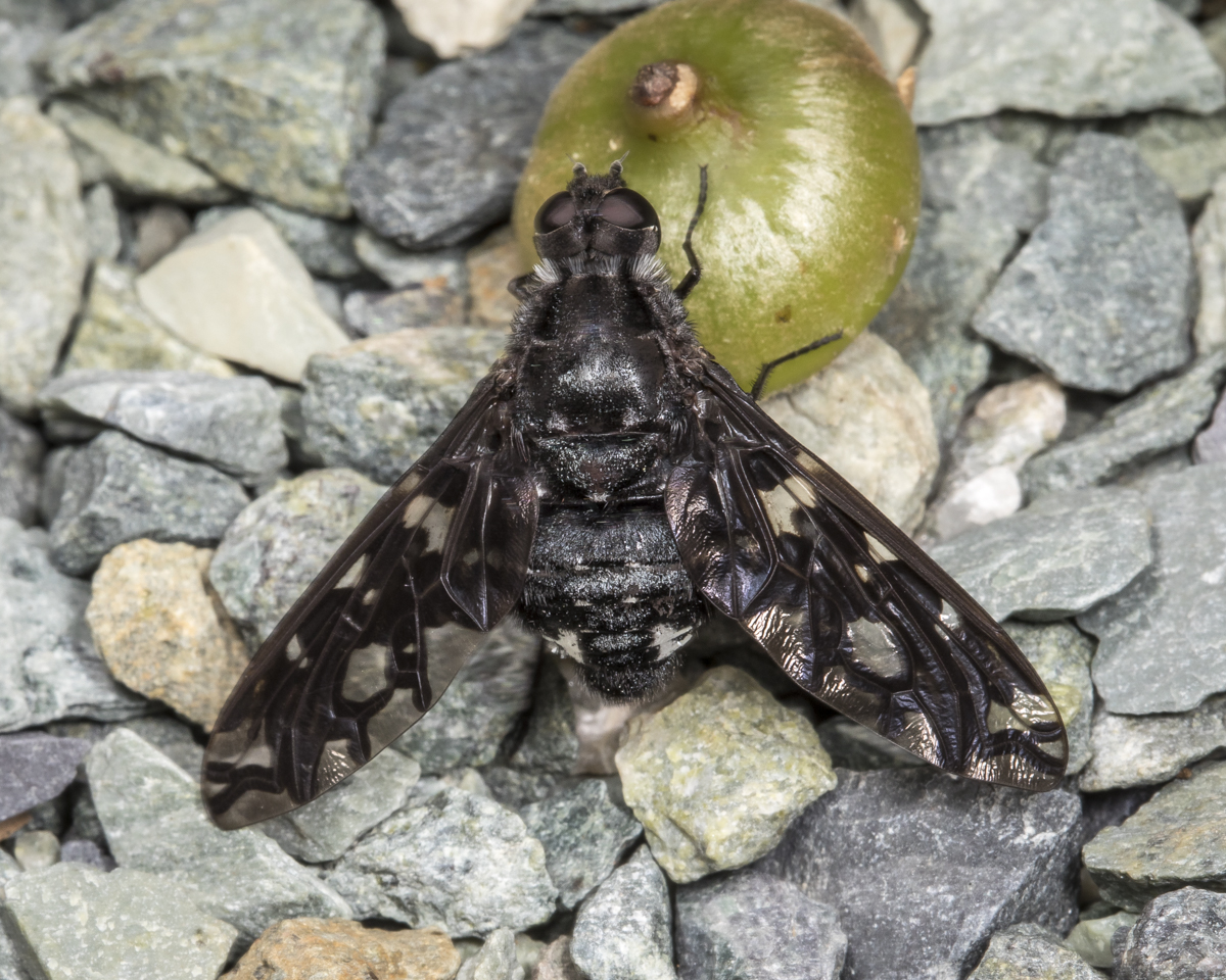
Common True Katydid, Pterophylla camellifolia (iPhone photo). The raspy calls of these leaf mimics are heard from now until autumn in our treetops. Both males and females stridulate. Females (like this one) will use their sword-like ovipositer to insert eggs into the loose bark of trees where the eggs will overwinter and hatch next spring to start the cycle anew. (click photos to enlarge)Green Cone-headed Planthopper, Acanalonia conica. I wrote about these tiny leaf mimics a few years ago in another blog post.This relatively large green guy is always a delight to find – a Green Treefrog, Hyla cinerea. It seems we find one of these in the yard every summer, often clinging onto the stem of a Jewelweed.A mating pair of Large Milkweed Bugs, Oncopeltus fasciatus. They feed on the seeds and sap of milkweed plants in all stages of their life cycle, acquiring the toxins of the plant and making them unpalatable to most predators (hence the bright orange and black warning coloration). Females can lay up to 2000 eggs in their one month life span, so our milkweed plants will soon be covered in the bright orange nymphs.A ghostly nymph of some sort of planthopper (perhaps after a fresh molt)A spiky larva of the Banded Tussock Moth, Halysidota tessellaris (iPhone photo). Varying in color from yellow-orange to gray, these caterpillars feed on a variety of trees and shrubs. They are often found on the tops of leaves out in the open, indicating their potential distastefulness to many predators (due to a combination of the stiff hairs and some chemicals acquired from their host plants).A species of Rose Chafer Beetle, Macrodactylus sp. Whenever I got close with the camera, it raised its long hind legs in what might be some sort of defensive posture.A Tiger Bee Fly (Xenox tigrinus) sitting on a green acorn cap. I’m always glad to see these around our wood-siding house as they are parasites on Carpenter Bees, which love to drill into our fascia boards. Adult Tiger Bee Flies feed on nectar and females seek out Carpenter Bee nest cavities and lay eggs in them where her young hatch and feed on the bee larvae.False Bee-killer, Promachus bastardii (iPhone photo). This large robber fly can be seen (and heard) buzzing around the yard waiting for a chance to pounce on unsuspecting flying insects (often some type of bee) which it then sucks dry.Underside of a female Arrow-shaped Micrathena, Micrathena sagittata, showing the prominent spines on her abdomen (males are tiny, seldom seen, and, well, spineless). Juvenile Black-and-yellow Garden Spider, Argiope aurantia, with a planthopper prey. I think this is a male Bronze Jumping Spider, Eris militaris. It was crawling around on an ironweed next to our kitchen door. It allowed me to get several portrait shots as it scrutinized my big white flash diffuser moving in on it as I tried to focus on those magnificent eyes.
Between every two pines is a doorway to a new world.
~John Muir
There is so much we see when we spend time in nature, but having a few trail cameras set out shows how much we miss. Here are a few of the wildlife happenings our three cameras caught over the past couple of months, vignettes of the life in our woods when we are not there to witness.
A juvenile Red-tailed Hawk sets off a chipmunk alarm call (turn up volume to hear the clucking sound). Chipmunks have different alarms for aerial versus ground predators. I wonder which one it uses for a hawk sitting on the ground?
A pair of Opossums running along the den log. Not sure what is happening here – courtship?; territorial dispute?; practicing crossing a road?
Maybe it is a courtship thing after all, and one party is not thrilled with the idea…
A mother Raccoon teaching her three young about the ways of the woods
Back at the den tree, there may only be two young Raccoons now (not sure)
A young deer escaping the heat with a dash in our wet weather stream after a heavy rain
A Coyote searching for breakfast
Two times last month, the camera caught a quick glimpse of a Coyote carrying something (presumably back to a den). I can’t quite tell what it is (this is the best of the two clips). Can you? A rabbit perhaps?
Nothing is more humbling than to look with a strong magnifying glass at an insect so tiny that the naked eye sees only the barest speck and to discover that nevertheless it is sculpted and articulated and striped with the same care and imagination.
~Rudolf Arnheim
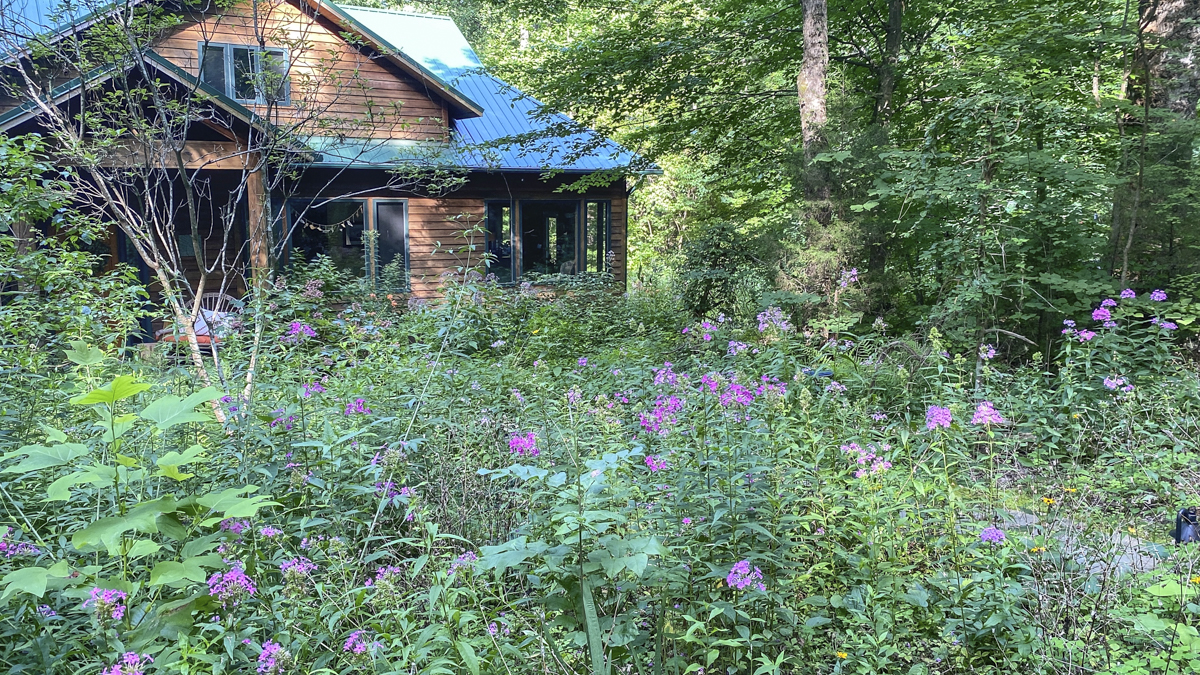
A view of the the native plant jungle that is our yard…there really is a walkway to the door, I promise (click photos to enlarge)
I’m blaming it on our month-long trip out West back in May. At least that’s what I will tell anyone that wonders why our yard is so, well, jungle-like. Over the years, I’ve kind of let plants do what they wanted to do, in violation of most standard gardening practices. There are tall Joe-Pye-Weeds in front of shorter plants, a couple of species of ferns have run amok and taken over large portions of beds, and the tree canopy has grown so much that most wildflowers are abnormally tall and leggy and therefore often fall over without adding plant supports. But, it helps keep the invasives, especially Microstegium, at bay (a little). And then there are the rabbits that like to munch on the species I truly prize (like Cardinal Flower and Rosinweed), so the garden definitely has a mind of its own in terms of species make-up and arrangement. But, it provides food and shelter for a pretty amazing array of creatures, big and small, that keep me company when I wander with my camera. The past few days, I have not had much energy for yard chores due to the heat (another reason it looks this way) but I have managed to stroll through the jungle, looking for some of our tiniest of neighbors.
On of the reasons we have so many insect and spider neighbors is the abundance of native plants like this Buttonbush (Cephalanthus occidentalis), a favorite of both day and night-time pollinators.
Below are some of the small things we see on our meanders through the greenery…
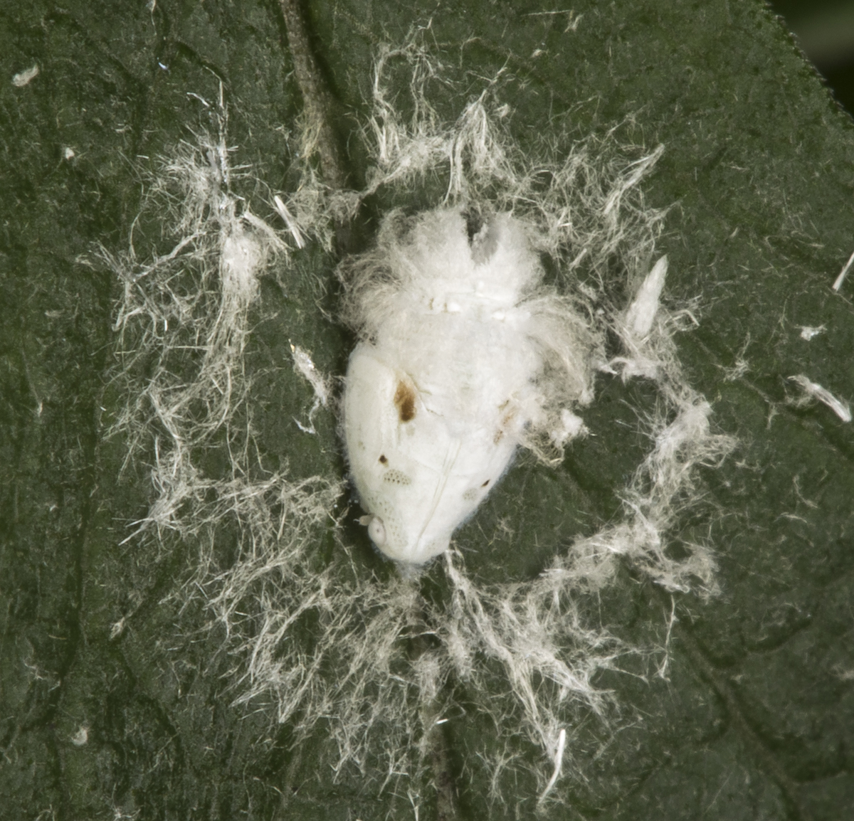
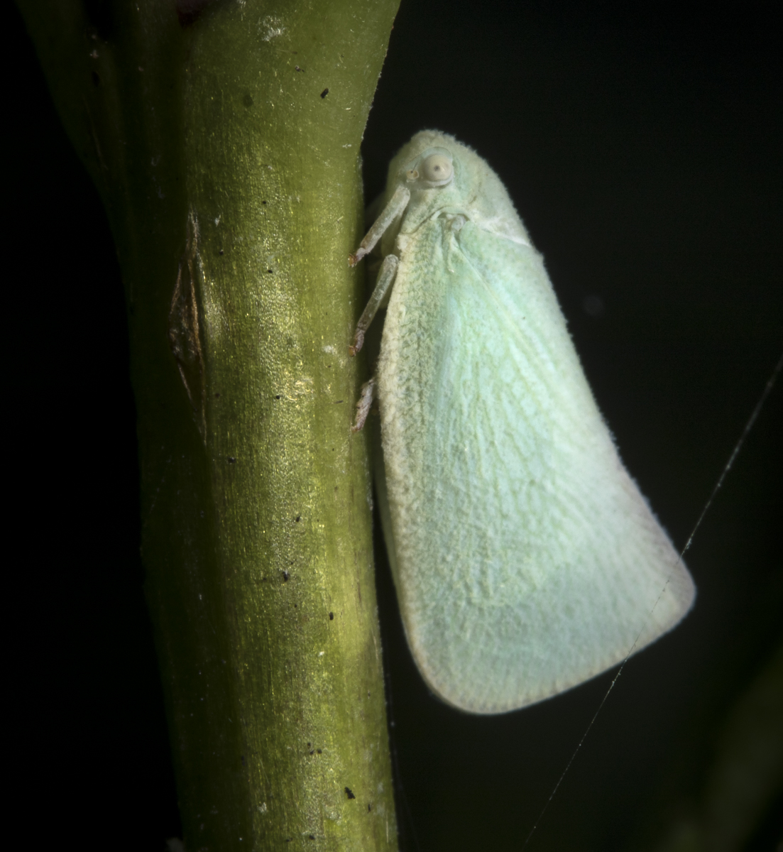
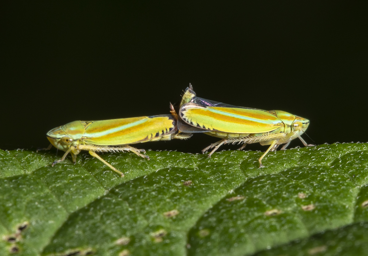
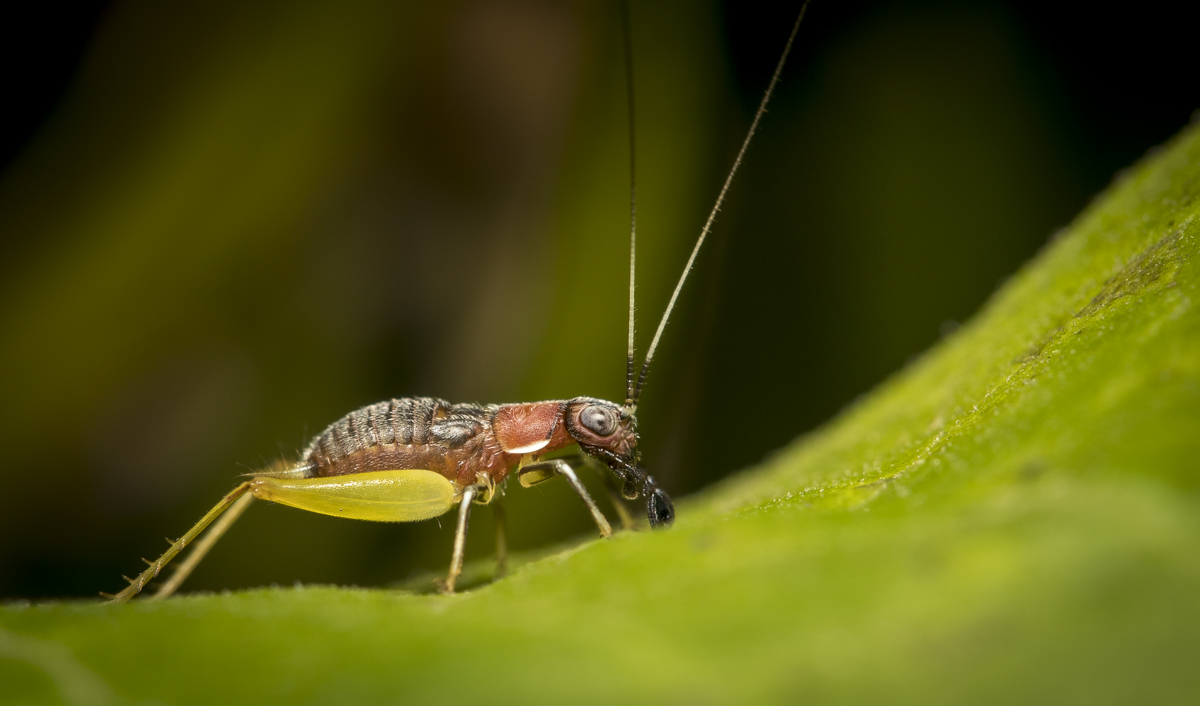
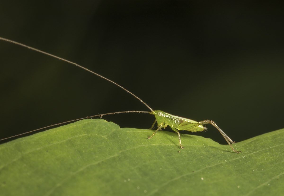
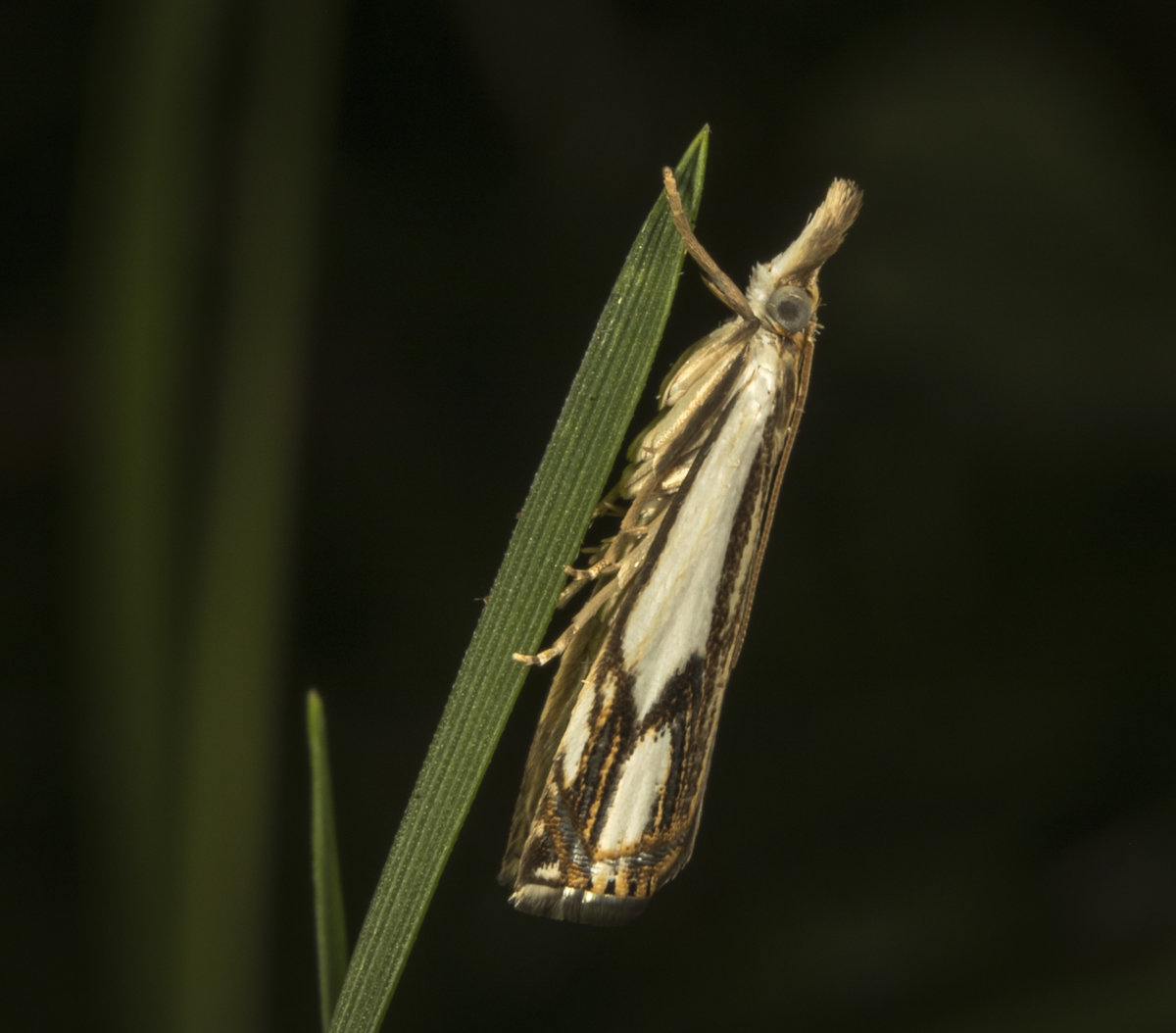
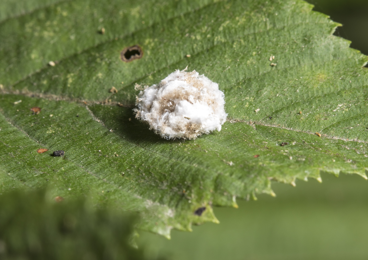
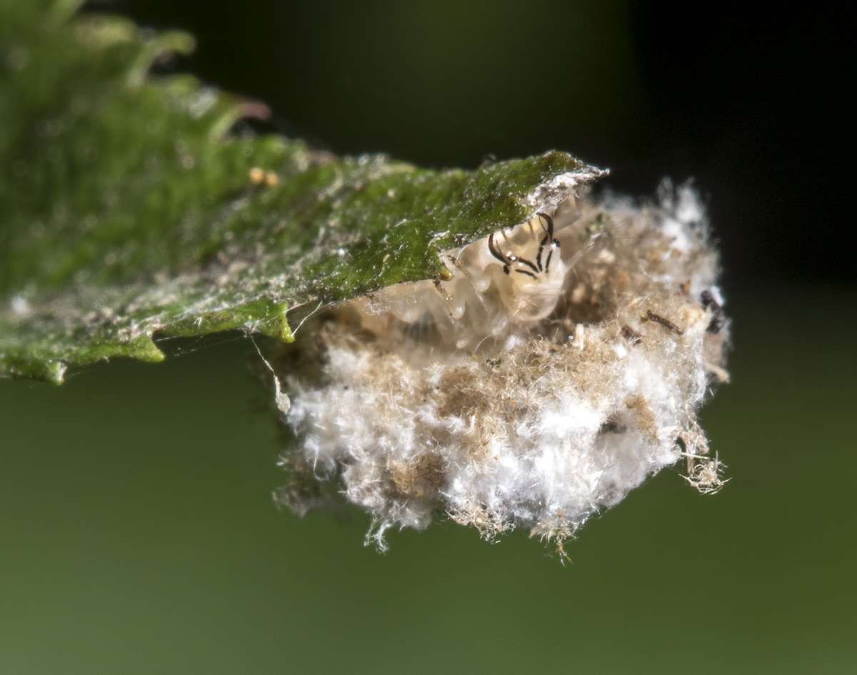
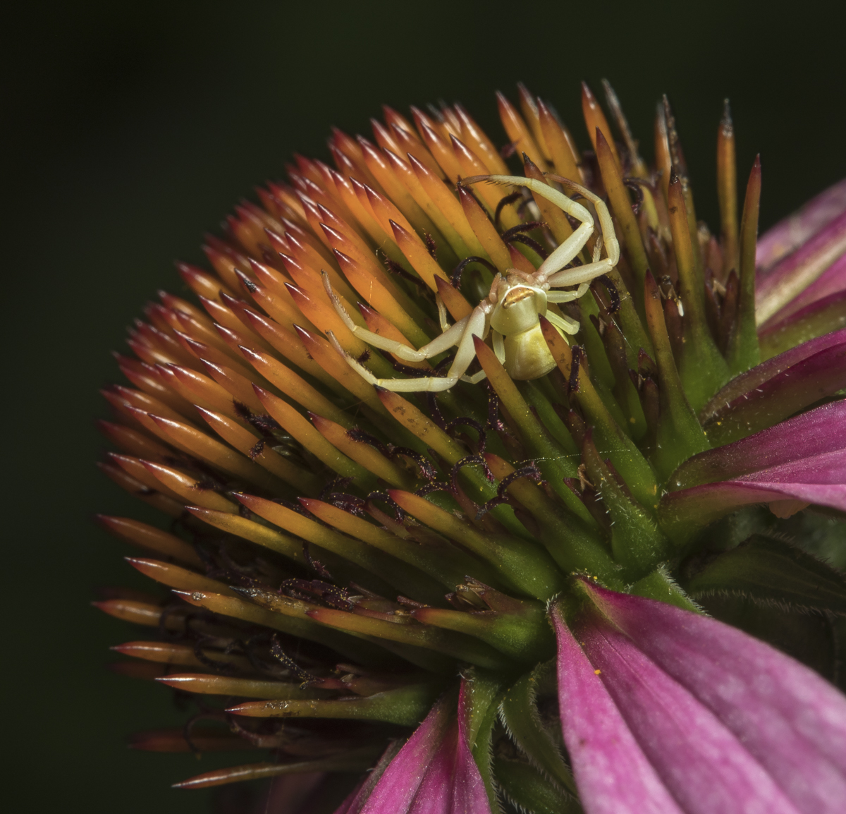
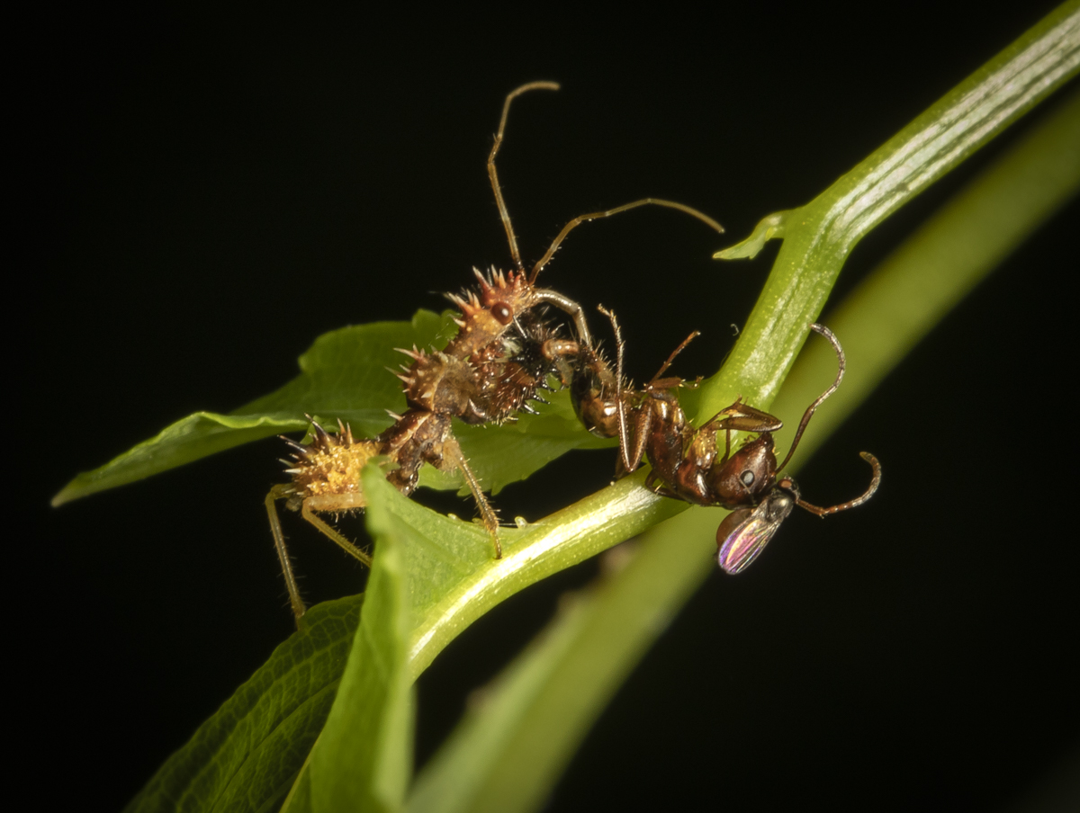
One of the most abundant group of insects right now are the planthoppers. I believe this is a nymph of a Northern Flatid Planthopper, Flatormenis proxima. The waxy filaments may serve a protective function.An adult Northern Flatid Planthopper. Most planthoppers (and other members of the Hemipiteran suborder Auchenorrhyncha) have piercing-sucking mouthparts for feeding on plant sap. They also have powerful legs for jumping, making some rather difficult to photograph.Another common planthopper species in our yard, the Citrus Flatid Planthopper (the adult in lower right of image). The nymph above it may be a Two-striped Planthopper.The SEEK app identifies this as a Two-striped Planthopper nymph, Acanalonia bivittata. It looks to me like some sort of armored creature from a Star Wars movie.A very tiny insect that SEEK identifies as a Coppery Leafhopper, Jikradia olitoria. I tried to confirm these ID’s using online resources like Bug Guide and the Hoppers of North Carolina, but if anyone knows what they are for sure, please let me know.A very persistent mating pair of Versute Sharpshooters, Graphocephala versuta.A beautiful Broad-headed Sharpshooter, Oncometopia orbona. Sharpshooters filter huge amounts of liquid from plants through their digestive system in order to obtain nutrients. They frequently must forcibly eject the excess water in a fine stream, hence their unusual common name.One of my favorite insects to photograph, a wandering Red-headed Bush Cricket (aka Handsome Trig) nymph, Phyllopalpus pulchellus. A tiny nymph of one of the Lesser Meadow Katydids (Conocephalus sp) sprouts an impressive pair of antenna.One of the bigger challenges for a macro photograph, a species of quick-on-its-feet-and-wings Long-legged Fly. These come in a variety of metallic colors and often jump out of the frame when the flash goes off and then return to the leaf. I discovered this when I kept getting blank photos but they were still on the leaf when I looked after taking the picture.A common small moth that I frequently scare up when walking through the yard, a Double-banded Grass Veneer, Crambus agitatellus.These little dots of debris are very common right now. They slowly waddle along the vegetation, and cause you to do a double-take when you see that lichen or that tuft of fuzz move..Beneath all that debris is a voracious predator of small insects, especially aphids and planthoppers, a larval form of one of the species of Green Lacewing. They have spines on their back that they attach material like lichens or the waxy remains of their victims (like planthopper nymphs) to as camouflage. Check out those mandibles on this one!A tiny Crab Spider (perhaps a White-banded Crab Spider) awaits its next meal on the head of a Purple ConeflowerAnother tiny predator is fairly abundant this week, a Spined Assassin Bug, Sinea sp. This aptly named little terror is covered with stout spines and has huge raptorial front legs it uses to grasp prey.Once it catches an insect (in this case a hapless ant), it pierces it with its needle-like proboscis, injects a toxin and a digestive enzyme, and then sucks out the nutrients. This one also had a Freeloader Fly (tiny winged insect on the ant’s head) along to lap up any spilled juices.