I will fill myself with the desert and the sky. I will be stone and stars, unchanging and strong and safe. The desert is complete; it is spare and alone, but perfect in its solitude. I will be the desert.
~Kiersten White
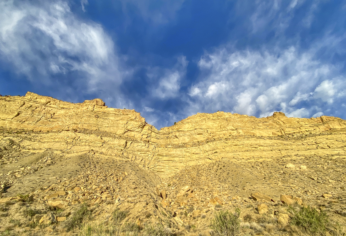
Much of our time in the Southwest was spent under red flag warnings of high winds, and our first afternoon in Grand Staircase-Escalante National Monument was no exception. Luckily, the wind tends to ease up as sundown approaches.
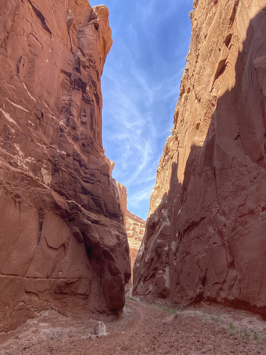
We had a good night in the high desert and headed out very early the next morning for one of Melissa’s main goals for the trip – to hike in a slot canyon. A slot canyon is a long, narrow, deep, and meandering drainage carved through sedimentary rock (usually). The epicenter of slot canyons is southern Utah and northern Arizona where there are many famous ones visited by hordes of tourists each year. We had picked Buckskin Gulch as our destination based on a friend’s recommendation, but fate had other plans for us that morning. As we were driving the 8 miles of dirt road out to the highway, our trusty truck started making some loud noises from the rear. Melissa got out and listened and the problem was in the right rear tire, a metallic clanging when the tire rotated. It wasn’t impacting the brakes or anything else, so we initially thought it might be a rock caught in the brake cylinder area. We continued to drive and the sound varied. Once we reached the highway, it didn’t sound as bad, so we thought, let’s try it. But, as we turned off to head down the dirt road to the Wire Pass Trailhead, the sound became worse, causing us to turn around and head for the only place with any hope of auto repair, Page, AZ, a distance of more than 30 miles. Melissa called and talked her way into an early check-in at a hotel in Page and we found an auto repair place that would open at 8 a.m. near the hotel. We checked into our room (having no idea how long a repair might take) and I took the truck over to the auto shop. They took me in right away and gave me the news that the parking brake on this 18-year old truck had just come apart, and it was pieces of metal causing that terrible noise. He also said it would be 2 or 3 days to get a part, but he could just take it out and we would be good to go (just don’t park on a steep hill). So, an hour later, we decided to take in the local sights and head to Buckskin Gulch early the next morning.

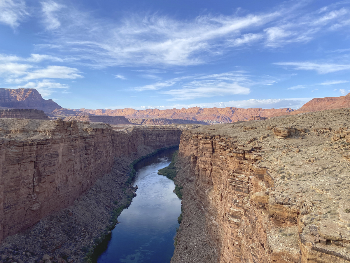
Our first stop was Horseshoe Bend, a famous meander in the Colorado River not far below Glen Canyon Dam. It was a circus of tourists, but certainly is a beautiful sight. Not being used to crowds of any type, we didn’t stay long. Melissa had called the Bureau of Land Management office and got some tips from a ranger the day before who had shared a location of another slot canyon in the area that she said we would likely have to ourselves. So, we headed out and hiked in a “private” slot canyon for a couple of hours.

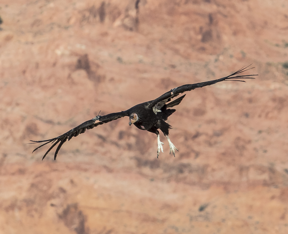
The same person that told Melissa about Buckskin Gulch had also shared her enthusiasm at seeing California Condors near Page at a place called the Navajo Bridge. This is an area where several condors had been released into the wild during restoration efforts and is known as a place where these huge birds return to the bridge and surrounding canyon walls to roost in the evening (especially in the spring).
The California Condor is North America’s largest land bird, weighing up to 25 lbs and having a wingspan of almost 10 ft. It is critically endangered and became extinct in the wild in 1987 when the known remaining 22 (or 27, depending on which reference you use) birds were captured for a captive breeding program aimed to help recover the species. Captive reared birds started being released back into the wild in 1991, and today, the condor population numbers over 500 birds, with around 300 flying free in California, northern Mexico, Utah, and Arizona. One of the release sites is the Vermilion Cliffs Wilderness adjacent to the Navajo Bridge. Condors prefer steep cliffs for roosting and nesting so they can launch their huge bodies into the air, and online reports mentioned they also roost on the bridge structures in this location. So, we arrived close to 5:30 p.m. and started watching and waiting. Melissa walked across the bridge and saw a woman with binoculars and a camera and struck up a conversation. She was there for the condors as well, and assured us they would be there at some point this evening. We kept scanning the canyon, expecting to see them fly in from one direction or another, but only swifts and an occasional hawk flew by. After about 30 minutes on the bridge I looked over and saw the woman with binoculars walking toward us pointing up into the sky. I turned and looked straight up, and there it was, a condor! It dropped rapidly as if descending from heaven (Melissa commented that she understood how many Native Americans incorporated this giant bird into their mythology with this type of grand appearance) and soared underneath and landed on our bridge. Over the next few minutes, three more condors came in, one landing on the bridge and two more on the cliffs.
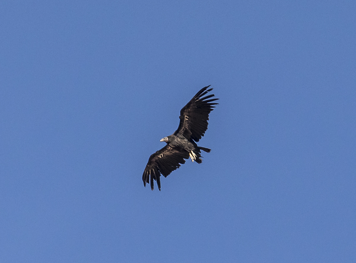
Each California Condor has a numbered or lettered tag and some carry radio transmitters on their wings for tracking so biologists can learn more about their habits and potential threats to the population (lead poisoning from feeding on carcasses shot with lead ammunition is one of the biggest threats to birds in the wild). The bird above is V7. The Peregrine Fund is one of the participating organizations in the condor recovery program and has an online database that gives you more information on each bird. According to that database, V7 is a juvenile bird (condors reach maturity at around 6 years) as indicated by the dark gray head and lack of bright white patches under the wings. It is a male, hatched in May of 2017 in the wild in Utah.
This bird soared beneath me with a clear view of its tag, #12. This bird is a female, hatched in 2016. She is attaining the pink skin on the head and has started to develop the white under-wing patches.


The only fully adult bird we saw landed a long way from us on the cliffs. It is a male reared in captivity that hatched in 2004, making it 17 years old. California Condors are one of the world’s longest-living birds and can live up to 60 years. This was, indeed, a magical evening in a stunning landscape.
Early the next morning, we headed to Buckskin Gulch. There is a fee that you must pay and obtain a permit online before going. We drove to the Wire Pass trailhead, which is also the trailhead for another popular hike to a geologic feature called The Wave, but permits are hard to get for that hike with a maximum of only 64 people allowed each day.
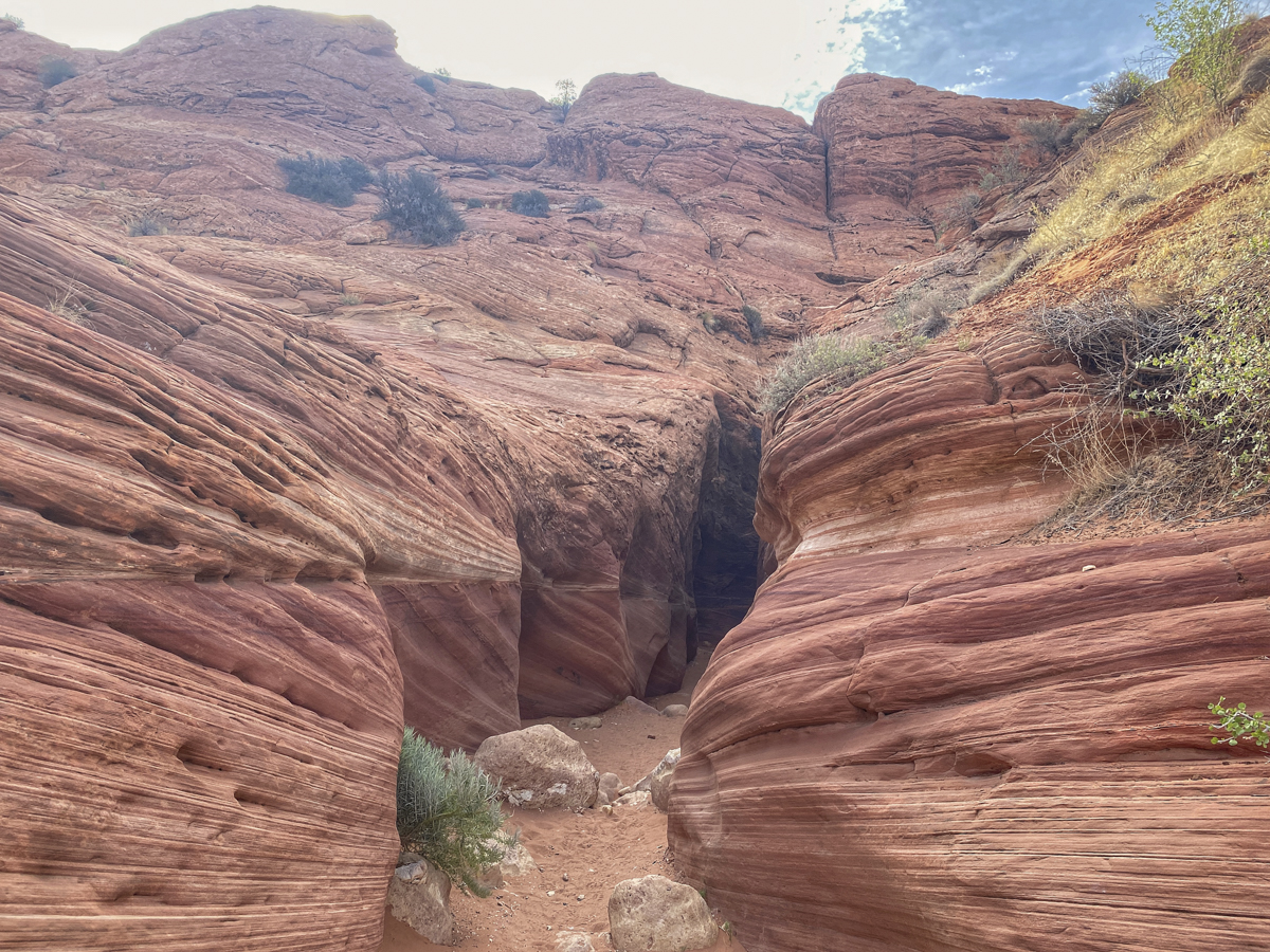

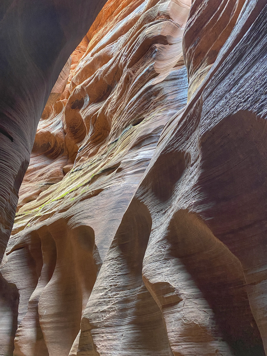
After entering the narrow slot, you are immersed in a fantastical world of swirls, lines, and light. We soon realized that by arriving early, we had avoided many of the people that do this popular day hike, so we had long stretches of the slot canyon to ourselves. After a mile or so, you reach a more open area that is the juncture with the Buckskin Gulch slot canyon. You want to take the trail to the right to continue down the more narrow slot canyon.

We hiked at least a couple more miles from the juncture, taking in the magic of this place and marveling at how such a feature can form. There are an average of 7 or 8 flash floods through the canyon each year, typically in July and August, that can send walls of water as high as 100 feet through the narrow canyons, so hikers are advised to check the weather before going and to not hike if rain is predicted anywhere in the region. At times, you may have to walk through water or mud, but conditions were very dry when we hiked through.
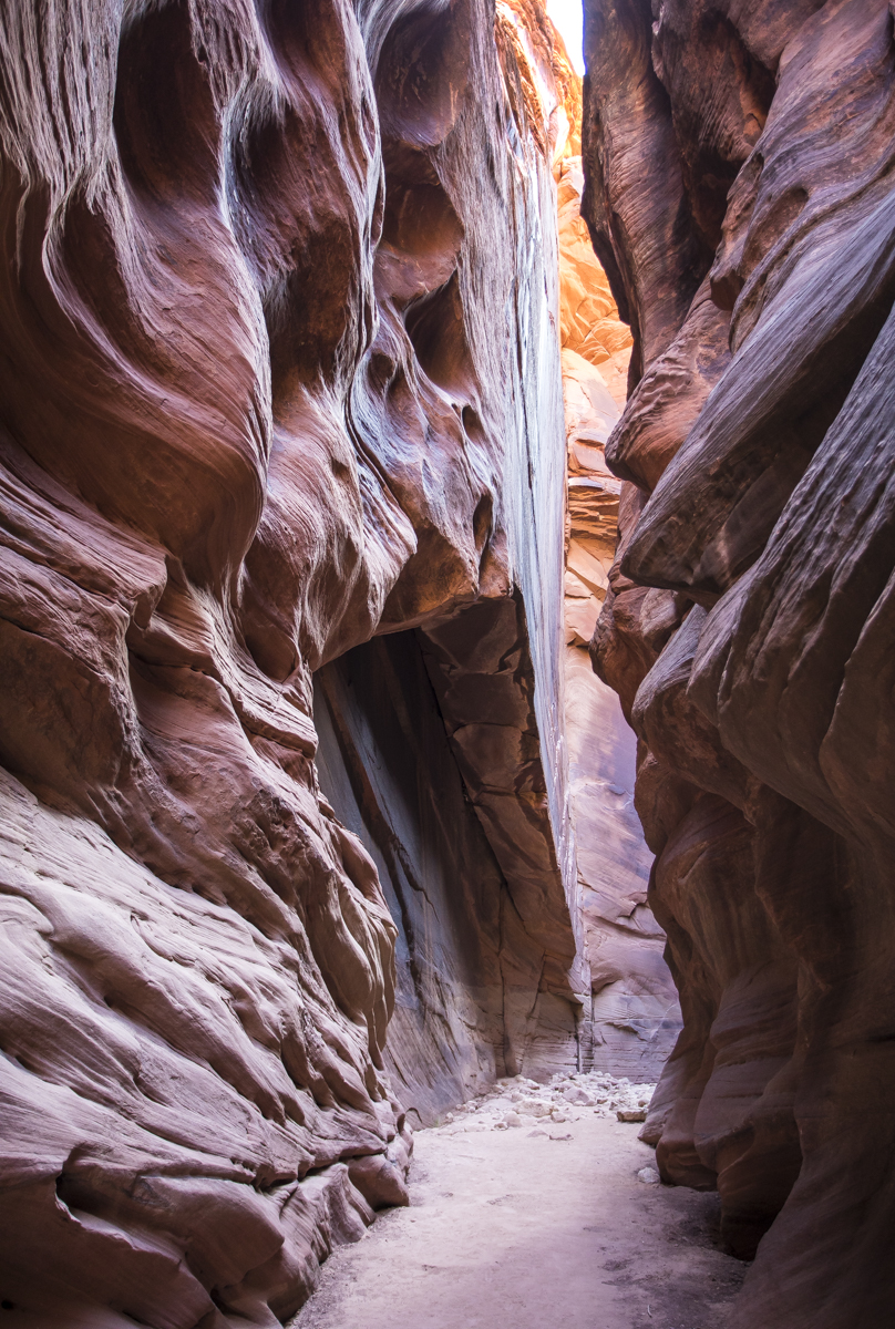

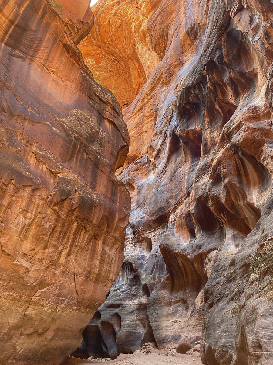


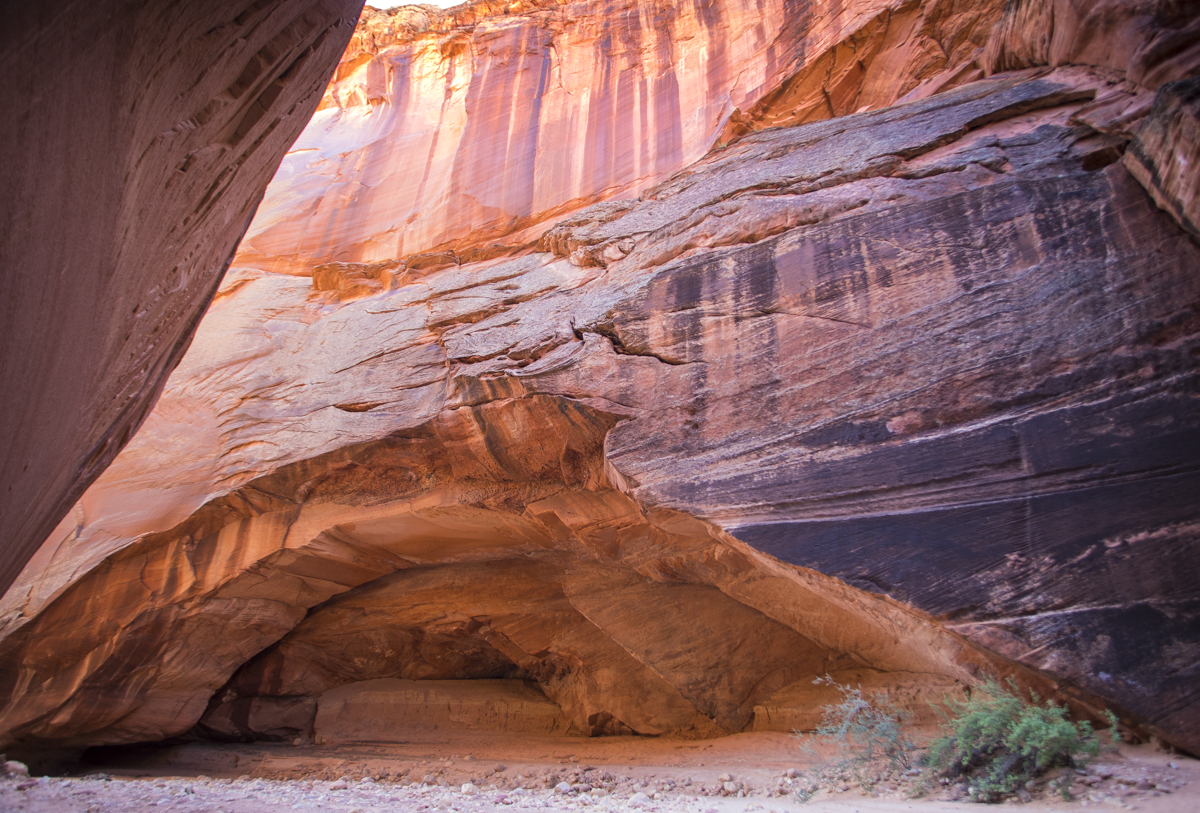


Buckskin Gulch is one of the most popular hikes in the Southwest and rightfully so. It is the longest and deepest slot canyon in North America (and perhaps the longest in the world) at almost 14 miles in length with walls soaring 500 feet above you in parts of the canyon. As we hiked out, we started passing the wave of visitors coming in we had heard we might expect. This is a very special trail and well worth a visit if you are anywhere near. And it was a special way to spend our anniversary and check off one of the few big items we had planned from our to-do list for this trip.
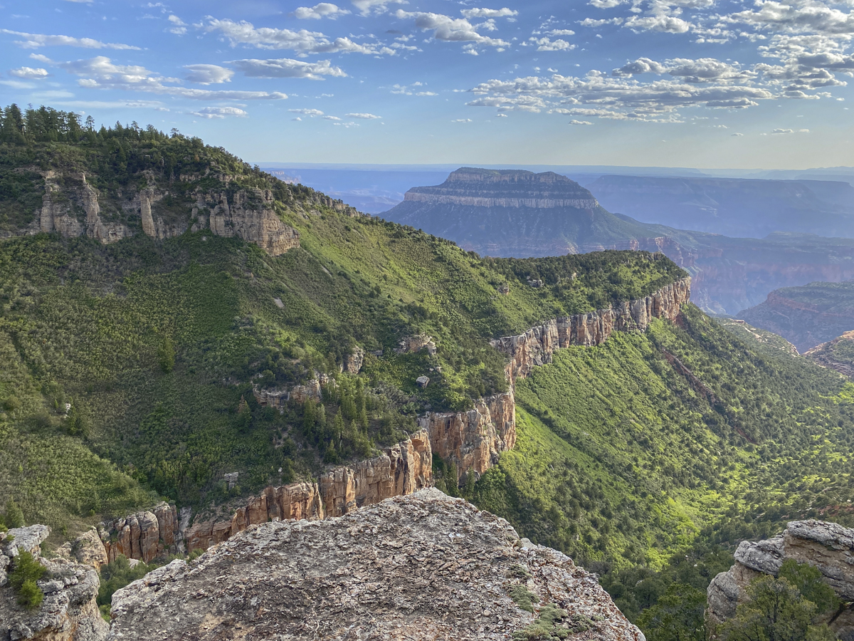
Looking at the maps, we decided to go ahead and make this day extra special with a couple of hour drive to the a park I had surprisingly never visited – Grand Canyon National Park. And we lucked into a very special campsite…more on that next time.

Leave a comment