For me, it always come back to the land, respecting the land, the wildlife, the plants, the rivers, mountains, and deserts, the absolute essential bedrock of our lives. This is the source of where my power lies, the source of where all our power lies.
~Terry Tempest Williams
It was hard to leave Boulder Mountain, but the road beckoned. Weather patterns were holding us back from heading to Jackson, WY, to see friends as a large rain and snow system seemed to be sitting on the Teton-Yellowstone area. We considered a trip farther west to a very under-utilized national park, Great Basin, in Nevada. But the lack of very many camping options deterred us, so we opted instead for a complete turn-around and got an Airbnb in Springville, UT (we agreed we finally needed a night in a place with a nice shower). We were very impressed by the mountainous areas of Utah as we drove through and we will certainly be back.
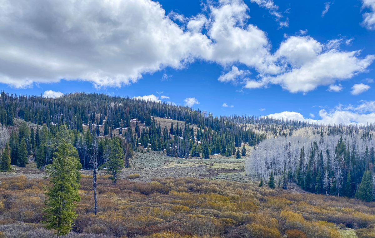
The high meadows, aspens, and conifers of the Uinta-Wasatch-Cache National Forest (click photos to enlarge)
Melissa found some good-looking areas in the nearby Uinta-Wasatch-Cache National Forest, so we headed there the next morning, exploring some high elevation meadows with somewhat muddy roads and scattered pockets of snow, before settling on a lower elevation campsite.
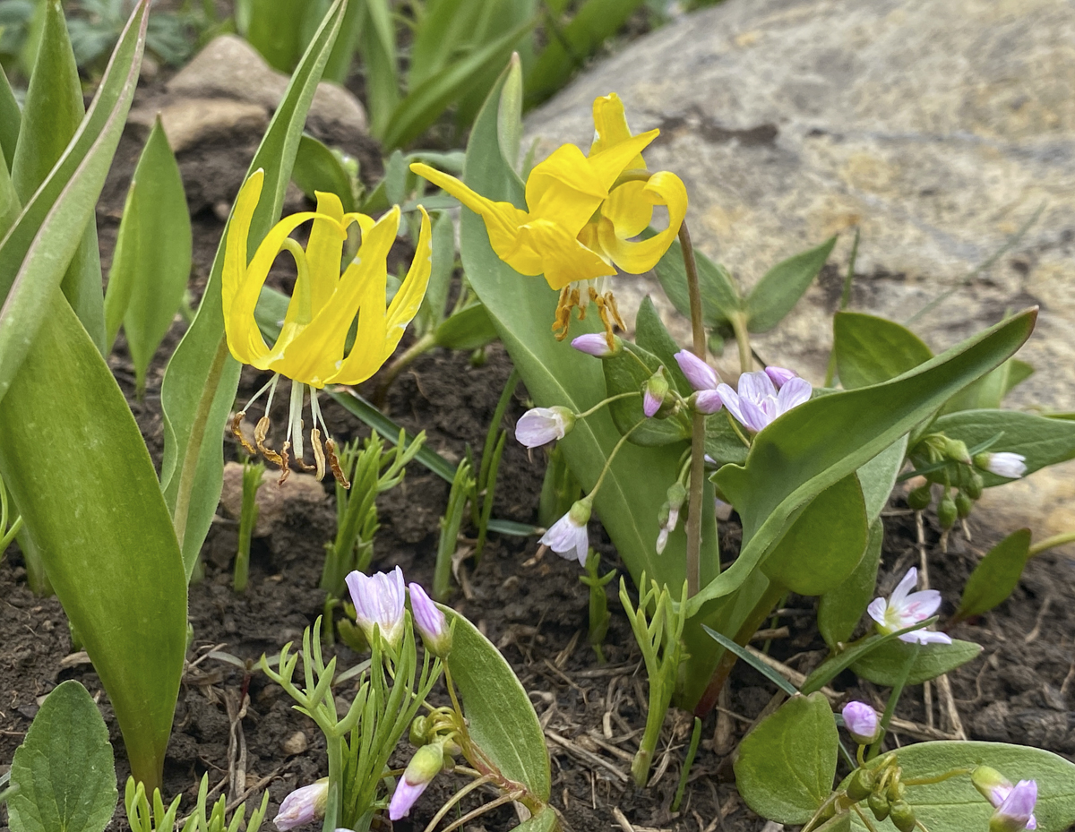
Glacier Lilies and Spring Beauties in a high meadowFields of Glacier Lilies at an elevation of about 9000 ft in the Uinta MountainsOur beautiful campsite at about 7800 ft off the Mirror Lake Highway
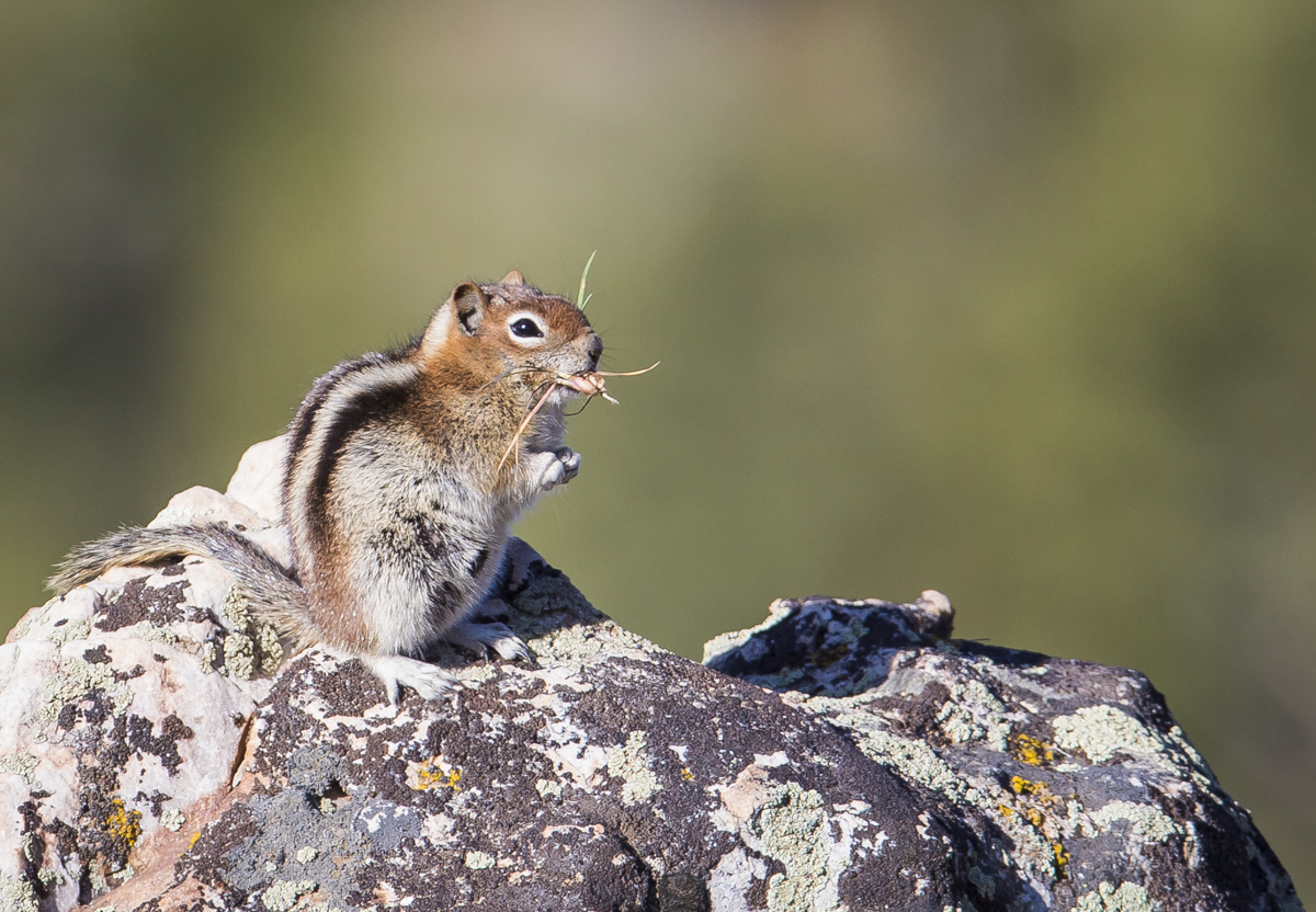
We checked a couple of spots off the Mirror Lake Hwy before picking a relatively open site at the edge of a small drop-off with distant views of mountains. The rocky ledge was home to a few ground squirrels and I managed to convince them I was harmless by sitting still for many minutes.
A Golden-mantled Ground Squirrel having a morning snack
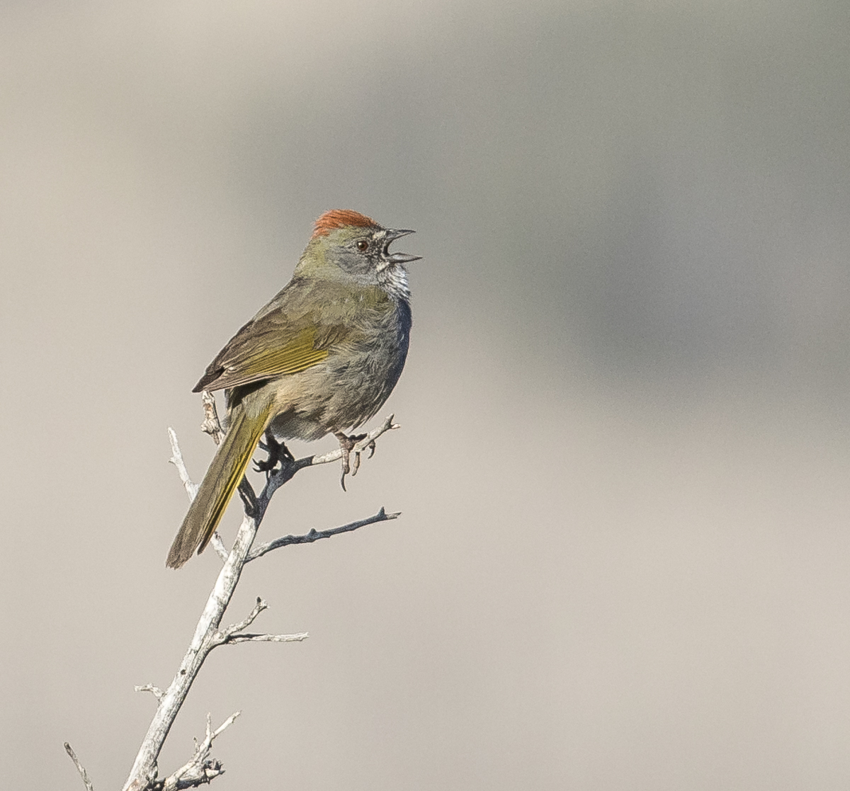
A less cooperative resident was a new species for me, a Green-tailed Towhee, that was singing from s small shrub snag until I would try to approach for a photo. We noticed a pattern in its behavior – shortly after I would retreat, the bird would return to the same snag and start singing again. So, I finally just sat down at a distance and heavily cropped the image you see below.
I looked at the field guide description online and was impressed that the author must have known this particular bird as they said “one of the best ways to find them is to visit a shrubby mountainside or sage flat during spring or early summer. Males will spend long periods perched at the tops of shrubs and singing.”
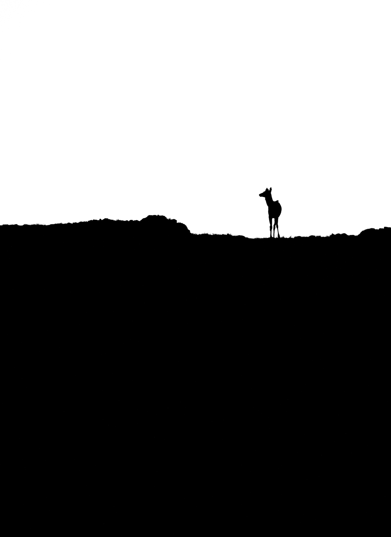
A Green-tailed Towhee laying claim to the mountain
The next day we headed to a destination I was eager to visit – Bear River Migratory Bird Refuge near Salt Lake City. This is a large wetlands complex that is home to huge numbers of waterfowl during migration as well as a variety of other birds throughout the year.
Bear River Migratory Bird Refuge is a sea of wetlands with a beautiful snow-capped mountain backdrop
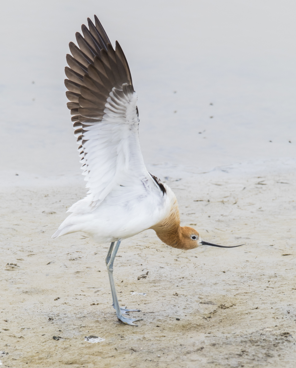
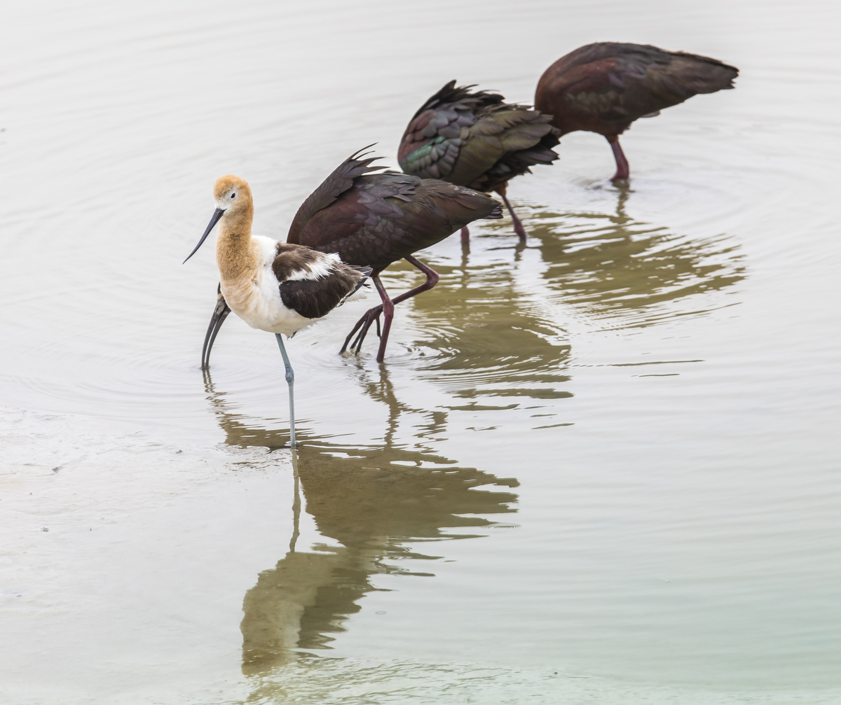
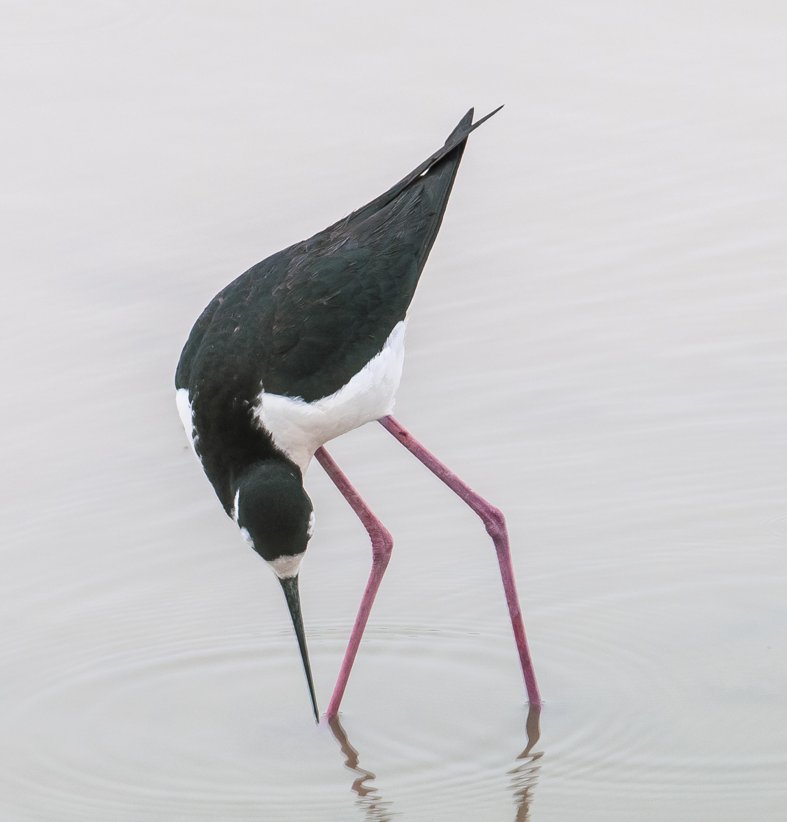
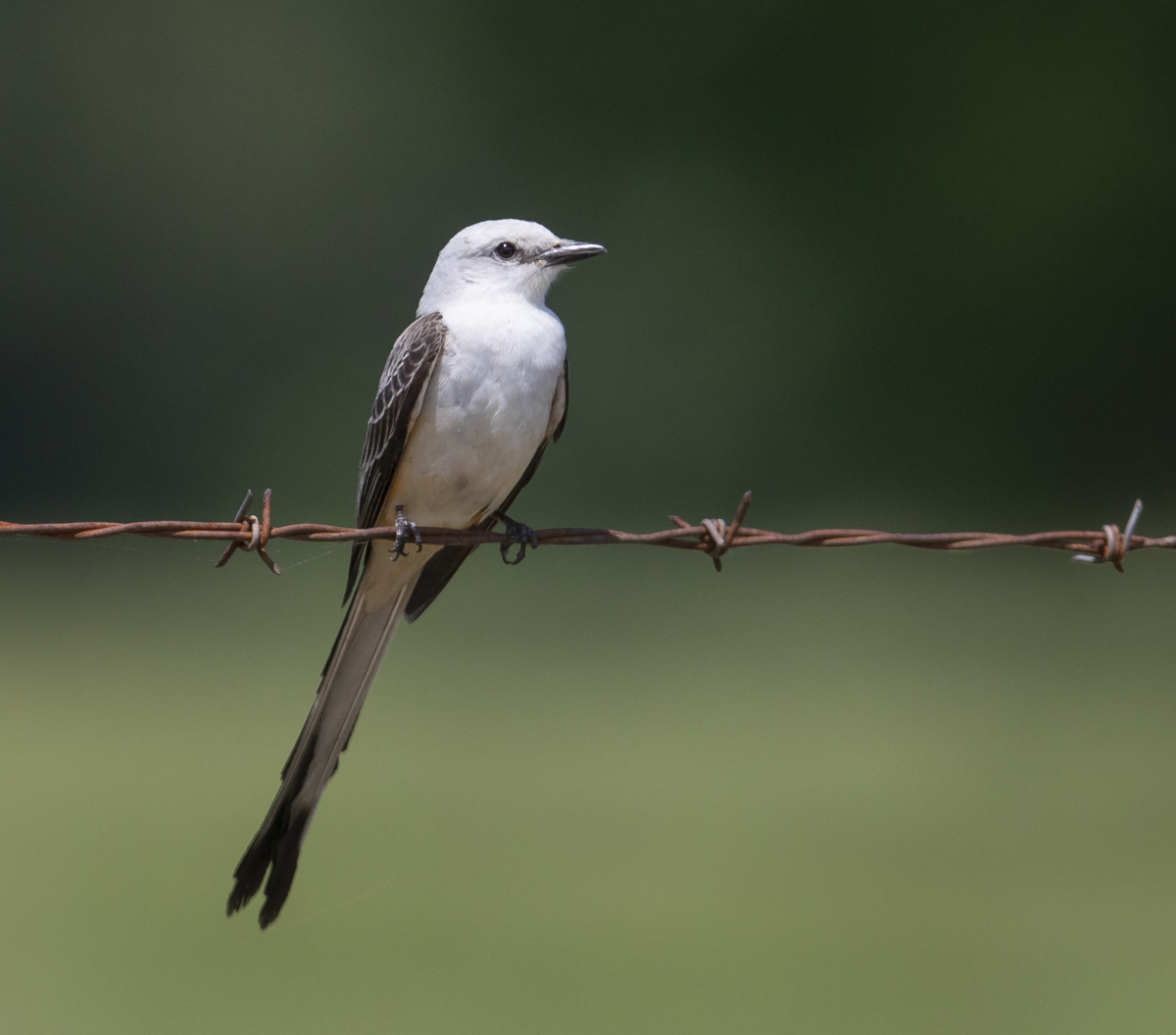
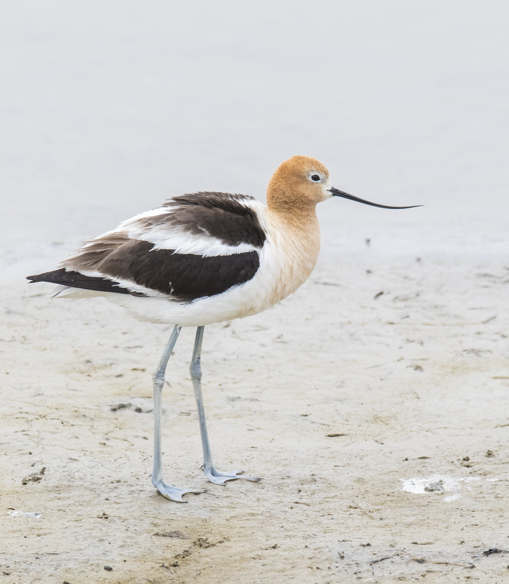
Two species I particularly hoped to see were American Avocets and Black-necked Stilts, both of which nest on the refuge. At the refuge entrance, an American Avocet obliged and was feeding right next to the road at a boat ramp. Birds of the World Online discusses the meanings of the names for this beauty – the generic name, Recurvirostra, comes from the Avocet’s long recurved, or up-turned bill. The name Avocet is from the Italian avosetta, which means ‘graceful bird’.
The American Avocets are in their breeding plumage now, with a nice cinnamon hue to their head and neck.
We spent the next couple of hours slowly driving the 10-mile auto tour and taking in the thousands of birds scattered throughout the varied wetlands that comprise this impressive refuge. Here are some of the highlights…
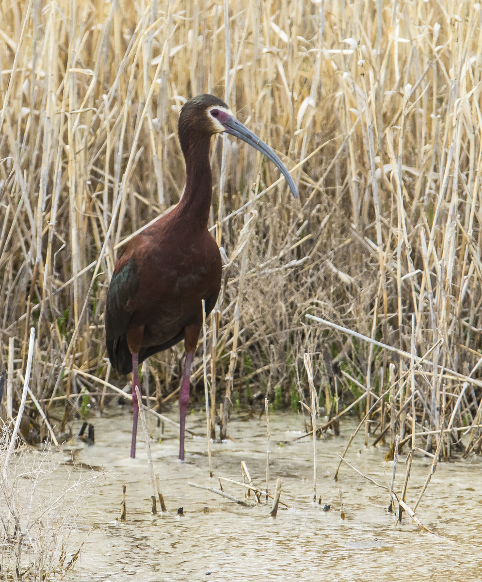
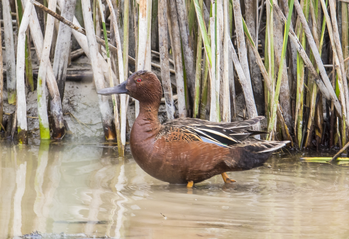
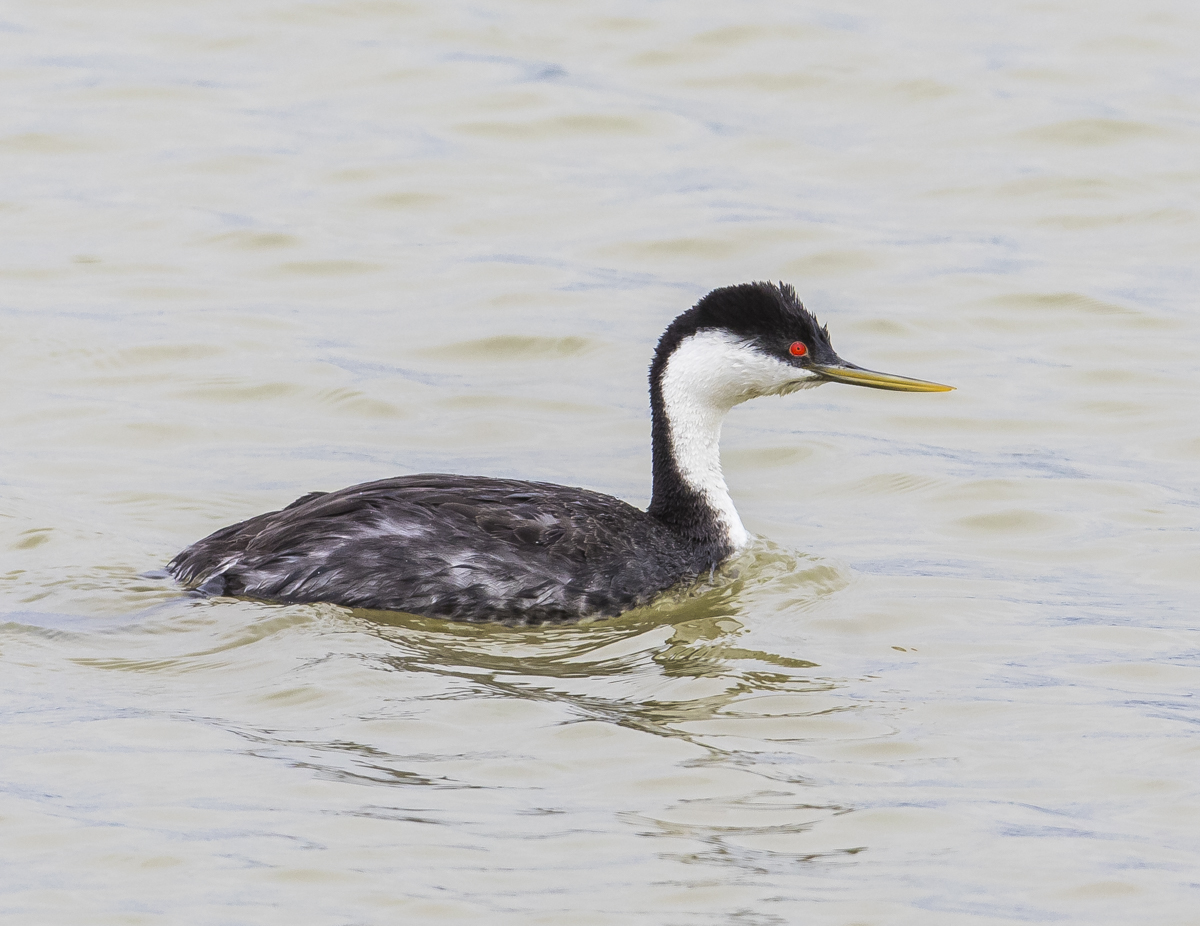
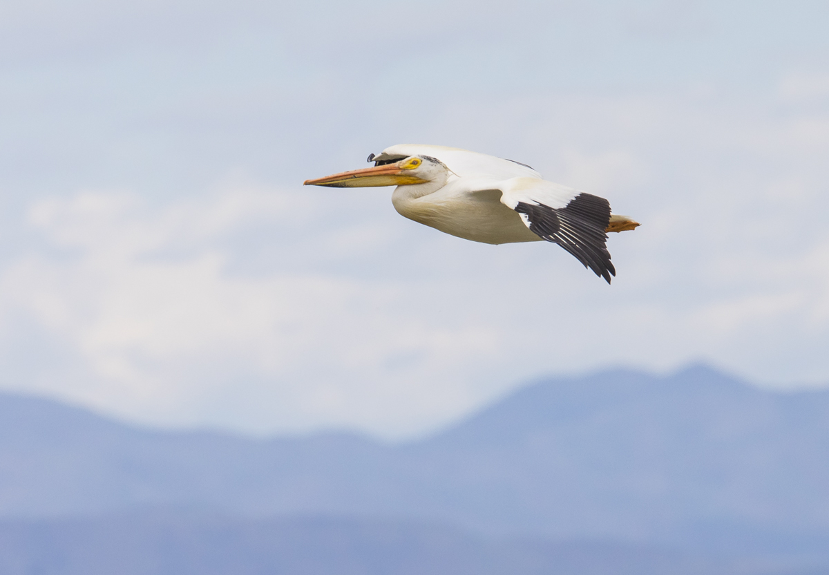
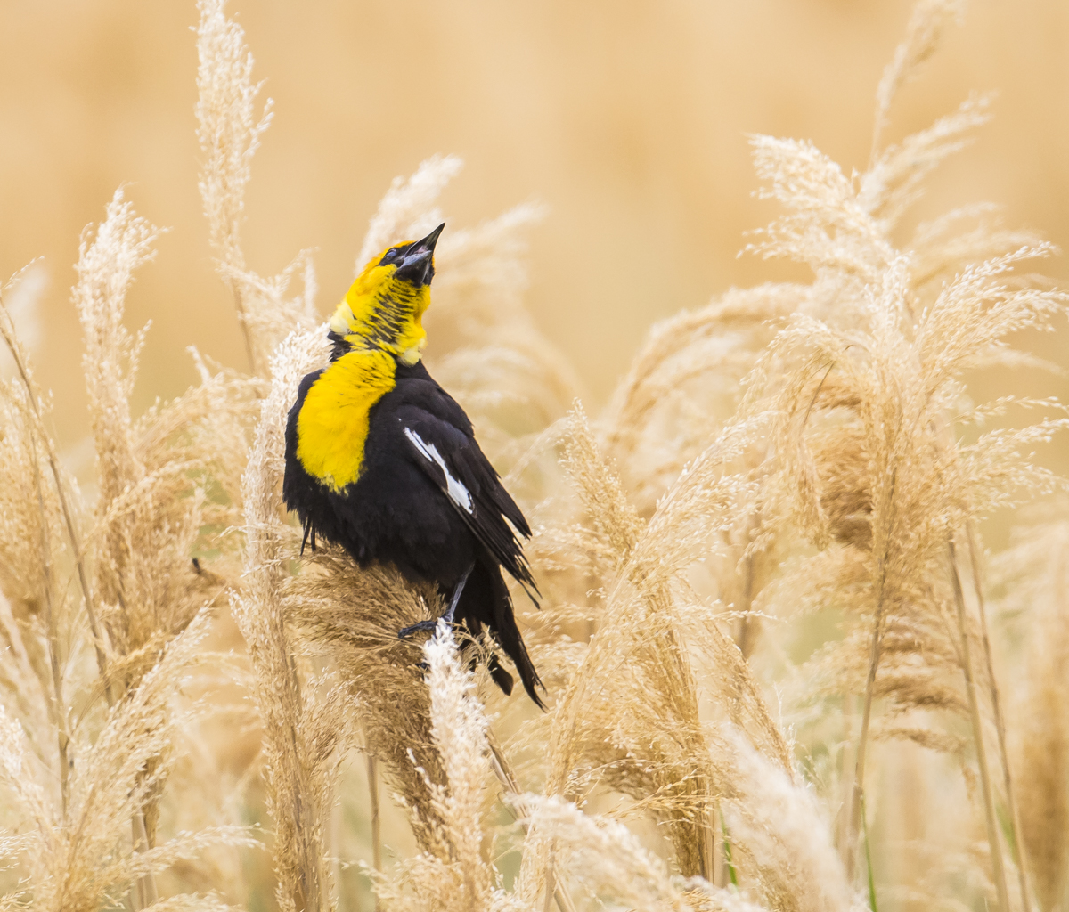
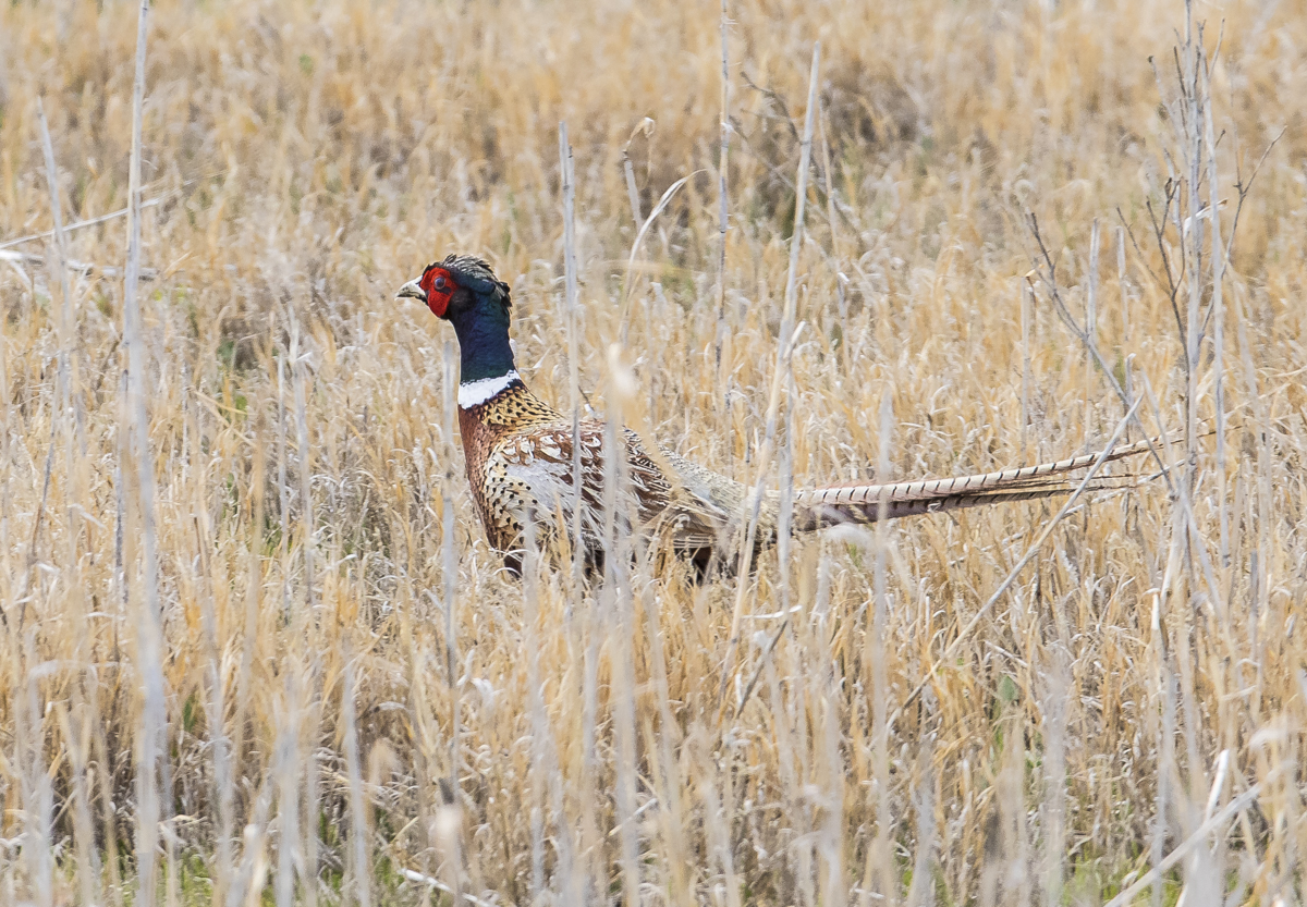
The refuge web site states that it is home to the largest White-faced Ibis colony in North America (and I can believe it as we saw so many of these birds feeding in the shallows).This time of year, the waterfowl are not the stars of the refuge, but we did see a few species such as this Gadwall, plus Blue-winged Teal (probably the most numerous duck we saw), Mallards, and…Always a delight to see Cinnamon Teal. Northern Utah’s wetlands provide habitat for over 50% of the breeding population of this beautiful birdWe were thrilled to see our first Long-billed Curlew in the short grasslands on the refuge. The generic name, Numenius, is from the Greek noumenios meaning “of the new moon”, since their 8-inch long curved bill is reminiscent of the crescent new moon.We watched avocets at every stop, sometimes not living up to their “graceful bird” monikerAvocet yogaAn American Avocet with a trio of White-faced IbisAnother stunning long-legged wader, the Black-necked Stilt. The refuge hosts about 3% of the breeding population of these beautiful birds, but an estimated 80% of their migratory population passes through the refuge and surrounding wetlands each yearWe see these birds on our Outer Banks, but seeing so many and being able to spend so much time observing them was a real treatThey look like a child was given a black and white sock and some pink pipe cleaners and black wire and told to assemble a birdWestern Grebes were feeding along many of the roadside ponds and canals. They can be recognized by their red eye being surrounded by dark feathers, a thicker dark line down their neck, and a somewhat dark yellow bill Similar in appearance to the Western Grebe, but the red eye of this Clark’s Grebe is surrounded by white feathers, the dark line down the neck is quite thin, and the bill is bright yellowBlack-crowned Night Herons were quite common on the refuge and were out feeding along the marsh edgesSmall flocks of American White Pelicans were seen all along the auto tour roadA male Yellow-headed Blackbird belting out his “song” among a picturesque (but hugely problematic) stand of Phragmites grassOur last bird on the refuge was a surprise, a male Ring-necked Pheasant. This species, originally from Asia, has been successfully introduced to many parts of the word as a game bird, including the U.S., where it is common in the Midwest
As is usual, we spent more time than we planned on the refuge, enjoying the continuous display of bird behaviors. It was a windy, gray day, which gave me reason to want to come back on a sunny day and spend an early morning and late afternoon photographing the amazing variety of birds in this special place. Plus, I would love to be here when many of these species have their young. And then there are the thousands of waterfowl in migration…so many birds, so little time.
If future generations are to remember us with gratitude rather than contempt, we must leave them something more than the miracles of technology. We must leave them a glimpse of the world as it was in the beginning, not just after we got through with it.
~President Lyndon B. Johnson
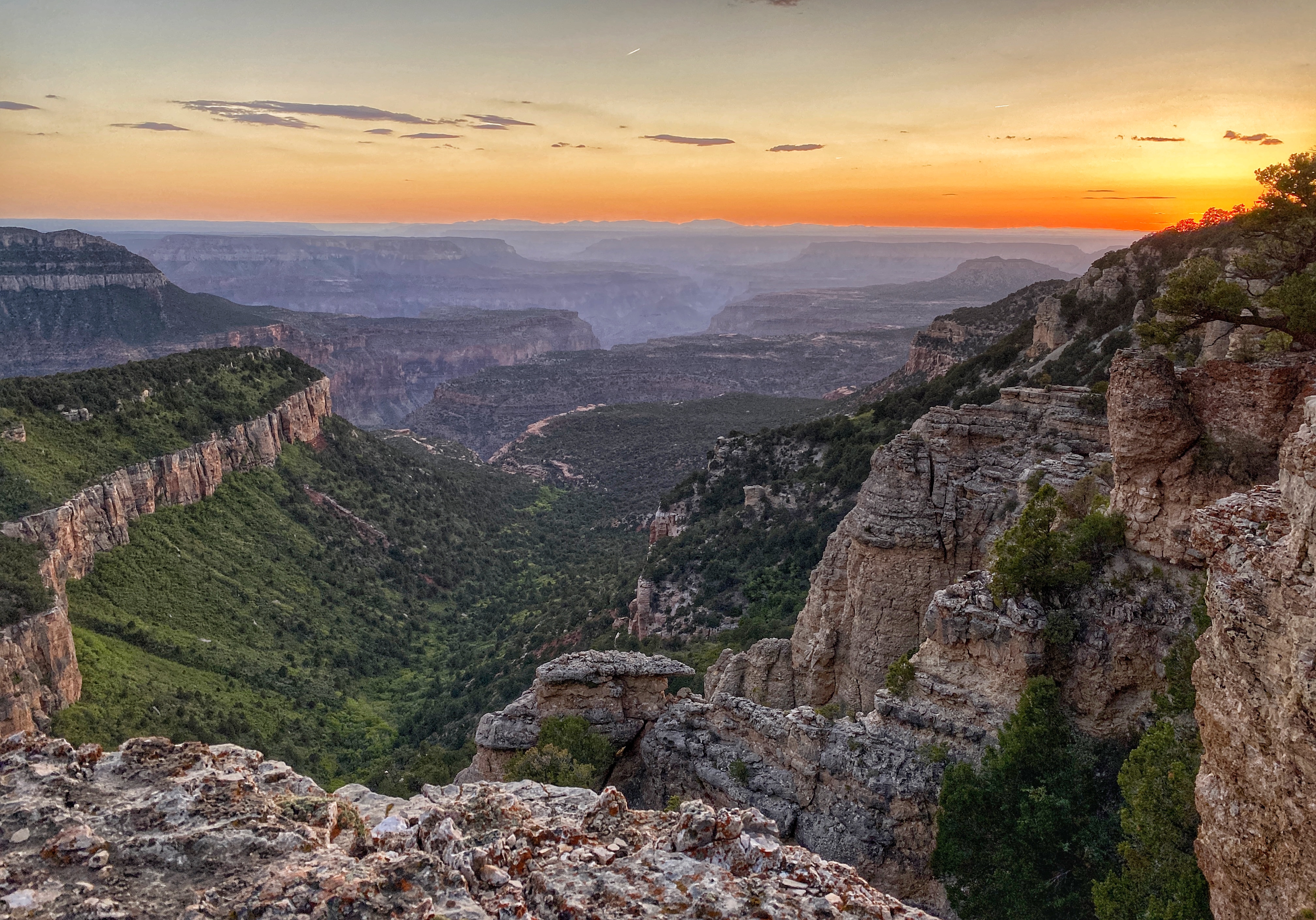
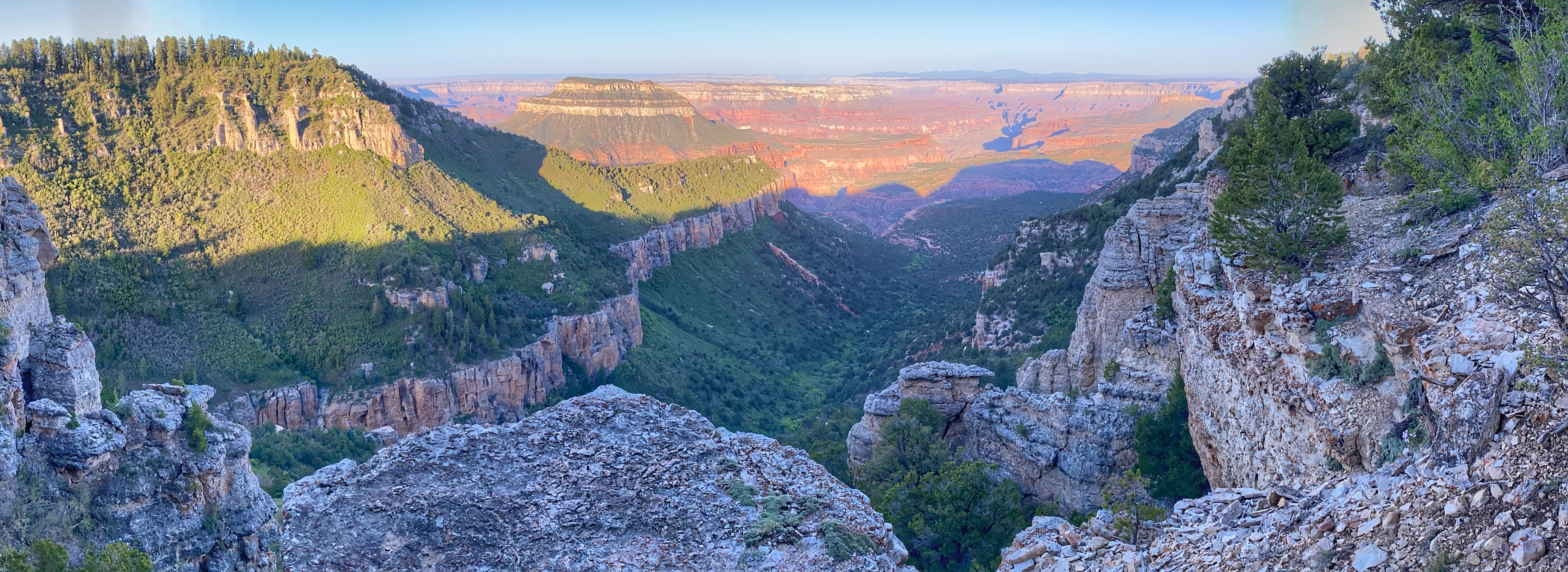
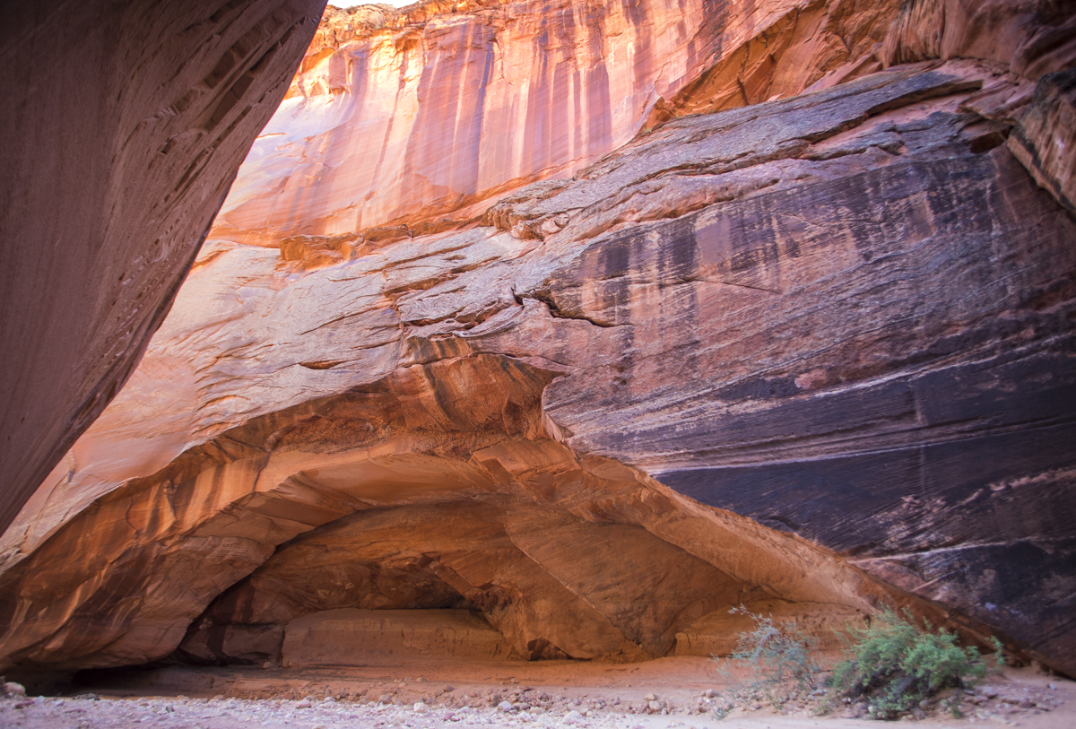
Just a reminder, these latest posts (and the next few) are about our truck camping adventure this past May, a month-long wandering across some of the beautiful public lands of our country, taking in what we could as we traveled. The last post highlighted one of our best hikes of our entire trip, Buckskin Gulch in Utah. It was a bonus hike in that it was high on Melissa’s bucket list and it happened on our anniversary (due, in part, to a one day delay for minor truck repairs). We ended our anniversary day on another high note with a perfect campsite on the north rim of Grand Canyon!
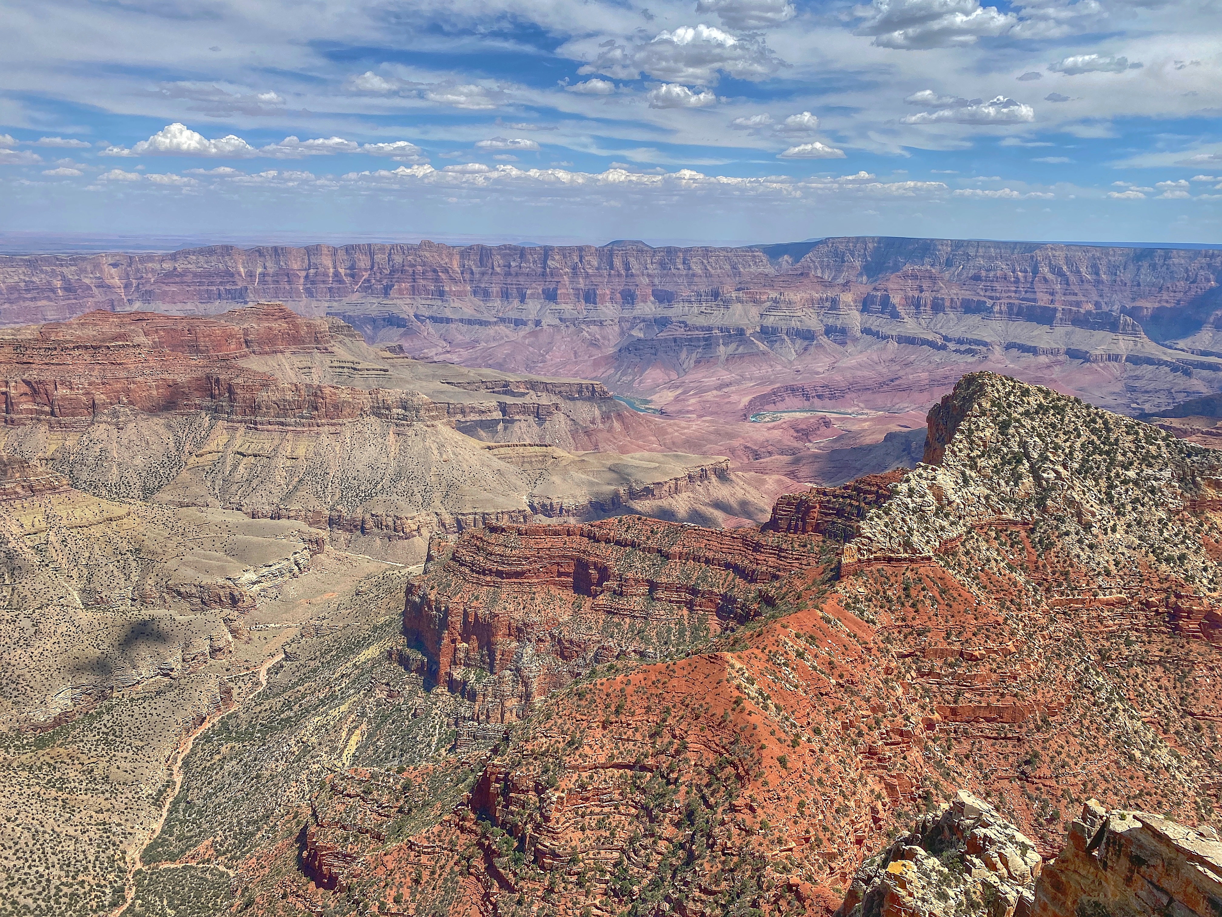
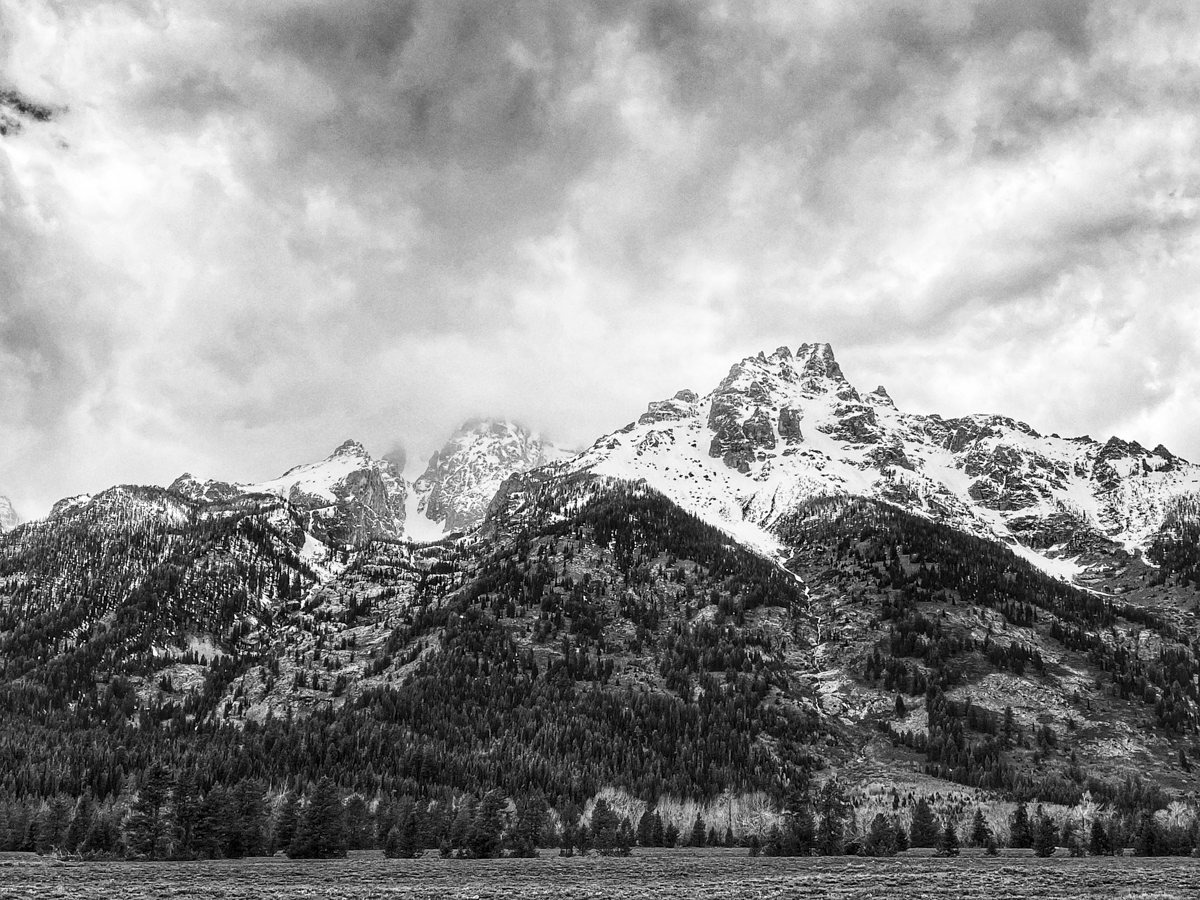
Our phenomenal campsite along the North Rim of the Grand Canyon in Kaibab National Forest (click photos to enlarge)
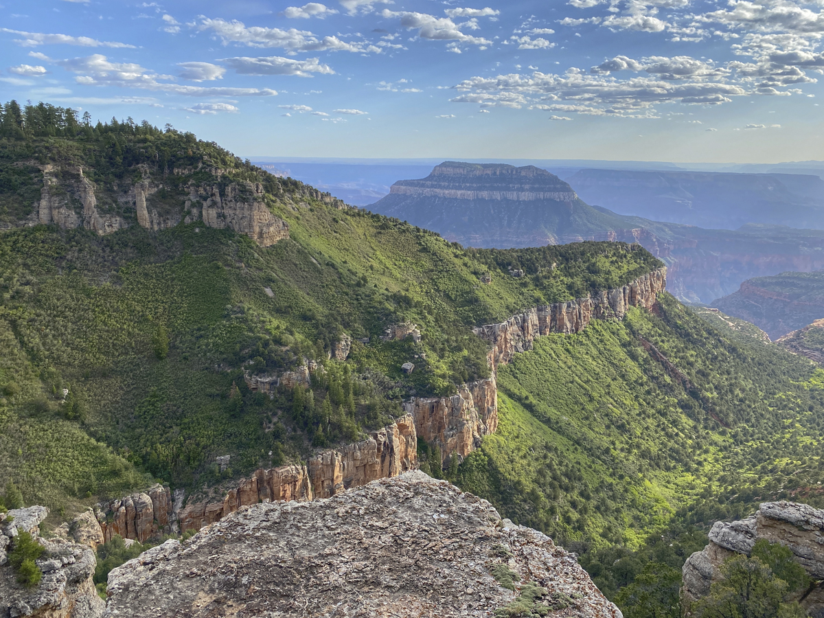
This iconic national park was not on our original itinerary, but when we found ourselves only an hour and a half from the north rim, we decided to go since I had never been to the park and Melissa had only been to the “Disneyland-esque” south rim. So, once we got cell service, she started googling national forest roads in Kaibab National Forest. She found what looked liked dispersed camping opportunities right on the north rim if you were wiling to drive 20+ miles of dirt roads off the main entrance road to the park. We always take a deep breath when heading out on unknown roads, especially long stretches, but they turned out to be fine. There were a few choices for turns that looked like they got close to the rim, so she picked one, and we found ourselves parked about 50 feet from the edge of an incredible view point. Not a bad way to end an already spectacular day. Once again, we were relatively isolated with only one tent camper within hearing distance (we could not see him, but we heard him occasionally close his car door). Farther down the road was the main view point with a few other campers, but we basically had this incredible vista of the Grand Canyon to ourselves! We admired a wonderful sunset and sunrise from our camp chairs on the rim, marveling at the vast story laid bare in the rocky landscape that stretched before us to the far horizon.
Sunset over the Grand Canyon from our campsiteSunrise the next morningMountain Phlox on the rim
The north rim receives only about 10% of the approximately 6 million visitors the park receives each year (last year was about half that due to the pandemic) so we were pleased to have relatively small crowds at the lookouts we visited the next morning.
The layers of rock represent millions of years of change from tropical seas to sand dunes to mud flats, all recorded in the stories told by their structure and the fossils and minerals they contain.A quote on an exhibit panel from John Strong Newberry – a physician, geologist and paleontologist that explored this region in the 1800’s – Nowhere on the Earth’s surface…are the secrets of its structure so revealed as here.
Visiting the Grand Canyon and gazing out upon its vastness, and realizing the millions of years of Earth’s history that it represents, is a humbling experience. And to do it in a place that was relatively uncrowded and to spend the night on its rim is something that will stick with us for a long time and that will no doubt beckon us to explore this grand landscape further in the future.
That afternoon, we debated returning to our rim campsite, but, with no guarantee it would still be available, and wanting to get an early start the next day (which meant not driving the entire 22 miles of dirt road) back to the paved highway we settled for a closer campsite in the national forest in a large meadow surrounded by conifers and aspens.
Aspen trunks distorted by snow in Kaibab NF
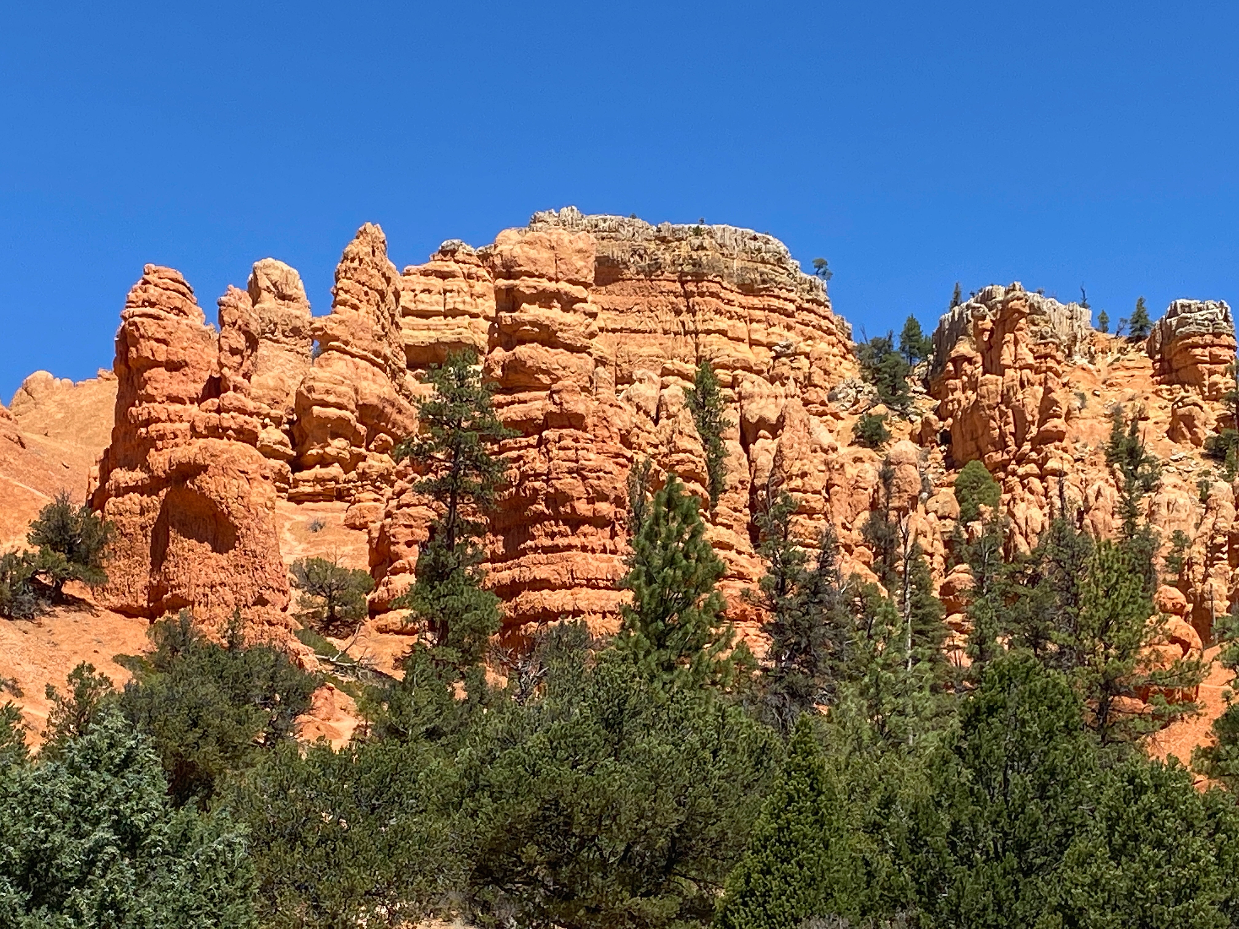
In talking with a woman in an outdoor store in Kanab, AZ, Melissa was torn between her desire to visit Zion National Park (it was so close) and this woman’s suggestion to skip it because it was so crowded. In the end, we opted to bypass the crowds and go directly to Bryce Canyon, another park that would be new for both of us. The drive there is incredible with beautiful vistas all along the way, including a stop at the wonderful Red Canyon Visitor Center in Dixie National Forest, not far from the entrance too Bryce Canyon. This area looks like another place we will need to explore more in future visits.
Red Canyon spires
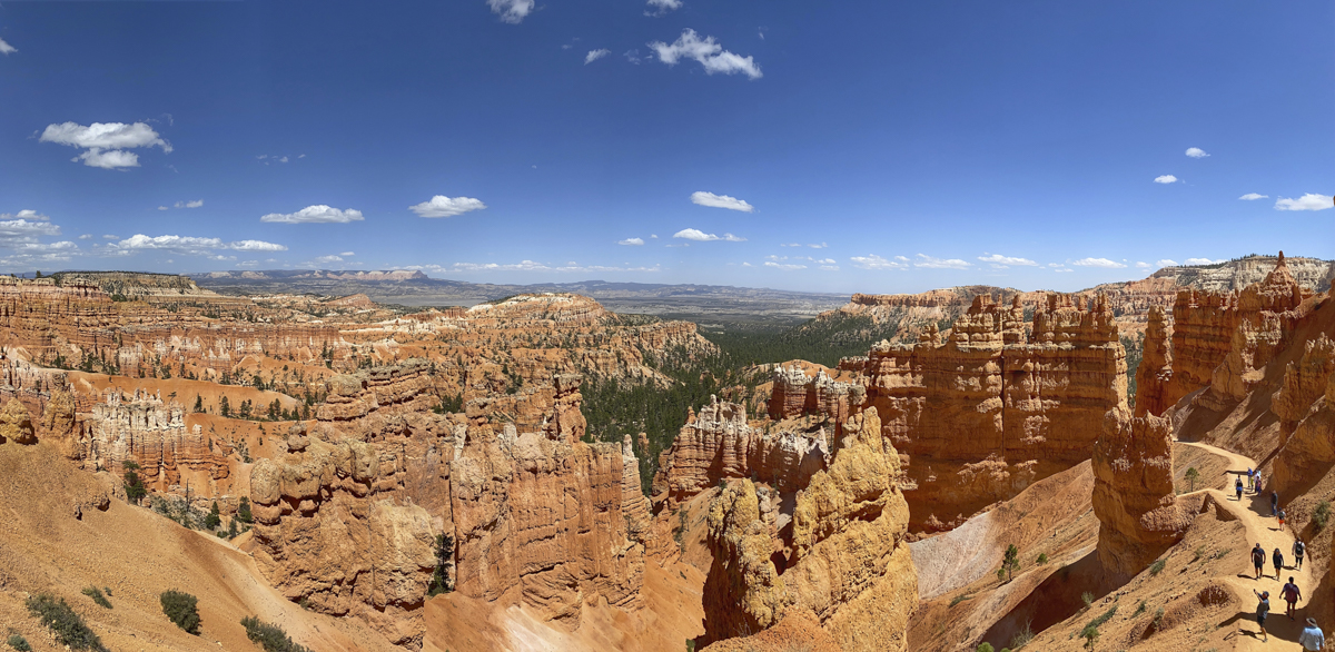
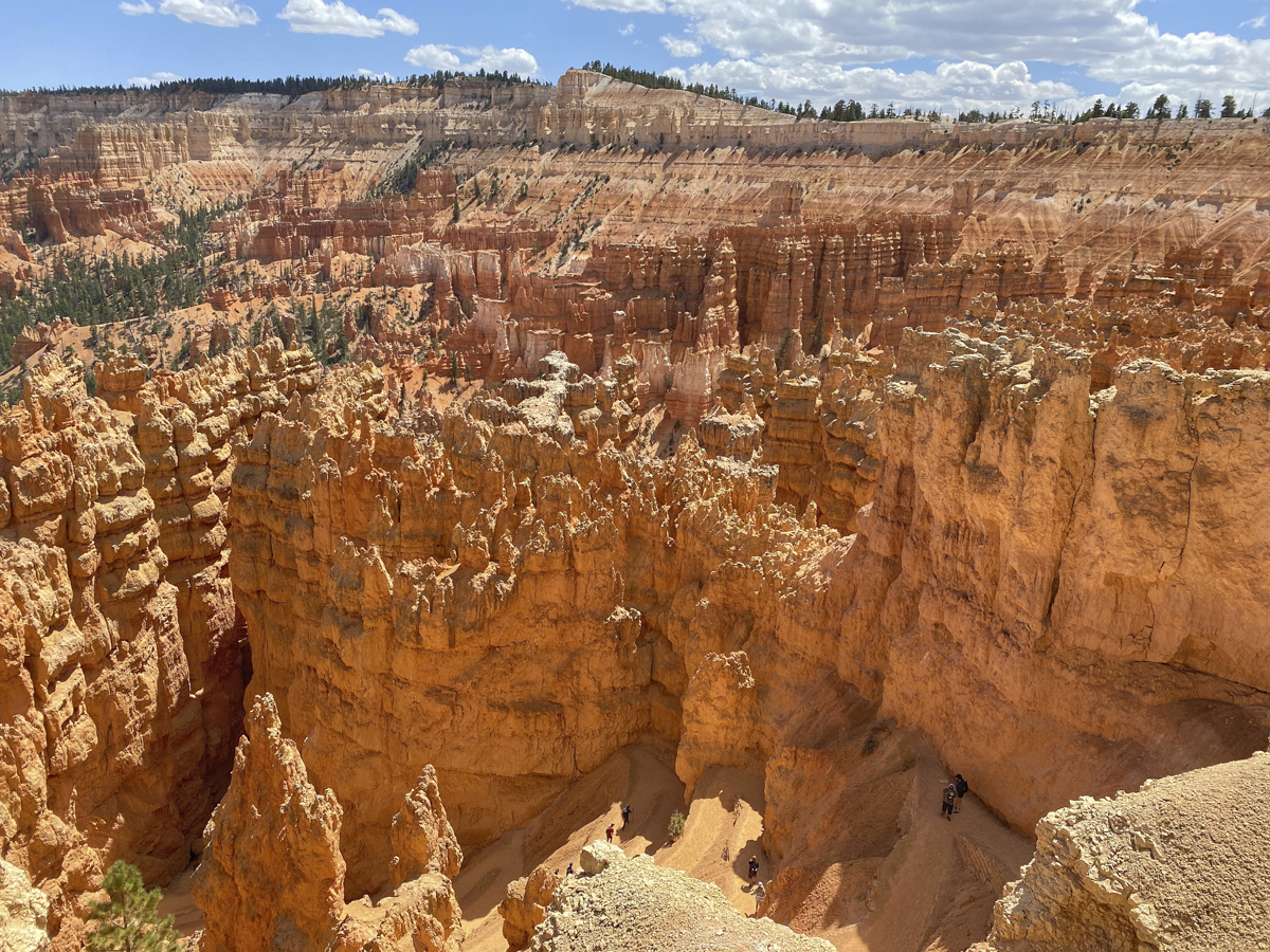
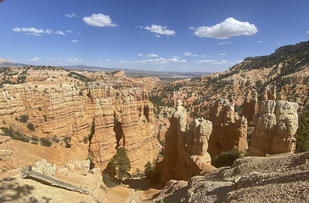
As we entered Bryce Canyon we felt the pressure of crowds at every turn, long lines at the shuttle tops, and road access to two of the major view points closed due to lack of parking (we were glad we skipped the more popular Zion, if these were the crowds here). We drove through the park on the 18-mile primary road route, stopping to take in the strange geology that has made this park so famous.
In the 1870’s, a geologist (Clarence Dutton) first came up with the idea that the geology of this vast region resembled a staircase, going from the ancient rocks at the bottom of the Grand Canyon, and proceeding through Zion and into Grand Staircase-Escalante and Bryce Canyon with a series of cliff formations (the steps) of younger and younger rocks. Bryce Canyon is the top step of that sedimentary staircase and its famed hoodoos have been created by a variety of erosional forces from the edges of the high plateau in a series of processes that proceeds from plateau edge to wall to window (or arch) to hoodoo.
Bryce Canyon is actually a series of amphitheaters (not a canyon) eroded from the edge of a high plateau
A hoodoo is a tall, thin spire of rock formed by natural weathering forces (in Bryce Canyon it is mainly ice and rain). The area experiences over 200 days a year where temperatures average above freezing in the day and below freezing at night, leading to a large potential for so-called ice wedging, where water seeps into cracks in the rock and then freezes (and expands), putting tremendous pressure on the rocks and causing them to split apart. As a result of this weathering and the geology of the rocks here, Bryce Canyon has the largest concentration of hoodoos in the world.
Hoodoos in Bryce Canyon NPNatural Bridge, Bryce Canyon NPPonderosa Canyon, Bryce Canyon NPNear Sunset Point, Bryce Canyon NP
Parking areas for the popular view points were still closed when we came back down the main road but we drove up to the lodge and parked which gave us access to some of the more scenic vistas (they always put lodges close to the most iconic areas in the park). It was another very windy day, but we managed a short hike down into some of the hoodoos for a different perspective of this unusual landscape.
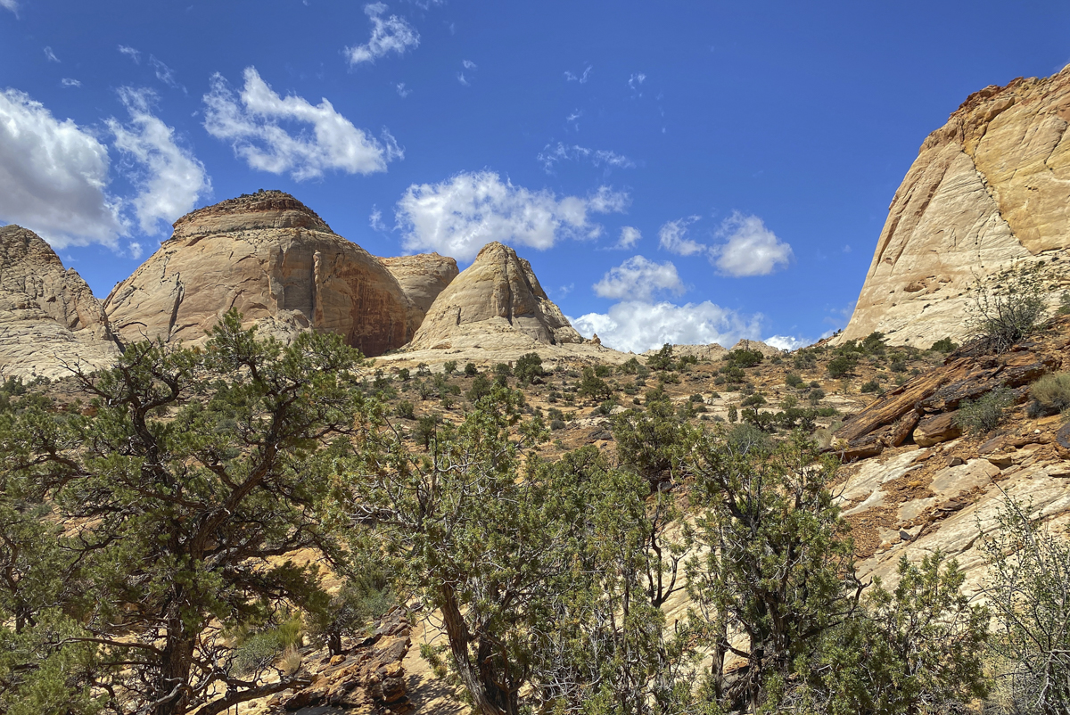
That night, we went to a place recommended by that same woman in the outdoor store for a take-out dinner – Hell’s Backbone Grill, a James Beard-recognized restaurant in Boulder, Utah, a town of 236 people. It was delicious and we highly recommend it, as well as the quirky, artistic Burr Trail Grill and Outpost next door. We dined in our truck (due to the wind) and camped on a desert road off the incredibly scenic nearby Burr Trail Road. The next morning, we headed for Capitol Reef National Park (another new one for us) and spent the day stopping at various view points and hiking the 2-mile round trip down the Capitol Gorge Trail to a unique geologic formation called The Tanks.
The Fluted Wall, Capitol Reef NPTree man along the trail, Capitol Reef NP
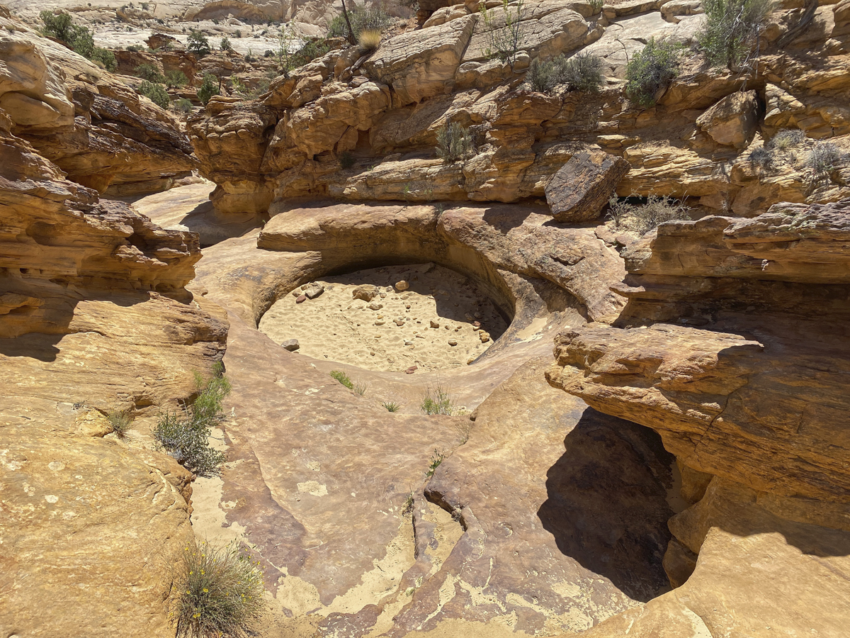
The Tanks are potholes formed by scouring action of rocks and water (they contain water most of the year I have read) in a narrow drainage down into Capitol Gorge, When they contain water they house a unique ecosystem of tadpoles, fairy shrimp, and algae.
The Tanks, Capitol Reef NPCapitol Gorge Trail, Capitol Reef NP
That night we drove up onto a rocky forest service road on Boulder Mountain and found a great campsite in the aspens with a creek and meadow in view. The next morning we headed for another spot recommended by that chance acquaintance in the outdoor store, the Lower Calf Creek Falls Trail. This is a well-known easy to moderate hike (6-miles round trip) to a beautiful waterfall. You are walking along a somewhat rare perennial water source, Calf Creek, along the way. The trail starts at the far end of a beautiful (but full when we were there) campground along the creek.
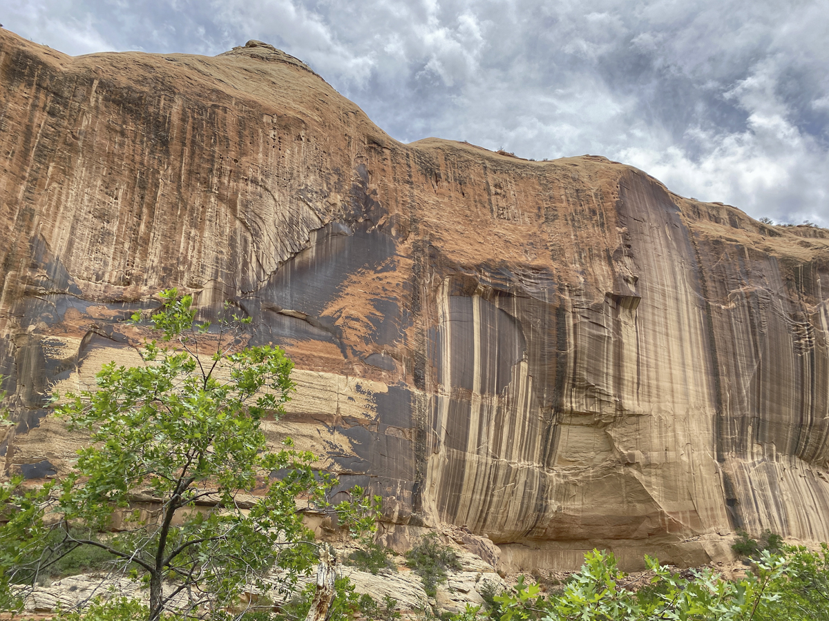
The dark streaks on the canyon walls are so-called desert varnish, formed when wind blown dust and rain leave behind trace amounts of iron and manganese. The resulting oxides created by rainwater and bacterial action harden to form thick layers of dark color.
The water leads to a diverse riparian habitat in the desert with beaver ponds, sizeable trout, and a host of wildflowers and bird life along the trail. We saw another new species for us, Black-headed Grosbeaks, flitting in and out of the shrub thickets as well as Yellow warblers and Spotted Towhees.
Beaver ponds and lush greenery along Calf Creek
Finally, you hear the waterfall and squeals of delight as the braver hikers venture into the cold pool at its base. This stunning waterfall is 126 high and drops down through a slit in a semi-circular canyon wall, forming a true desert oasis.
Lower Calf Creek Falls, part of Grand Staircase-Escalante National Monument
After soaking in the cool spray, we headed back along the same trail, taking in the diversity of life along the creek. I need to brush up on my desert/riparian plants before our next trip as there was quite a variety in bloom as we headed back to the car. By the way, the parking lot here (and at many of the popular spots we stopped) is quite small, so we ended up parking a 1/2 mile or so above the trailhead on the main road. Best advice is to plan ahead and get there as early as you can.
Cactus flowers along the trailA Globemallow of some sort (perhaps Smallflower Globemallow?)A delicate wildflower along the trail (perhaps an aster or fleabane)
We returned to our campsite in the aspens (we had left a chair and table there to claim it) and relaxed the rest of the afternoon and thought about where our destination might be as we head out the next morning…
Note – Now that we are back and hearing the news of the extreme heat, drought conditions, and huge crowds of tourists descending on our Western parks and public lands, we feel extremely fortunate to have had the wonderful experiences we did back in May. It looks like another tough summer in many Western states for abnormally high temperatures (though this may become the new norm due to climate change) and wild fires. I just saw a news release stating that the entirety of Kaibab National Forest is closed to the public effective today due to drought conditions and fire danger. The Forest Service is evacuating campers and closing all roads for the foreseeable future. Here’s hoping for better conditions soon.
I will fill myself with the desert and the sky. I will be stone and stars, unchanging and strong andsafe. The desert is complete; it is spare and alone, but perfect in its solitude. I will be the desert.
~Kiersten White
Much of our time in the Southwest was spent under red flag warnings of high winds, and our first afternoon in Grand Staircase-Escalante National Monument was no exception. Luckily, the wind tends to ease up as sundown approaches.
Late day sun turns the cliffs a golden yellow in Grand Staircase-Escalante National Monument (click photos to enlarge)
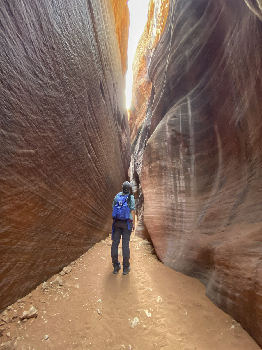
We had a good night in the high desert and headed out very early the next morning for one of Melissa’s main goals for the trip – to hike in a slot canyon. A slot canyon is a long, narrow, deep, and meandering drainage carved through sedimentary rock (usually). The epicenter of slot canyons is southern Utah and northern Arizona where there are many famous ones visited by hordes of tourists each year. We had picked Buckskin Gulch as our destination based on a friend’s recommendation, but fate had other plans for us that morning. As we were driving the 8 miles of dirt road out to the highway, our trusty truck started making some loud noises from the rear. Melissa got out and listened and the problem was in the right rear tire, a metallic clanging when the tire rotated. It wasn’t impacting the brakes or anything else, so we initially thought it might be a rock caught in the brake cylinder area. We continued to drive and the sound varied. Once we reached the highway, it didn’t sound as bad, so we thought, let’s try it. But, as we turned off to head down the dirt road to the Wire Pass Trailhead, the sound became worse, causing us to turn around and head for the only place with any hope of auto repair, Page, AZ, a distance of more than 30 miles. Melissa called and talked her way into an early check-in at a hotel in Page and we found an auto repair place that would open at 8 a.m. near the hotel. We checked into our room (having no idea how long a repair might take) and I took the truck over to the auto shop. They took me in right away and gave me the news that the parking brake on this 18-year old truck had just come apart, and it was pieces of metal causing that terrible noise. He also said it would be 2 or 3 days to get a part, but he could just take it out and we would be good to go (just don’t park on a steep hill). So, an hour later, we decided to take in the local sights and head to Buckskin Gulch early the next morning.
The famous Horseshoe Bend in the Colorado River below the Glen Canyon Dam
Our first stop was Horseshoe Bend, a famous meander in the Colorado River not far below Glen Canyon Dam. It was a circus of tourists, but certainly is a beautiful sight. Not being used to crowds of any type, we didn’t stay long. Melissa had called the Bureau of Land Management office and got some tips from a ranger the day before who had shared a location of another slot canyon in the area that she said we would likely have to ourselves. So, we headed out and hiked in a “private” slot canyon for a couple of hours.
Our private slot canyon near Page, AZWhen we found this carcass in the bottom of the canyon, I had to wonder, what type of critter is bad enough to kill a Great Horned Owl? (I don’t want to meet it!)
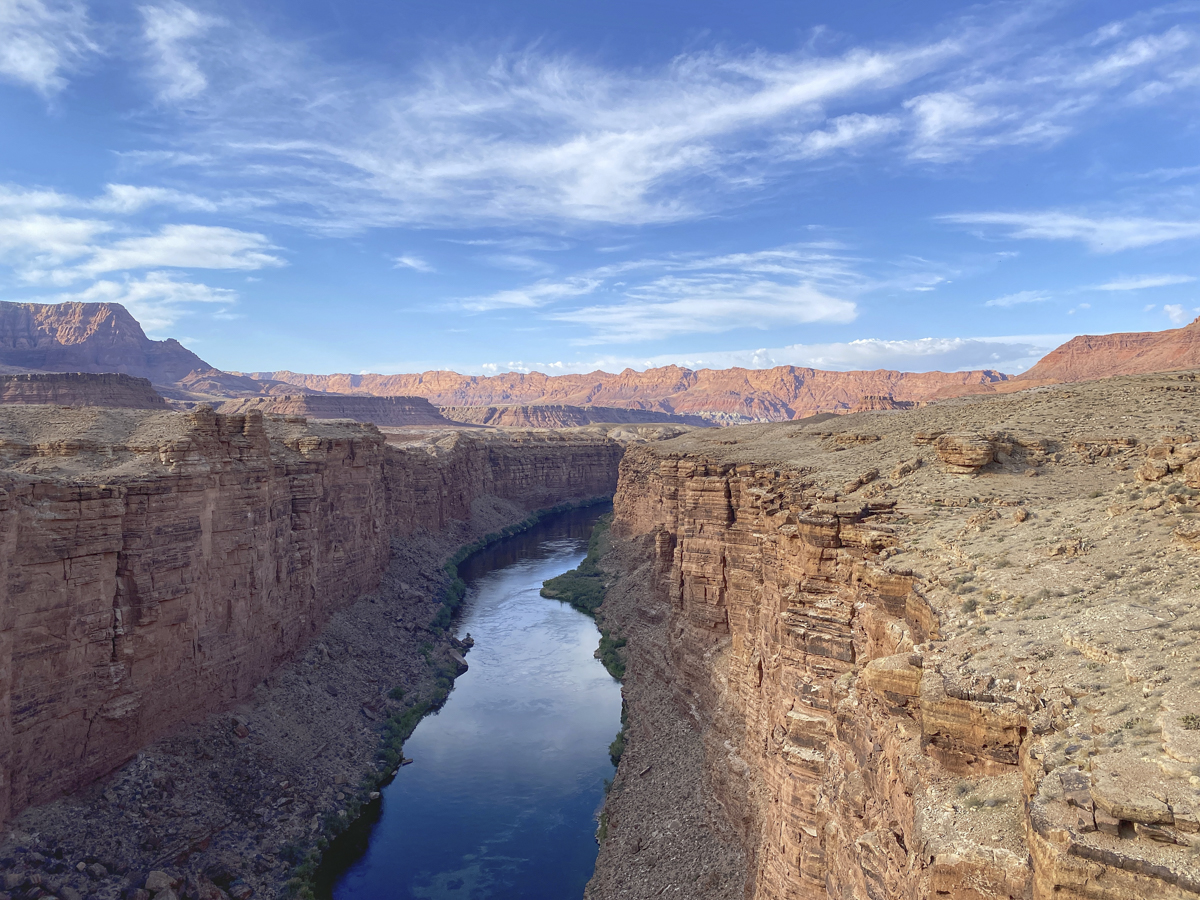
The same person that told Melissa about Buckskin Gulch had also shared her enthusiasm at seeing California Condors near Page at a place called the Navajo Bridge. This is an area where several condors had been released into the wild during restoration efforts and is known as a place where these huge birds return to the bridge and surrounding canyon walls to roost in the evening (especially in the spring).
View of Marble Canyon from the Navajo Bridge. There are two bridges here, one for people, one for cars.
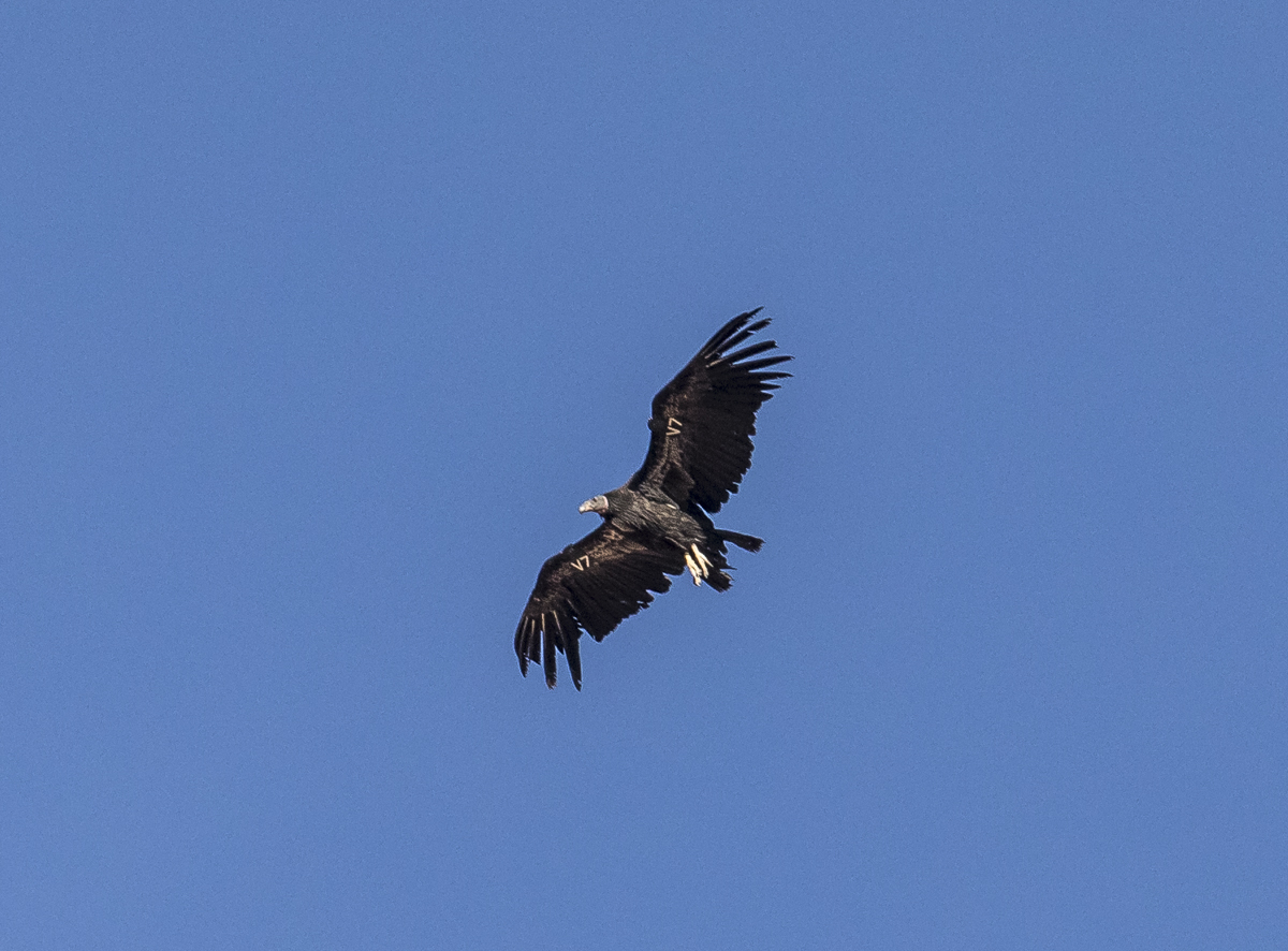
The California Condor is North America’s largest land bird, weighing up to 25 lbs and having a wingspan of almost 10 ft. It is critically endangered and became extinct in the wild in 1987 when the known remaining 22 (or 27, depending on which reference you use) birds were captured for a captive breeding program aimed to help recover the species. Captive reared birds started being released back into the wild in 1991, and today, the condor population numbers over 500 birds, with around 300 flying free in California, northern Mexico, Utah, and Arizona. One of the release sites is the Vermilion Cliffs Wilderness adjacent to the Navajo Bridge. Condors prefer steep cliffs for roosting and nesting so they can launch their huge bodies into the air, and online reports mentioned they also roost on the bridge structures in this location. So, we arrived close to 5:30 p.m. and started watching and waiting. Melissa walked across the bridge and saw a woman with binoculars and a camera and struck up a conversation. She was there for the condors as well, and assured us they would be there at some point this evening. We kept scanning the canyon, expecting to see them fly in from one direction or another, but only swifts and an occasional hawk flew by. After about 30 minutes on the bridge I looked over and saw the woman with binoculars walking toward us pointing up into the sky. I turned and looked straight up, and there it was, a condor! It dropped rapidly as if descending from heaven (Melissa commented that she understood how many Native Americans incorporated this giant bird into their mythology with this type of grand appearance) and soared underneath and landed on our bridge. Over the next few minutes, three more condors came in, one landing on the bridge and two more on the cliffs.
The first California Condor descended rapidly from a great height and landed beneath the bridge
Each California Condor has a numbered or lettered tag and some carry radio transmitters on their wings for tracking so biologists can learn more about their habits and potential threats to the population (lead poisoning from feeding on carcasses shot with lead ammunition is one of the biggest threats to birds in the wild). The bird above is V7. The Peregrine Fund is one of the participating organizations in the condor recovery program and has an online database that gives you more information on each bird. According to that database, V7 is a juvenile bird (condors reach maturity at around 6 years) as indicated by the dark gray head and lack of bright white patches under the wings. It is a male, hatched in May of 2017 in the wild in Utah.
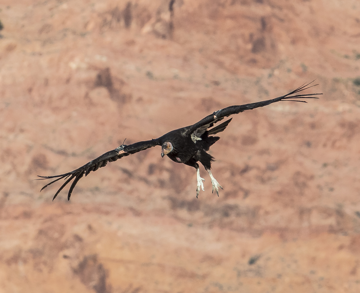
A second condor swept in and landed on the cliffs of the canyon. The huge wing span gives this bird amazing control as it twists and turns to come in for a landing.
This bird soared beneath me with a clear view of its tag, #12. This bird is a female, hatched in 2016. She is attaining the pink skin on the head and has started to develop the white under-wing patches.
We can see the numbered wing tag clearly as she passes beneath us.This bird landed quite a distance downstream, but a heavy crop of the image shows the number is 54.
The only fully adult bird we saw landed a long way from us on the cliffs. It is a male reared in captivity that hatched in 2004, making it 17 years old. California Condors are one of the world’s longest-living birds and can live up to 60 years. This was, indeed, a magical evening in a stunning landscape.
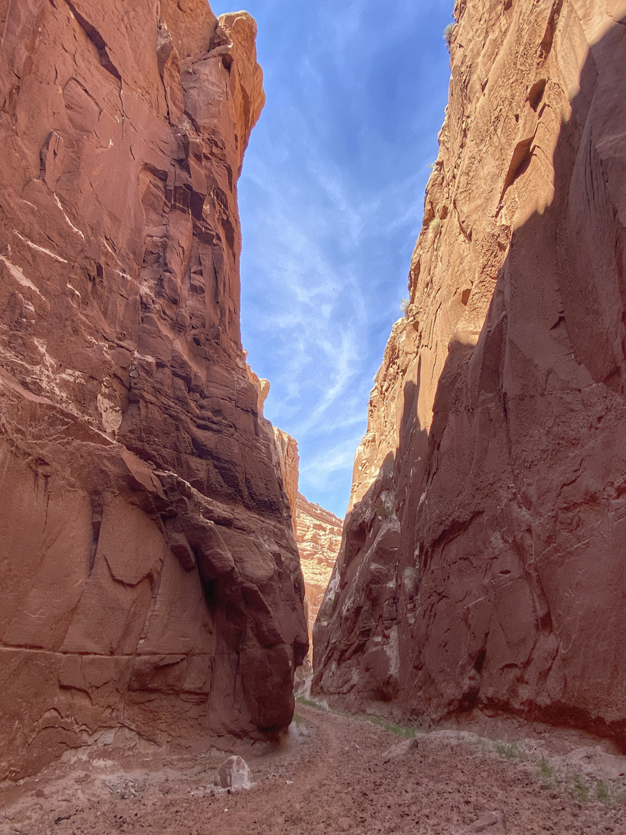
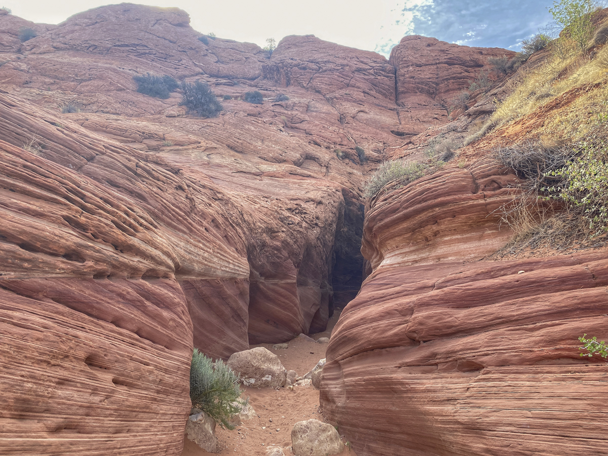
Early the next morning, we headed to Buckskin Gulch. There is a fee that you must pay and obtain a permit online before going. We drove to the Wire Pass trailhead, which is also the trailhead for another popular hike to a geologic feature called The Wave, but permits are hard to get for that hike with a maximum of only 64 people allowed each day.
You reach the entrance to the narrows of Wire Pass slot canyon a little over a mile from the trailhead.The canyon walls are shaped by thousands of flash floods over the millennia that carve the Navajo Sandstone into beautiful shapes and patterns
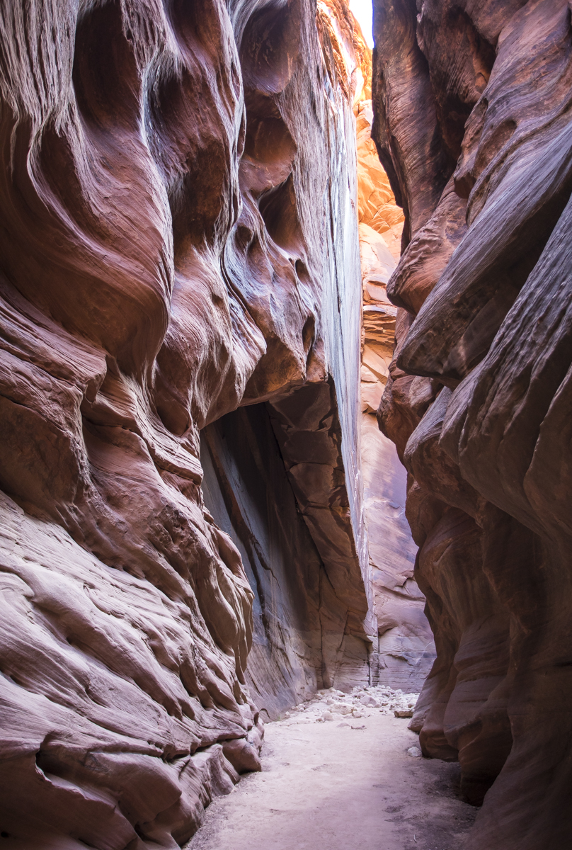
After entering the narrow slot, you are immersed in a fantastical world of swirls, lines, and light. We soon realized that by arriving early, we had avoided many of the people that do this popular day hike, so we had long stretches of the slot canyon to ourselves. After a mile or so, you reach a more open area that is the juncture with the Buckskin Gulch slot canyon. You want to take the trail to the right to continue down the more narrow slot canyon.
At the juncture of Wire Pass and Buckskin Gulch, look for petroglyphs of bighorn sheep on the canyon walls
We hiked at least a couple more miles from the juncture, taking in the magic of this place and marveling at how such a feature can form. There are an average of 7 or 8 flash floods through the canyon each year, typically in July and August, that can send walls of water as high as 100 feet through the narrow canyons, so hikers are advised to check the weather before going and to not hike if rain is predicted anywhere in the region. At times, you may have to walk through water or mud, but conditions were very dry when we hiked through.
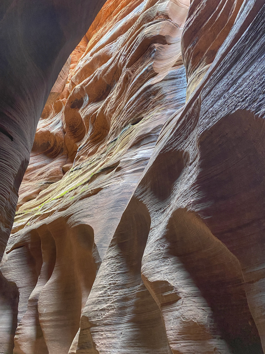
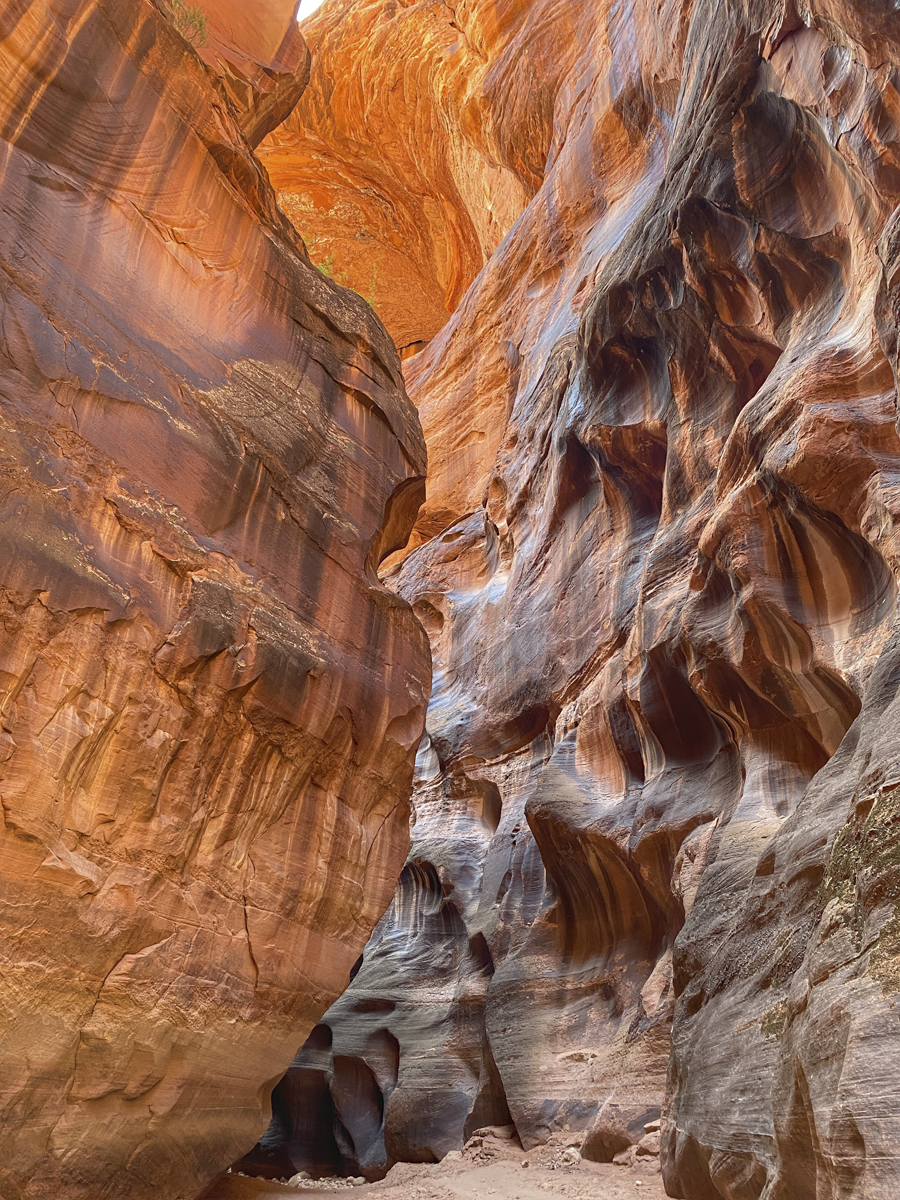
The average width of the channel is 10 feet, but it is barely shoulder width in a few spots with walls towering a hundred feet or more above Sunlight bouncing off the canyon walls reveals the detailed layering and smooth curves This log jam above Melissa is some of the evidence of the power of flash floods that periodically surge through the canyonThe colors change dramatically as the angle and intensity of light changes In places, you cannot see the sky when looking straight up due to the convoluted shapes of the canyon wallsMuch of the trail we hiked consisted of cobbles and small boulders with occasional deep sand or dried and cracked mud bedsA rare wide spot in the canyon with huge walls vaulting skywardThis beautiful Firecracker Penstemon was one of several plant species found in the wider, more open areasAn unforgettable hike
Buckskin Gulch is one of the most popular hikes in the Southwest and rightfully so. It is the longest and deepest slot canyon in North America (and perhaps the longest in the world) at almost 14 miles in length with walls soaring 500 feet above you in parts of the canyon. As we hiked out, we started passing the wave of visitors coming in we had heard we might expect. This is a very special trail and well worth a visit if you are anywhere near. And it was a special way to spend our anniversary and check off one of the few big items we had planned from our to-do list for this trip.
Looking at the maps, we decided to go ahead and make this day extra special with a couple of hour drive to the a park I had surprisingly never visited – Grand Canyon National Park. And we lucked into a very special campsite…more on that next time.
Travel is still the most intense mode of learning.
~Kevin Kelly
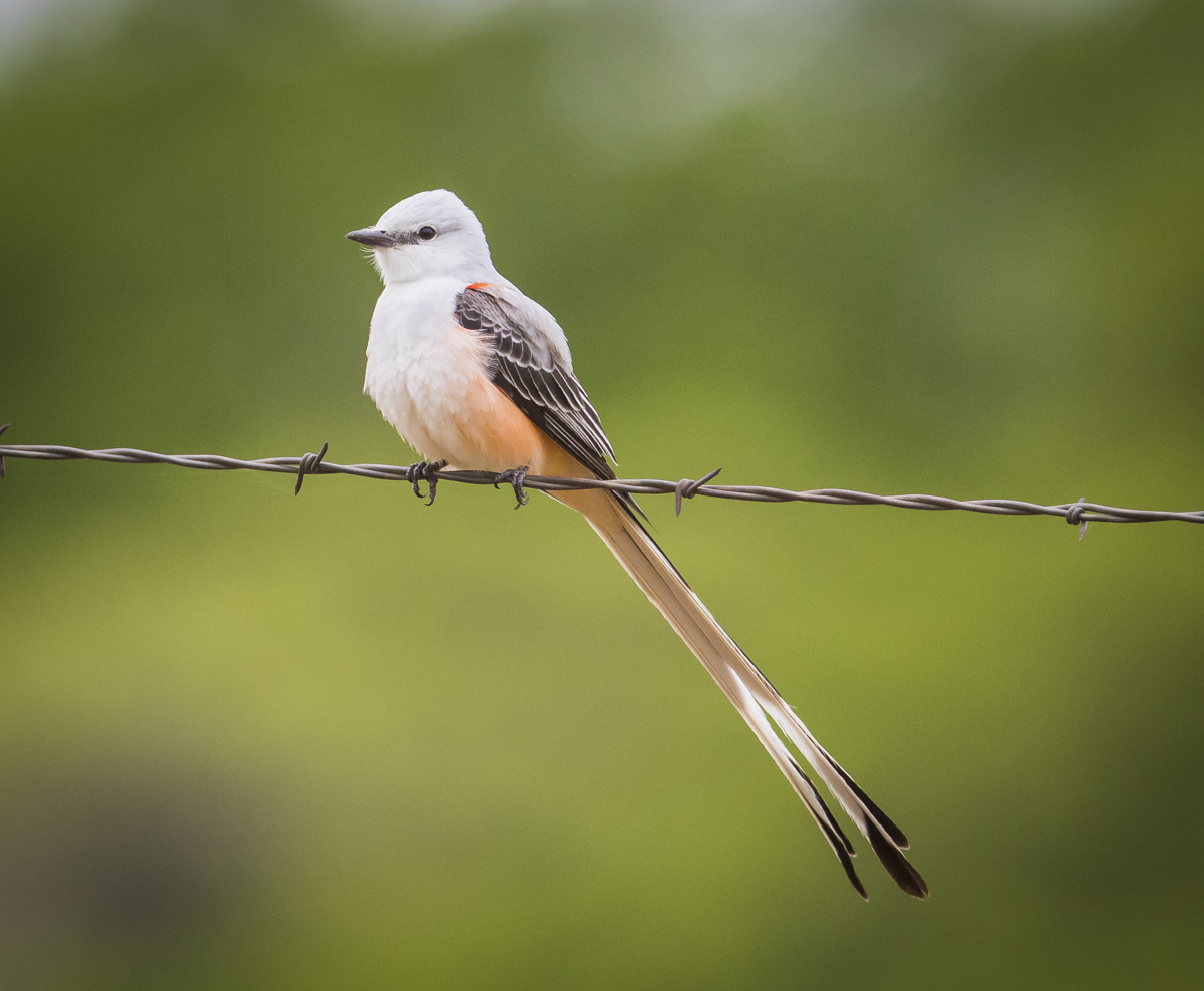
After leaving Arkansas, we headed toward Palo Duro State Park in the panhandle of Texas. We had learned of this canyon from a couple camped near us at Natchez Trace State Park in TN (they were moving from TX to KY and had brought their pet dogs and birds with them and had a separate outdoor enclosure at the campsite for their birds, so, naturally, i had to ask some questions). They said Palo Duro was a beautiful canyon worthy of a visit. It’s a long drive from AR so we spent a night at a forgettable state park in Oklahoma (our first couple of state park visits really made me appreciate even more the beautiful and well-maintained state parks back in North Carolina). Melissa steered us toward a couple more wildlife refuges and we once again, had some great birds (including more Scissor-tailed Flycatchers) at Sequoyah NWR in OK.
A Dicksissel singing by the roadside (click photos to enlarge)A male Indigo Bunting with some lingering molt splotchinessThis refuge provided us with another round of Scissor-tailed Flycatchers near the road. This is a male (note the bright side colors and very long tail).Another quick shot of one in flight (he dove to the ground for an insect).
I’m beginning to think I understand Texans a bit more now after visiting the exhibits at Palo Duro (they are really proud of Texas, and everything is better there). This canyon is deemed the second largest canyon in the United States (only Grand Canyon is bigger they say). After visiting and googling a bit, I think it is the second longest canyon at about 120 miles (you don’t sense that when you visit for as short a time as we did). It certainly is beautiful, and you can actually drive from the rim down to the floor of the canyon in the park. With threatening weather, we snagged an Airbnb on the rim of the canyon just outside the park entrance (a tiny house in an RV Park, this seems to be a trend). The next morning, you could barely see into the canyon due to clouds, wind, and rain, so we headed out with the general thought of heading to some national parks we have never seen – Bryce, Zion, and Capitol Reef.
Palo Duro Canyon State Park
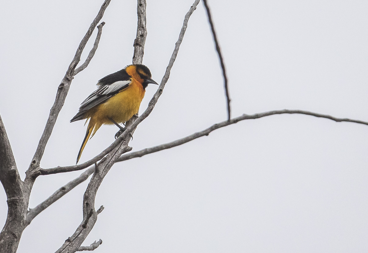
We took in two more wildlife refuges without much detour – Buffalo Lake and Las Vegas NWRs. And though the weather was iffy (a mix of sun and clouds and very gusty winds), we managed a few interesting species, including two new ones for us, Lark Buntings and Bullock’s Orioles.
Though we were some distance away in our truck, this Great Horned Owl wasn’t thrilled at our presenceA new species for us, a male Bullock’s Oriole. They were abundant in the scattered groves of Cottonwoods.Another new species, the Lark Bunting, was seen in small flocks along the fence line
I should mention that we really had no specific itinerary as we went along, other than looking for national forests with what looked like decent dispersed camping, and then hitting some sights along the way, especially areas that had interesting hikes. We usually planned each day no more than one day ahead and often made decisions on the fly, based on what Melissa was finding as she worked her navigation mojo. That is how we ended up heading toward Bandelier National Monument. She saw it was in the general direction we were headed and the images online looked interesting. Plus, the online information mentioned there were Abert’s Squirrels there, and we both really wanted to see one of those tufted-eared rodents (unfortunately, we never saw one).
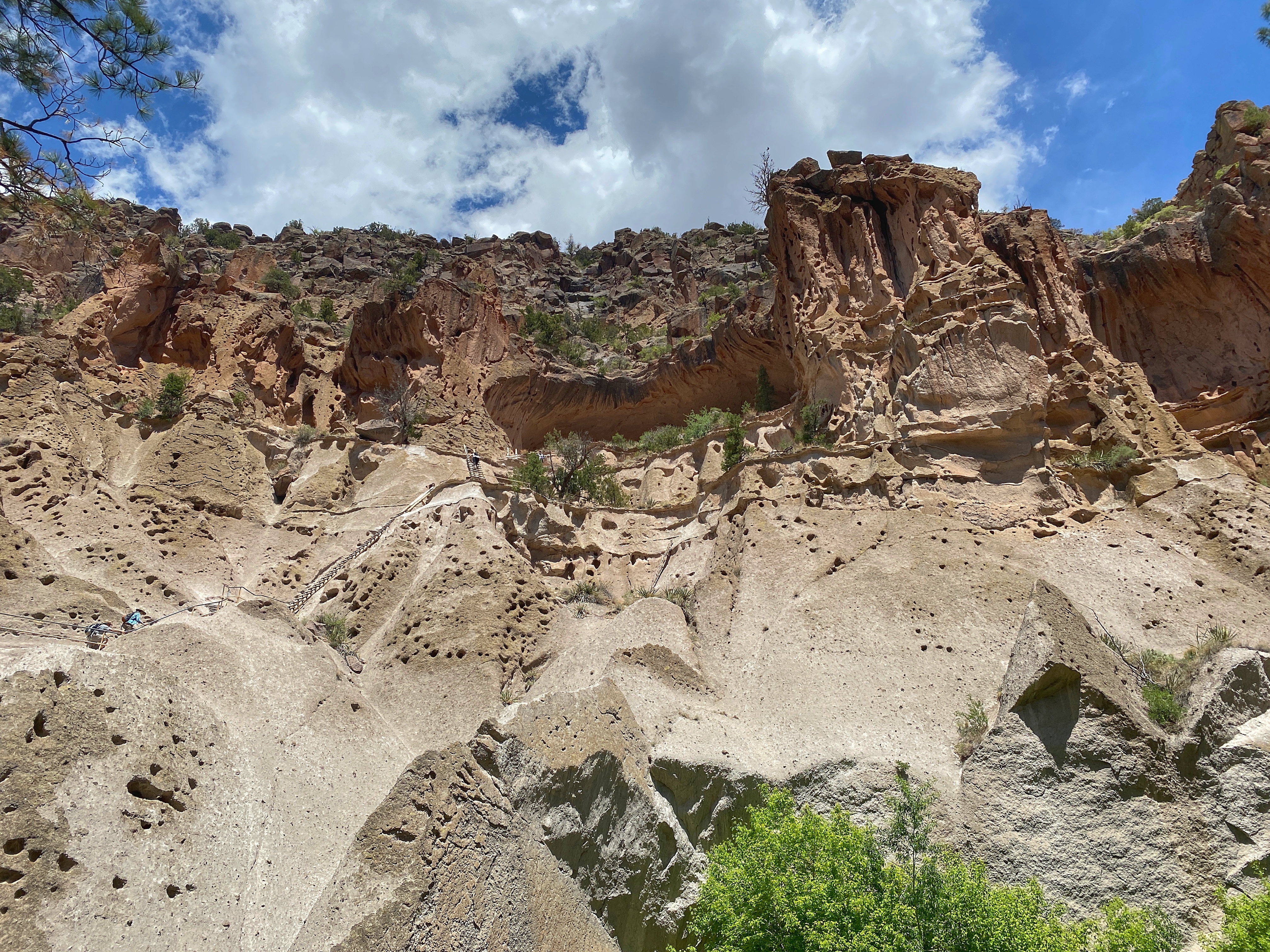
Looking out at the remaining structures of the village of Tyuonyi of the Ancestral Pueblo people at Bandelier National Monument
We visited the main archeological sites along the Pueblo Loop Trail and then did a side trip to the Alcove House. The village site is down on the valley floor but there are hand dug cavates (cave dwellings) on the face of the cliffs above with stone steps leading to several for easy viewing. The creek is one of the few permanent sources of water in the region, so I can see why the Ancestral Pueblo chose this site – a strip of green in an otherwise parched landscape.
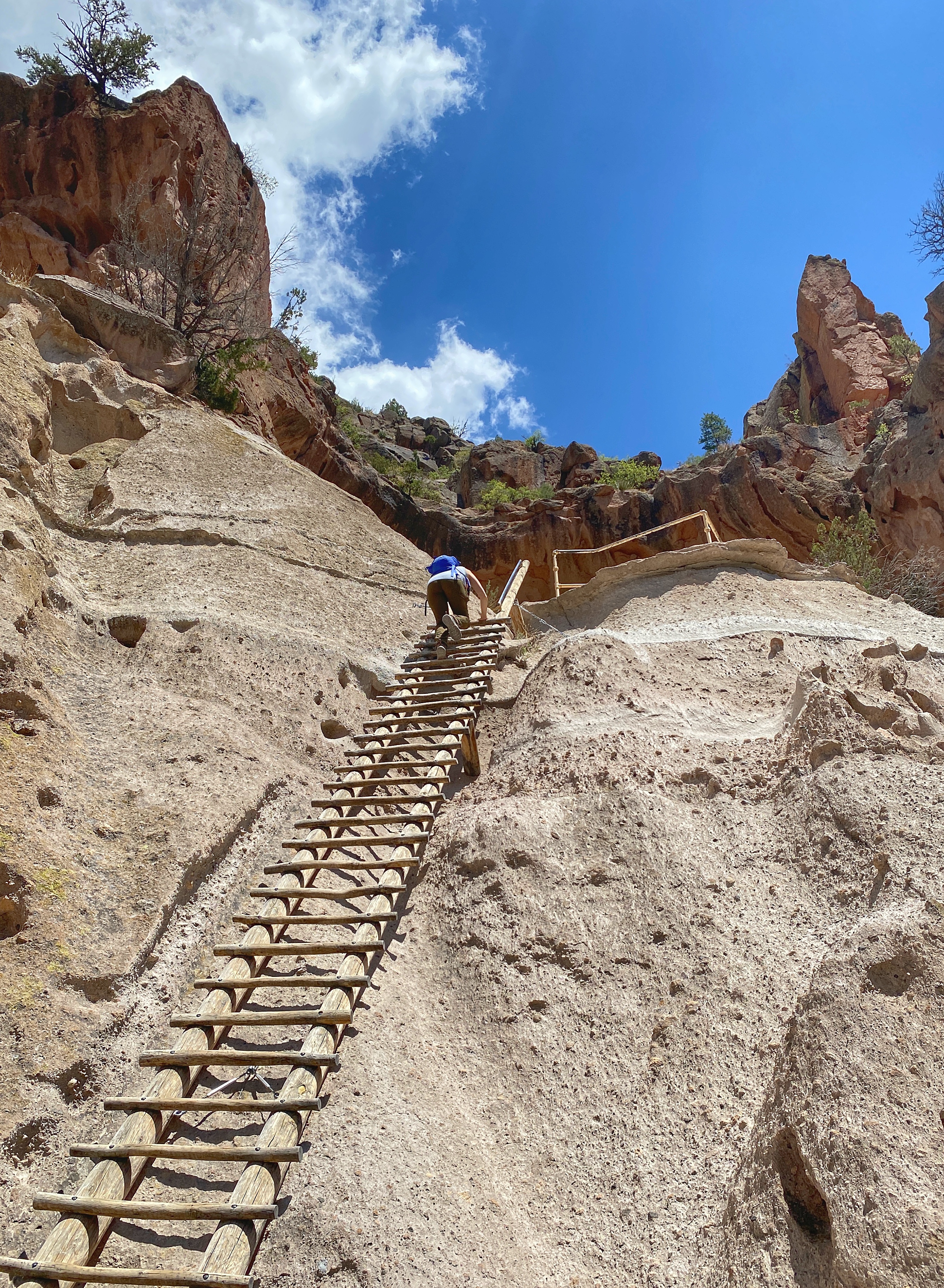
View from below of the Alcove House, an ancient dwelling for an estimated 25 Ancient Pueblo people, high above the floor of Frijoles CanyonMelissa on one of the four ladders and numerous stone steps used to climb the 140 feet up to the Alcove House
Nearby is Valles Caldera National Preserve, and the online images reminded us of another caldera we love – Yellowstone. So, naturally, we had to head in that direction. We arrived late in the day and saw that this NPS unit has some different rules from the usual park – hunting of elk and turkey is allowed (elk were reintroduced into New Mexico here in the mid-1900’s and this area now has the second largest elk herd in the state), the hours are shorter than most parks, and, as it turned out, they were opening the back country roads to 35 vehicles (first come-first serve) the next morning for the season. So, we went in to the office to get some information, and while were talking to a volunteer, a park vehicle drove up, and out gets a ranger we knew from Yellowstone (she had given our museum groups programs at Old Faithful for several years). She had just started here at Valles Caldera, so it was great catching up and getting a few insider tips.
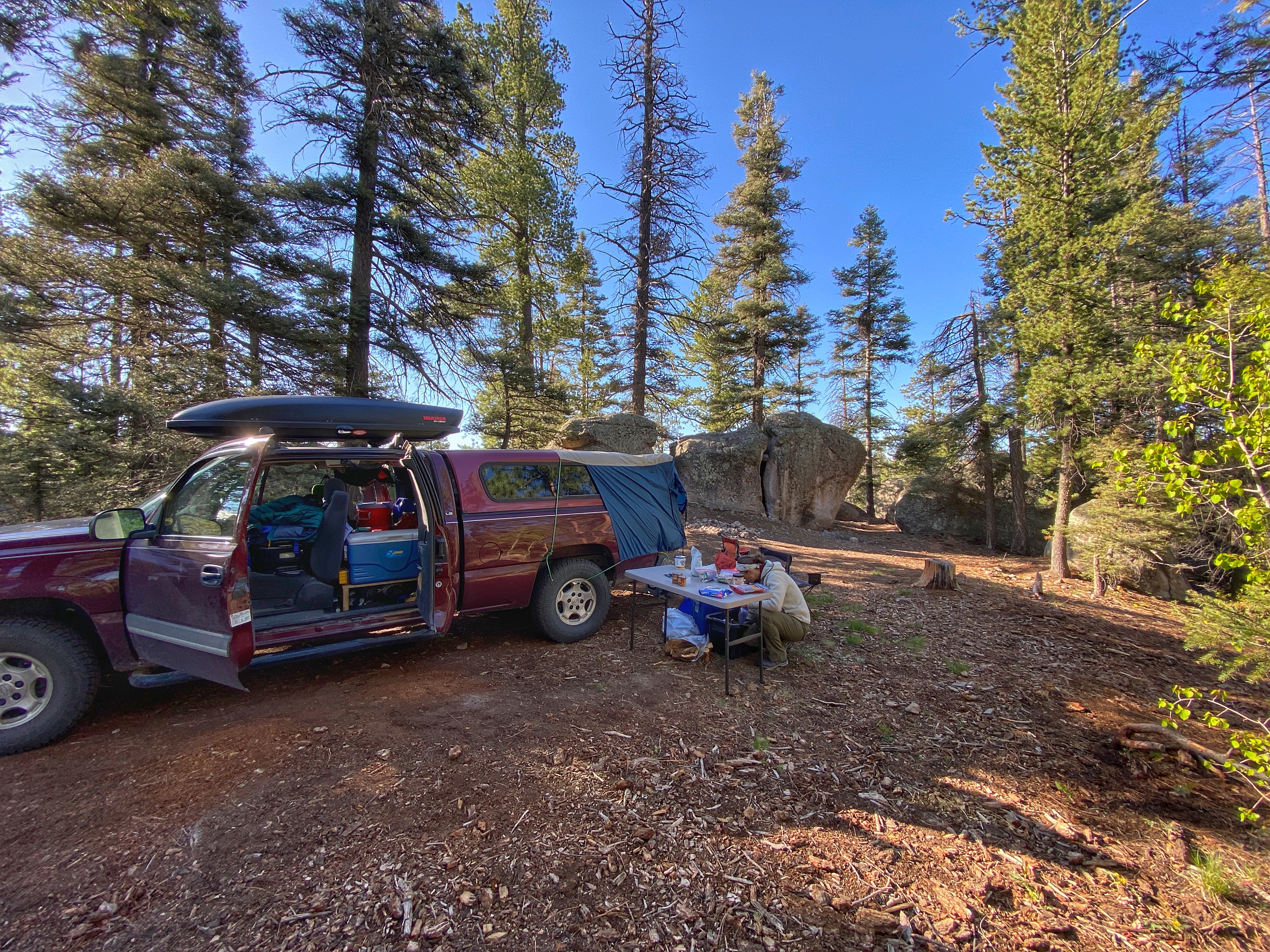
Our campsite among the boulders in Santa Fe National Forest
Melissa always feels the stress of trying to find just the right campsite – ideally on or near water, high elevation, scenic views, and maybe a combination of meadows and forest. But, even though she researches the maps and satellite images, and looks for online reviews of various areas, you often can’t tell what it is really like until you drive down a potentially bumpy road and see for yourself. We had picked one site that looked good and was on the edge of a steep gorge, but as we stood along what looked like a hiking trail at the edge of the rim, two dirt bikes blasted through the site. Turns out the path was a designated dirt bike trail, so we decided to look elsewhere for a campsite. We finally came upon a forested site surrounded by huge boulders. There were several fire rings, indicating this was a popular spot, so we settled in for the evening.
Without going into too much detail, I’ll share what I saw that afternoon as I was out on “bucket patrol”. As I returned to the truck, walking between two of the boulders, something moved on the ground. It was a very impressive (and totally harmless) Bull Snake about 6 feet in length. I admired its beautiful color and pattern and took a quick video clip as it went on its way.
On our way to this location, we had passed a trailhead along the main road that looked promising, so we headed back down for a look. Being a weekday, it was not very crowded, so we hiked in and we were so glad we did. Las Conchas Trail is an absolutely gorgeous hike along the East Fork of the Jemez River with fantastic rock outcrops and a mix of meadows and conifers all along its length. Elevation here is about 8400 ft but the hike is an easy 4 mile (out and back) stroll with plenty of natural beauty to observe.
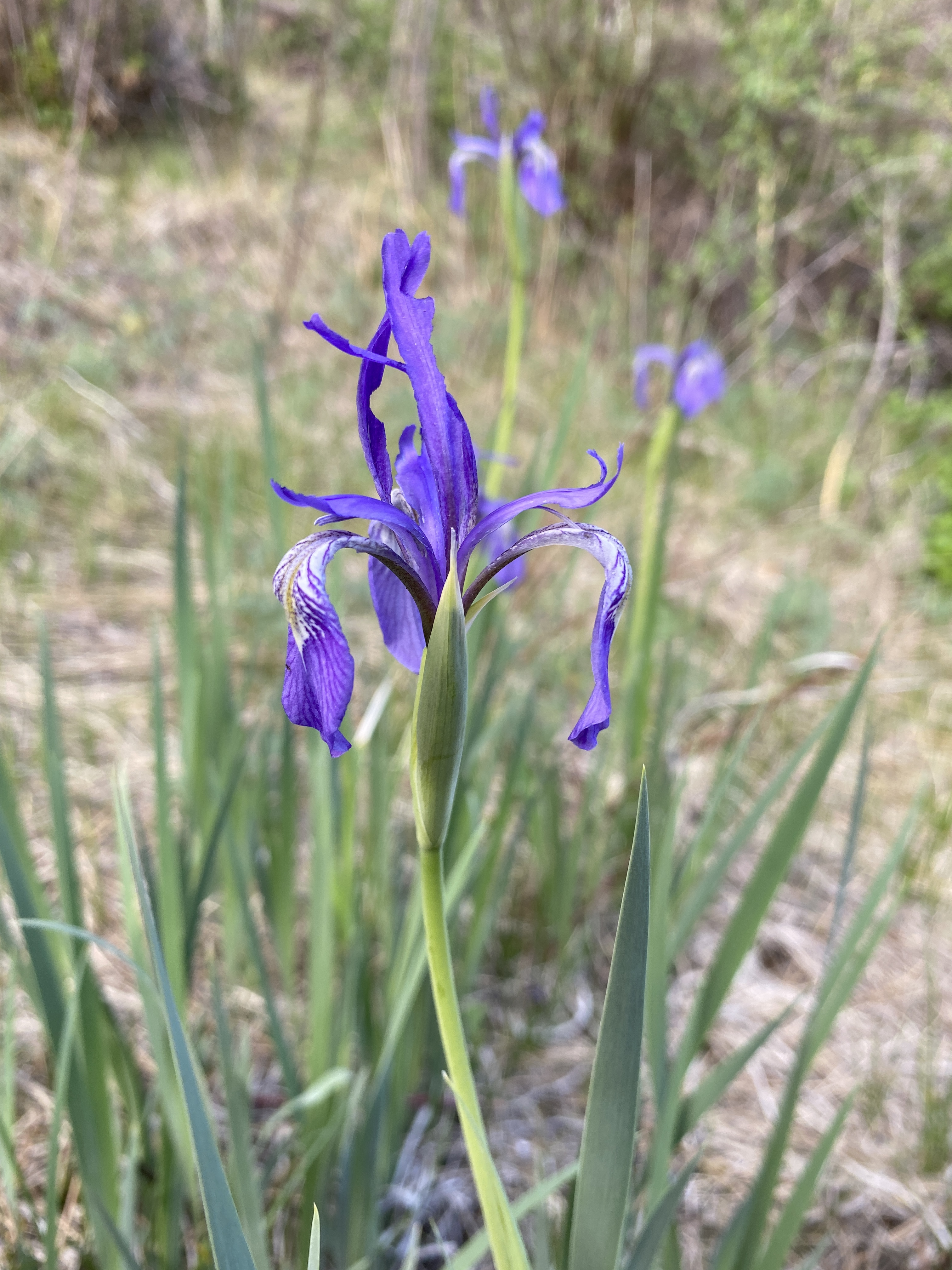
Las Conchas Trail, a truly beautiful hikeSmall waterfall at the end of the Las Conchas TrailRocky Mountain Iris along the trail
The water is crystal clear and allowed us some great fish watching. At a few points along the trail we saw groups of these fish (I believe they are Rio Grande Suckers) in what is probably spawning behavior. Groups of smaller ones (presumably males) in an area, sometimes moving gravel in the stream bottom, and then converging on a larger individual when it would come into the picture (I guess that is a female). We sat at one spot and watched them for about 20 minutes as they glided back and forth in the creek.
The next morning we were in line at the gate of Valles Caldera to secure one of the back country road passes. Most of the people in line were fishermen, although I was later amazed at how tiny the creeks were that these folks were trying to catch trout in. This is one of the newest NPS units, having been officially turned over to the Federal Government in 2014. The terrain reminded us of parts of Yellowstone with vast mountain meadows and conifers. The landscape was shaped by a massive volcanic eruption about 1.25 million years ago followed by a collapse of the volcano (the caldera). Like Yellowstone, early people were drawn to this area for the abundant wildlife and obsidian which was used and widely traded for projectile points and other tools. The land was granted to private ranchers in the late 1800’s and for decades was an active cattle and sheep ranch and used for logging, hunting, geothermal energy exploration, and more. Preserve managers are now working to restore the natural processes n this unique ecosystem.
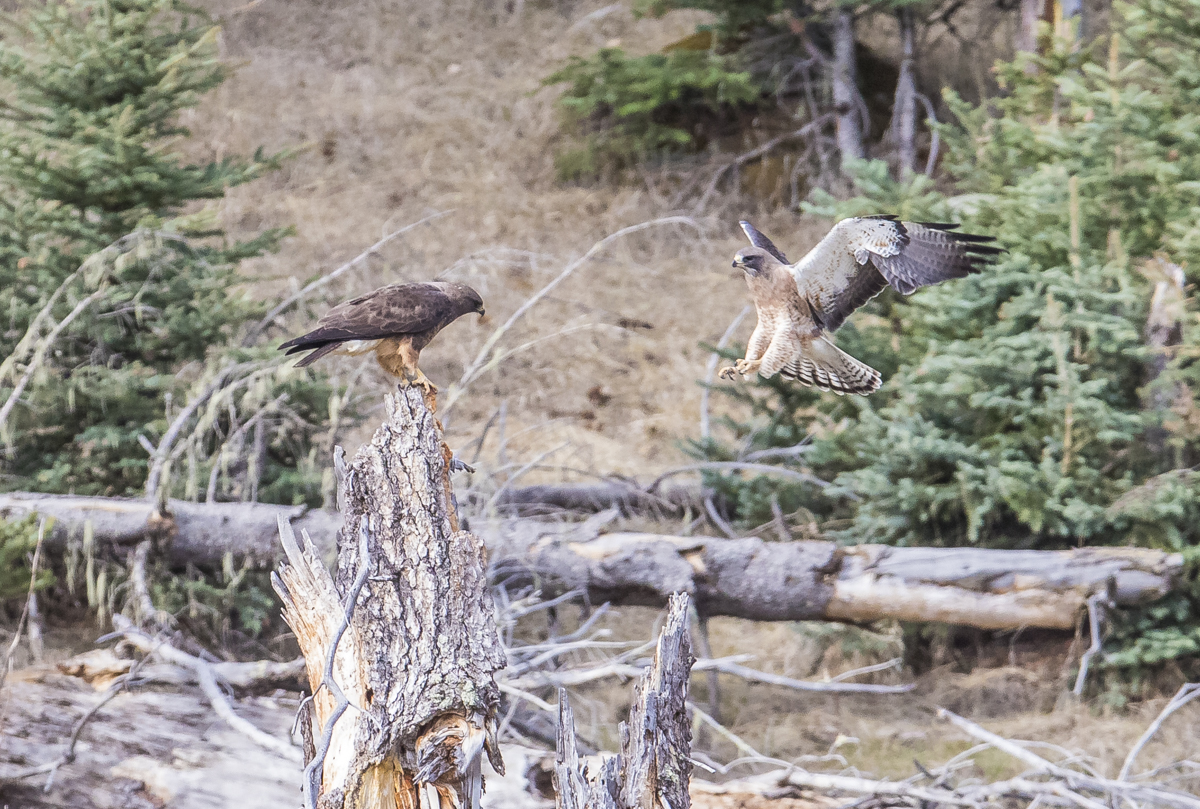
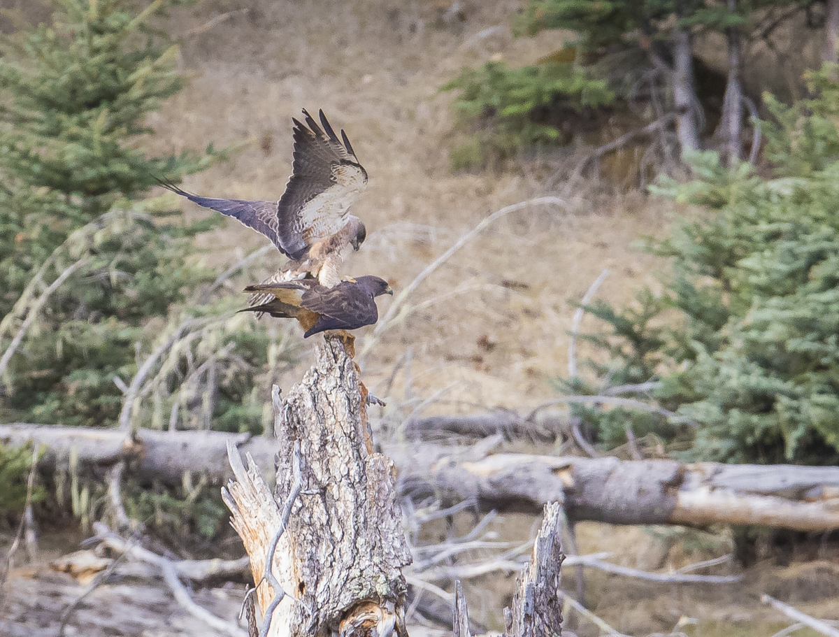
The view from the entrance of Valles Caldera National PreserveThis is part of the historic cabin district at the preserve. One of the cabins was used in the filming of Longmire, one of our favorite TV shows. This was the sheriff’s cabin in the show.One of hundreds of Gunnison Prairie Dogs we saw at Valles CalderaI stopped the truck to ID and take a quick photo of this Swainson’s HawkSuddenly, another hawk flew into the scene……and mated with the first one! The time stamp on my images showed that the mating only took 20 seconds before the male flew away.A small herd of Elk leaving the meadow at Valles CalderaWe had to remove all our gear and wipe down the back of the truck after spending all day on the dusty back country roads of Valles Caldera
After spending a couple of days in the high mountains, we packed up and headed into the dry desert environments of Grand Staircase Escalante National Monument, a vast and amazing land that offer such a different take on the West. The beauty and strange (to us) landscapes of Arizona and Utah await…
Sunset at our campsite in Cottonwood Canyon at Grand Staircase Escalante National Monument
My wish is to stay always like this, living quietly in a corner of nature.
~Claude Monet
On our previous two truck camping road trips, we headed due west across the plains through Missouri, Illinois, Kansas, until we hit the mountains. This trip, we had no real plans, just head west. We played with the idea of going to Big Bend National Park in Texas, but by the time we would have arrived, temperatures were already heading into the high 80’s and low 90’s (not my favorite temperature range for camping), but we did decide to take a more southerly route than before. Our first night was in Natchez Trace State Park in Tennessee, a pretty typical campground, with sites too close together for our liking (we’ve been spoiled by Forest Service dispersed camping) but with a beautiful lake and lots of bird life (tanagers, woodpeckers, thrushes, various warblers).
We had heard some good things about the natural beauty of Arkansas, so we pointed the truck in that general direction the next day and Melissa worked her navigation magic from the passenger seat by downloading Vehicle Use Maps from likely national forest units we would pass and reviewing satellite images to ground truth what the terrain might be like. She is also very kind to me in our on-the-fly planning and looked for side trips to wildlife refuges along the way (we both love viewing wildlife, but I probably need a wildlife pic fix more often than she does), so we hit Hatchie National Wildlife Refuge in TN and Bald Knob NWR in Arkansas the next day. Hatchie is a beautiful cypress swamp and had lots of warblers (especially Blackpolls and Prothonotaries).
Bald Knob was great with a variety of habitats and we soon found ourselves following waves of Bobolinks and Dicksissels as they flew up from the vegetation along refuge roads (although it was challenging to get close enough for photos). These are two species that I have seen occasionally in NC. They are both grassland species so I have observed them in migration near the coast and at the Museum’s Prairie Ridge Ecostation. And on the Museum’s Spring Mountain Birding trips, I have seen Bobolinks in some fields in the mountains where they are known to nest. But this was amazing, as they seemed to be everywhere along these roadsides.
Pair of Bobolinks at Bald Knob NWR in Arkansas (click photos to enlarge)Dicksissel
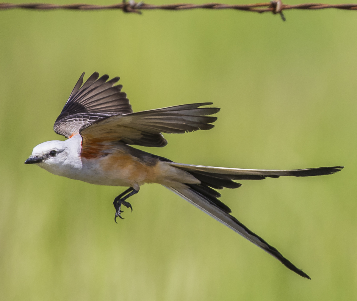
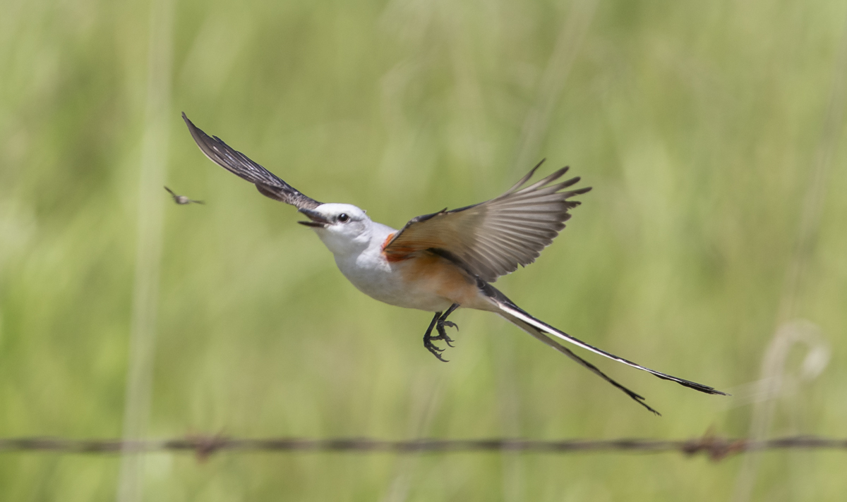
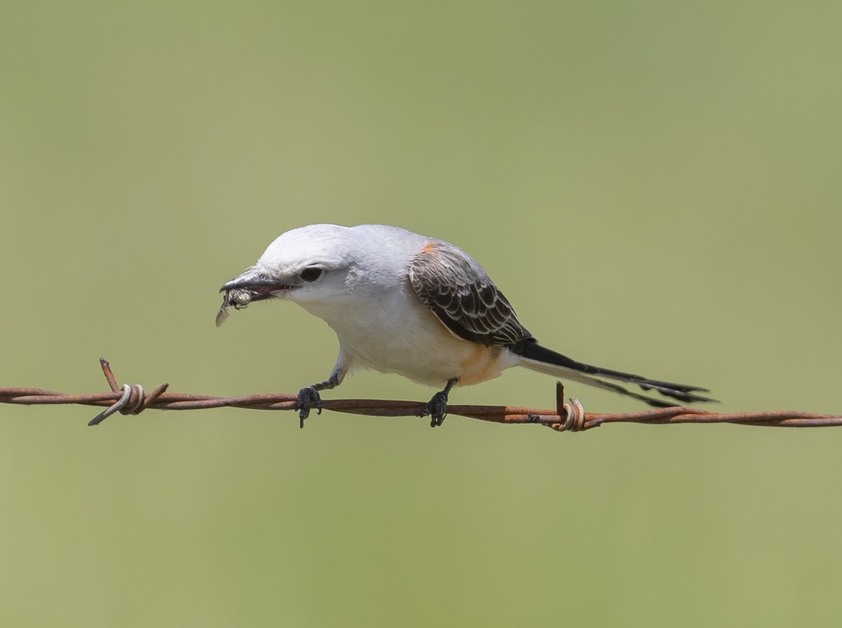
At Bald Knob NWR, we came across what is now one of my favorite birds – the elegant Scissor-tailed Flycatcher. I had seen one in the NC Sandhills years ago but they are considered a rare migrant and even rarer breeder in my home state. We spotted two sitting on a barbed wire fence next to a road so I pulled the truck up alongside for a closer look. They were very cooperative and let us hang with them quite awhile as they scanned the skies for an insect treat.
Scissor-tailed Flycatcher on barbed wire
Just look at that tail! The tail usually makes up over half the overall length in this species, with males generally having longer tails and more color on their sides. After taking way too may photos of them sitting on the wire (a very common pose we were to learn), we hoped to get a shot of one in flight highlighting that forked tail (the long tail is useful for making quick turns in flight as they pursue flying insects). I waited, and waited, and finally one took off and I just squeezed the shutter in burst mode and tried to follow it. Though not as sharp as I wanted, I was pleased with the sequence showing a successful snag of a fly.
Launching from the wire and showing that awesome tailIn hot pursuit of a flying insectEating the fly you just caught
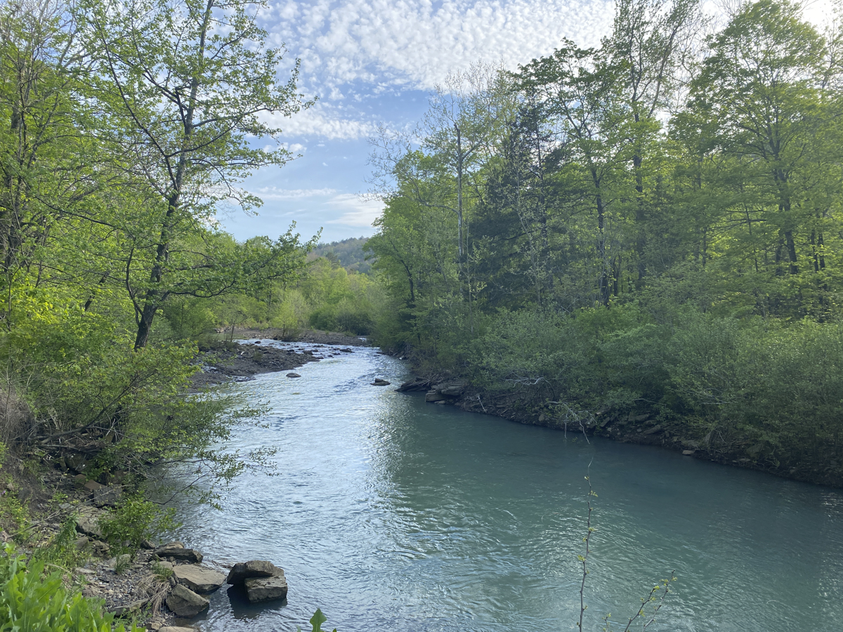
After spending a lot of time with flycatchers, we moved on to Ozark National Forest and camped along beautiful Richland Creek for the night. I’m not sure why, but the waters in this area are some of the bluest freshwater I have ever seen.
Our campsite next to Richland Creek
Melissa had scoped out some trails very close to our campsite, so the next morning we walked up the road a short distance and hiked along a well-marked trail leading to Keefe Falls. The forest had been burned, probably last year, and the resulting wildflower display was amazing all along the trail.
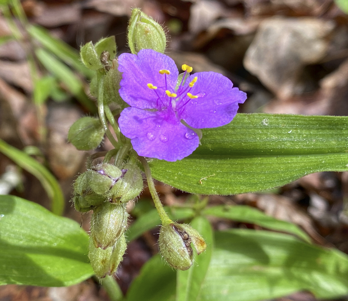
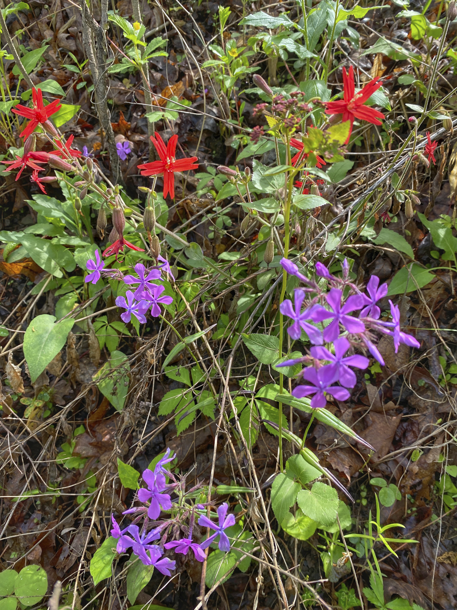
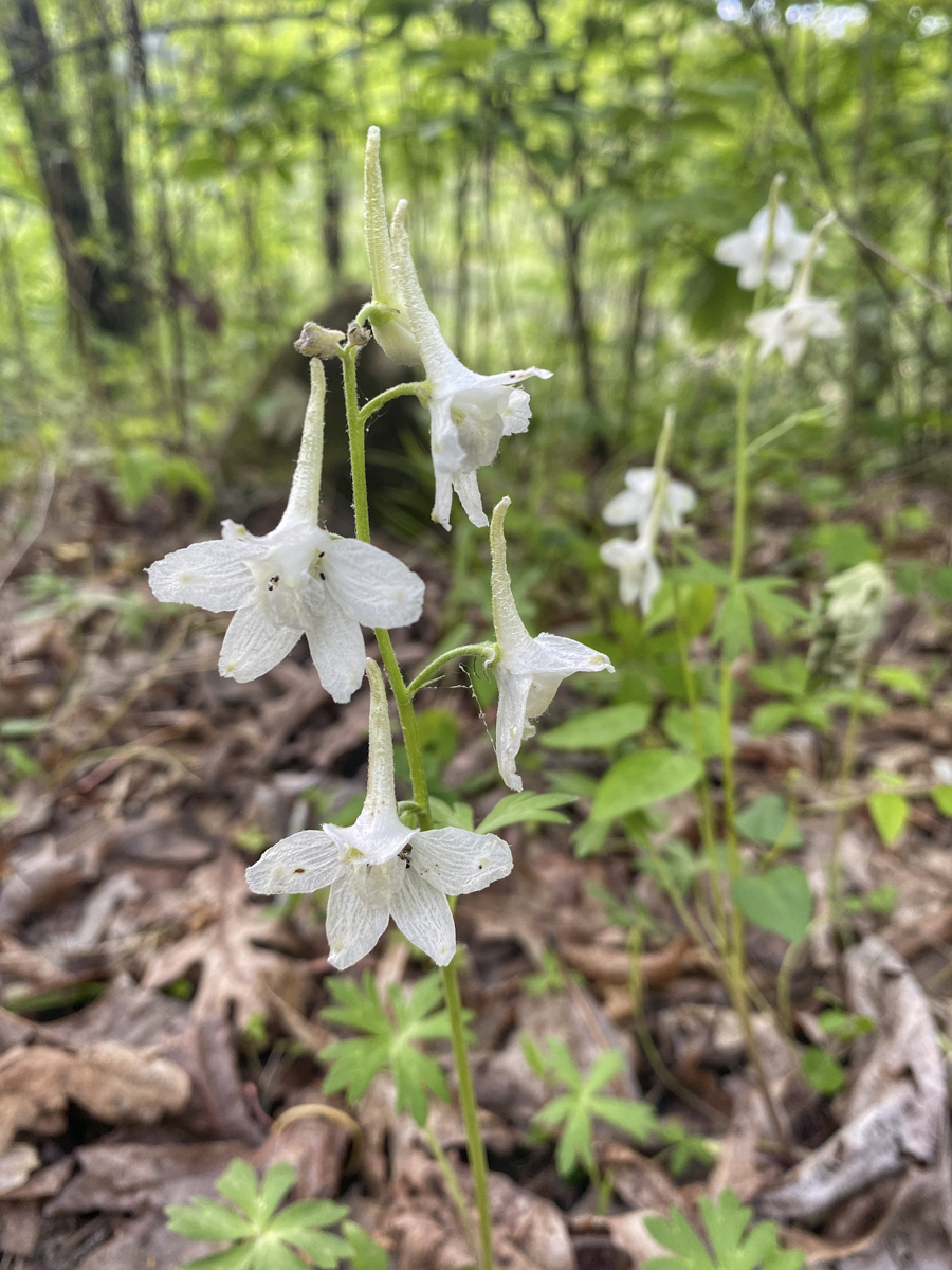
Spiderwort (Tradescantia sp.) in our campsitePhlox and Fire Pink along the trailA white Larkspur (Delphinium sp.) was scattered in the woods and on the upper rim of the waterfall
The state motto for Arkansas is The Natural State. And after our day in the Ozarks, we know why. As we hiked, the trail split and we decided to take what looked like the lesser traveled route which climbed a slope and soon came to a cliff of loose sandstone. The trail started to disappear as we headed down-slope toward the creek and the sound of a waterfall. The last 50 yards or so were a bit dicey, with slippery soil on a steep slope, and then we rounded a corner…
We were both stunned when this tropical-looking waterfall came into view
I can truly say this is one of the most beautiful waterfalls I have ever seen. The greenery-covered walls and the aqua blue color of the water with rays of sunshine piercing the still developing forest canopy…and we had it all to ourselves!
A side view of what we think is Splashdown FallsIt is a magical place and we had it all to ourselves
We lounged by this pool for quite some time (someone I know took a swim), and, once again, we took way too many pictures trying to capture the beauty of this tropical-looking scene. On the hike back we encountered another couple hiking toward Keefe Falls. We told them about our find (which we now think is called Splashdown Falls) but warned them about the steepness of the last section. They shared an encounter with a rattlesnake on their hike to another nearby waterfall and told us about the abundance of beautiful falls and cascades in this forest.
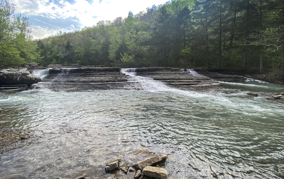
One of the spectacular roadside waterfalls, Six Fingers Falls
On our way out the next morning, we stopped at two of the more popular roadside waterfalls – Falling Water Falls and Six Fingers Falls, and they did not disappoint. Arkansas maybe should change their motto to The Waterfall State if this one section of Ozark National Forest is any indication of what can be found elsewhere. Needless to say, we will return to Arkansas on future trips. But for now, we headed west (more in the next post).
Yep, we did it again, another awesome truck camping road trip. We just returned home Wednesday morning at 3:30 a.m. after an epic 18-hour drive from Missouri. We had planned at least one more night on the road, but the weather wasn’t cooperating and we were following a large rain-making system across the middle part of the country. After camping in fairly dry weather for almost a month, we decided to just head home rather than deal with the wet conditions. We traveled almost 7,400 miles over 29 days (see map below). We visited three state parks, a state conservation area, six national parks (including three new ones for me), a national monument, a national preserve, a national recreation area, seven national forests, and nine national wildlife refuges. I think we can safely say, we love our public lands! We did stay with friends a couple of nights in Jackson, and hotels or an Airbnb for a total of 5 other nights. The rest of the time, we camped in our truck, mostly dispersed camping in national forests. Over the next couple of weeks, I’ll post some more details of the trip (and probably some highlights of things going on here in our woods).
Our road map for the last month (click photos to enlarge)
For more details on the locations highlighted on the map, see this link.
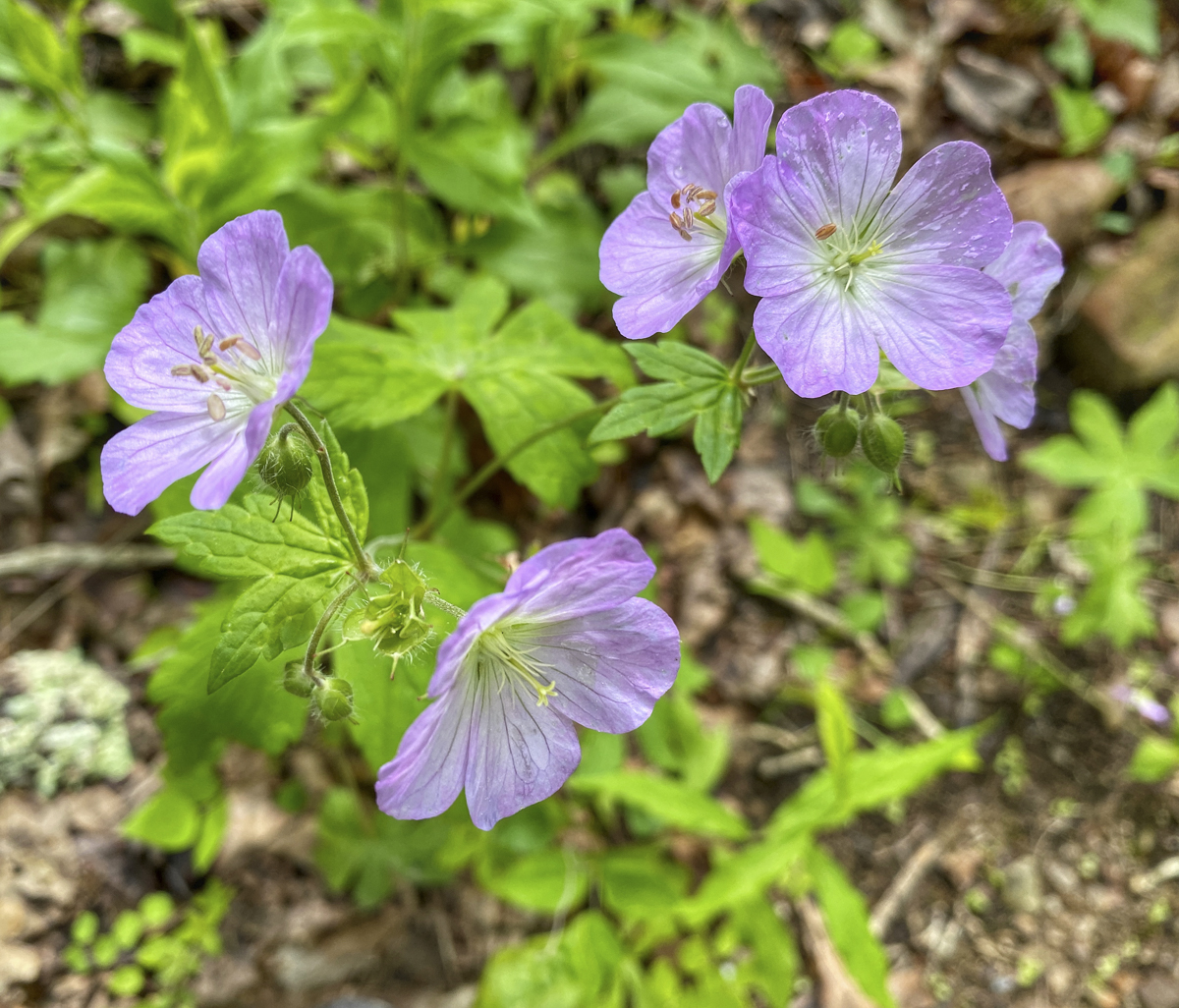
One of the many great U.S. Forest Service dispersed campsites on our journeyWild Geraniums, one of the countless wildflowers we photographed on our trip (this one in Ozark NF in Arkansas)Falling Water Falls in Ozark NFMaybe my new favorite bird, the Scissor-tailed Flycatcher – so many in Arkansas and OklahomaMelissa in an awesome slot canyon – Buckskin GulchNorth rim of the Grand CanyonSpires in Bryce Canyon National ParkAmerican Avocet in Bear River National Migratory Bird Refuge, UtahThe majestic TetonsBack in our happy place, Lamar Valley, Yellowstone NPOne of our wildlife highlights was having this Red Fox trot past us in YellowstoneWe had to switch our campsite plans in the Bighorn Mountains due to snow (this was near the site we eventually selected)Melissa in one of her favorite places, the Sandhills of Nebraska
I’ve always loved butterflies, because they remind us that it’s never too late to transform ourselves.
~Drew Barrymore
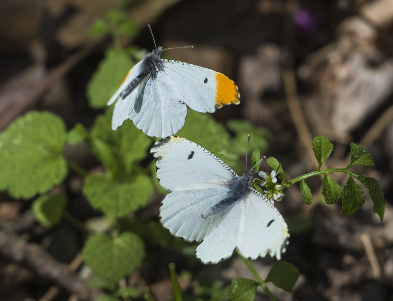
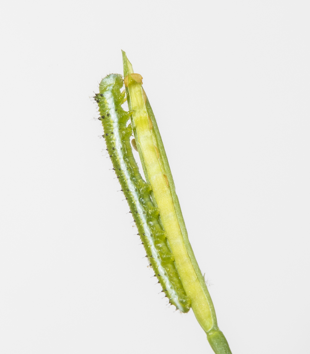
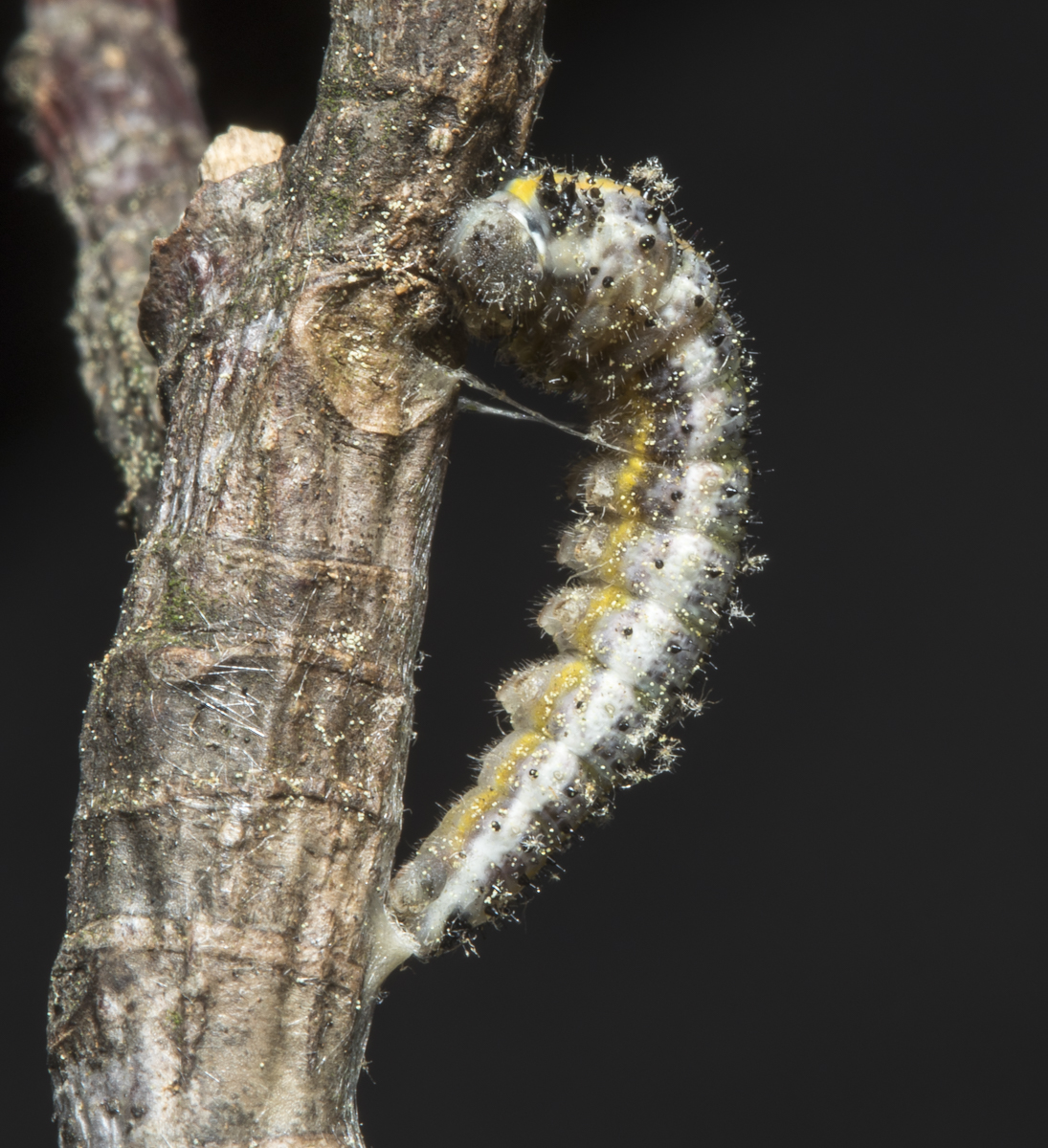
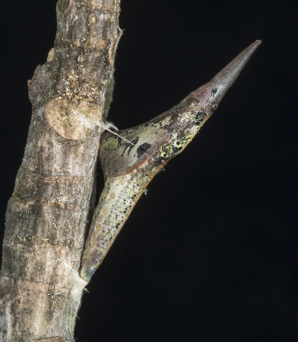
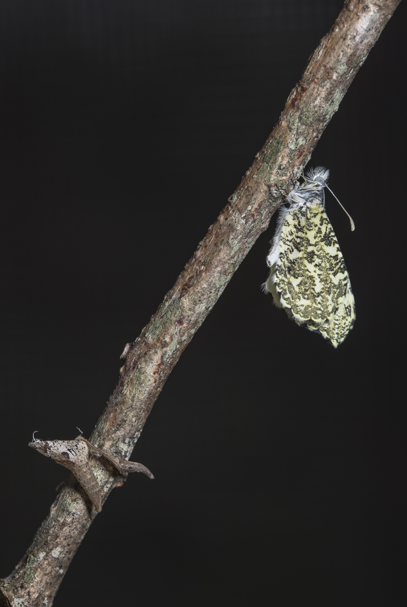
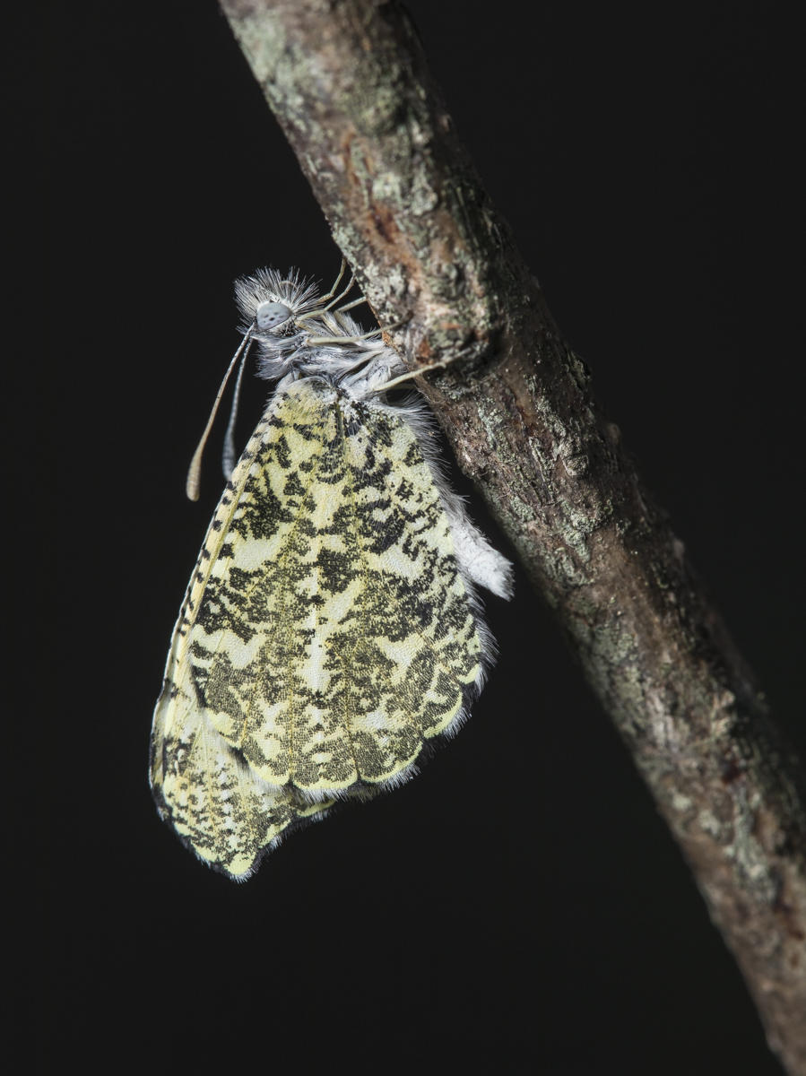
Last year I finally had success in photographing a chrysalis of a beautiful spring-time butterfly, the Falcate Orange-tip. I collected four eggs and their host plants and brought them inside to rear because I had no success in locating their thorn-mimic pupa in the wild. I have kept them on the screen porch all year so they would be exposed to cold temperatures and humidity. I saw my first Falcate Orange-tip flying in the yard on Tuesday of this week, so I figured it was time to start observing my pupae. Sure enough, two emerged yesterday and one early this morning. I photographed the freshly emerged adult (a female) right before releasing her.
Below is the entire sequence from an egg from last March, to larva, to chrysalis, to the adult from this morning. The circle is complete…a sure sign of Spring.
Falcate Orange-tip butterflies with male in courtship flight (click photos to enlarge)Egg (orange-colored structure) on host plantLate instar larva of Falcate Orange-tipPrepupaThe thorn-mimic chrysalis on a twigJust emerged Falcate Orange-tip female on twig above spent chrysalisShe is hardening her wings by pumping fluid from her abdomen through the wing veinsA closer view of the head of a Falcate Orange-tip
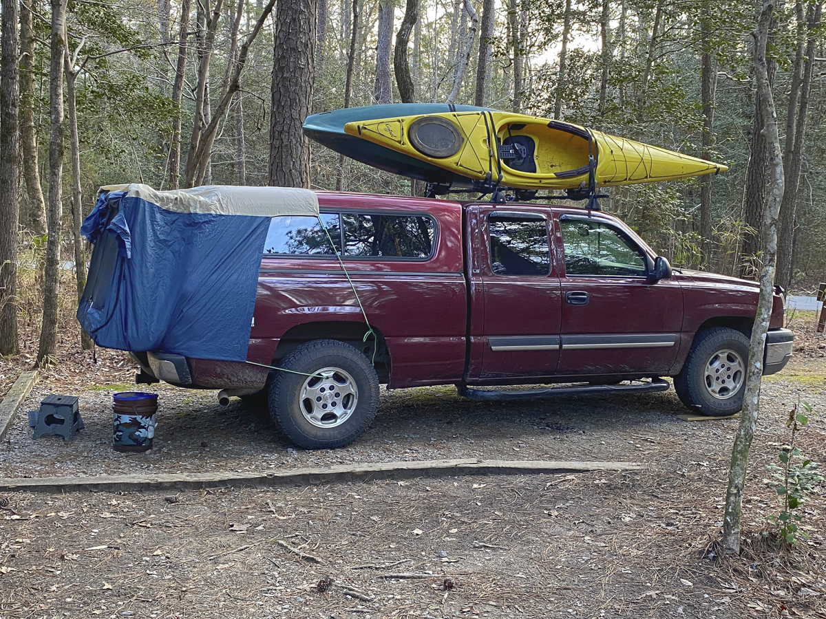
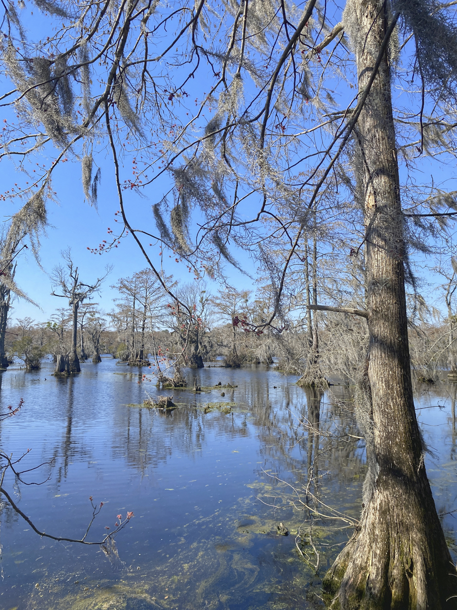
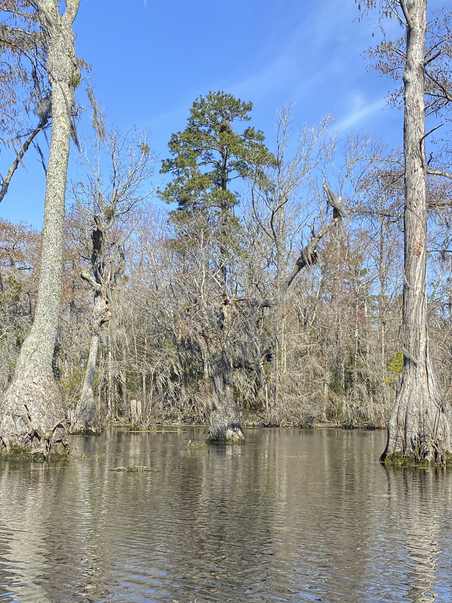
When I worked as a District Naturalist for the state park system oh-so-many years ago, one of my favorite parks was Merchants Millpond State Park in northeastern North Carolina. It is a true natural gem of our state and remains one of my favorite spots to spend some time in the solitude of a beautiful swamp. The millpond was created in 1811 by damming Bennetts Creek to construct a grist mill, sawmill, and other commercial enterprises that gave rise to the name Merchants Millpond. Today, the park encompasses over 3200 acres of cypress-tupelo swamp and beech-mixed hardwood uplands. Melissa has a workshop on the millpond in a few weeks, so she wanted to do a scouting trip and introduce some of her co-leaders to the place. She decided to take a day off for exploring before her staff arrived, so we packed up the truck and threw our kayaks on top for a mid-week adventure in this perfect springtime weather.
Truck camping with some new accessories on top (click photos to enlarge)
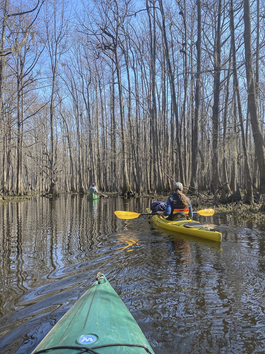
I contacted our friends, Floyd and Signa, that live just outside the park, to see if they wanted to paddle with us on Wednesday. They are some of the best naturalists I know and certainly know the millpond better than anyone (Floyd was a ranger there for many years). They offered to take us up Lassiter Swamp to “the big trees”, a scattered group of Bald Cypress trees that are hundreds of years old and tower above the rest of the swamp forest – heck yeah!
The dominant trees on the millpond – Bald Cypress (left) and Tupelo Gum (right)
The 760-acre millpond is dominated by two tree species – Bald Cypress and Tupelo Gum. Stumps of ancient cypress cut in the 1800’s form islands of vegetation with Swamp Rose, Wax Myrtle and a host of other plant species. Spanish Moss is draped off most of the tree branches and Yellow Cow Lily (Spatterdock) is just starting to poke its leaves out of the water surface.
Spanish Moss adorns many of the trees on the millpond
Paddle to the far end and you enter an entirely different world – Lassiter Swamp. The channel narrows and winds through a maze of gnarled Tupelo Gum that have been transformed into gargoyle-like shapes by Mistletoe (a semi-parasitic plant that causes the gum trees to create odd growths as they forms “scar tissue” in reaction to the Mistletoe’s intrusion). So many trees have been disfigured by the Mistletoe that the entrance to the swamp is known as “the enchanted forest” by locals.
Paddling up Lassiter Swamp with our friendsThe Tupelo Gum take on new forms under the influence of Mistletoe
I have always loved Lassiter Swamp for its solitude and abundance of wildlife. And this trip provided both. As we paddled around one bend, Melissa said, There’s a Raccoon in that tree. I looked, but didn’t see it at first. It was curled up inside a giant gnarl on a gum tree. We were all impressed she spotted it.
The Raccoon treeA closer look reveals the sleepy RaccoonSwamp cuteness
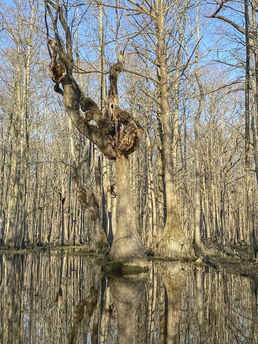
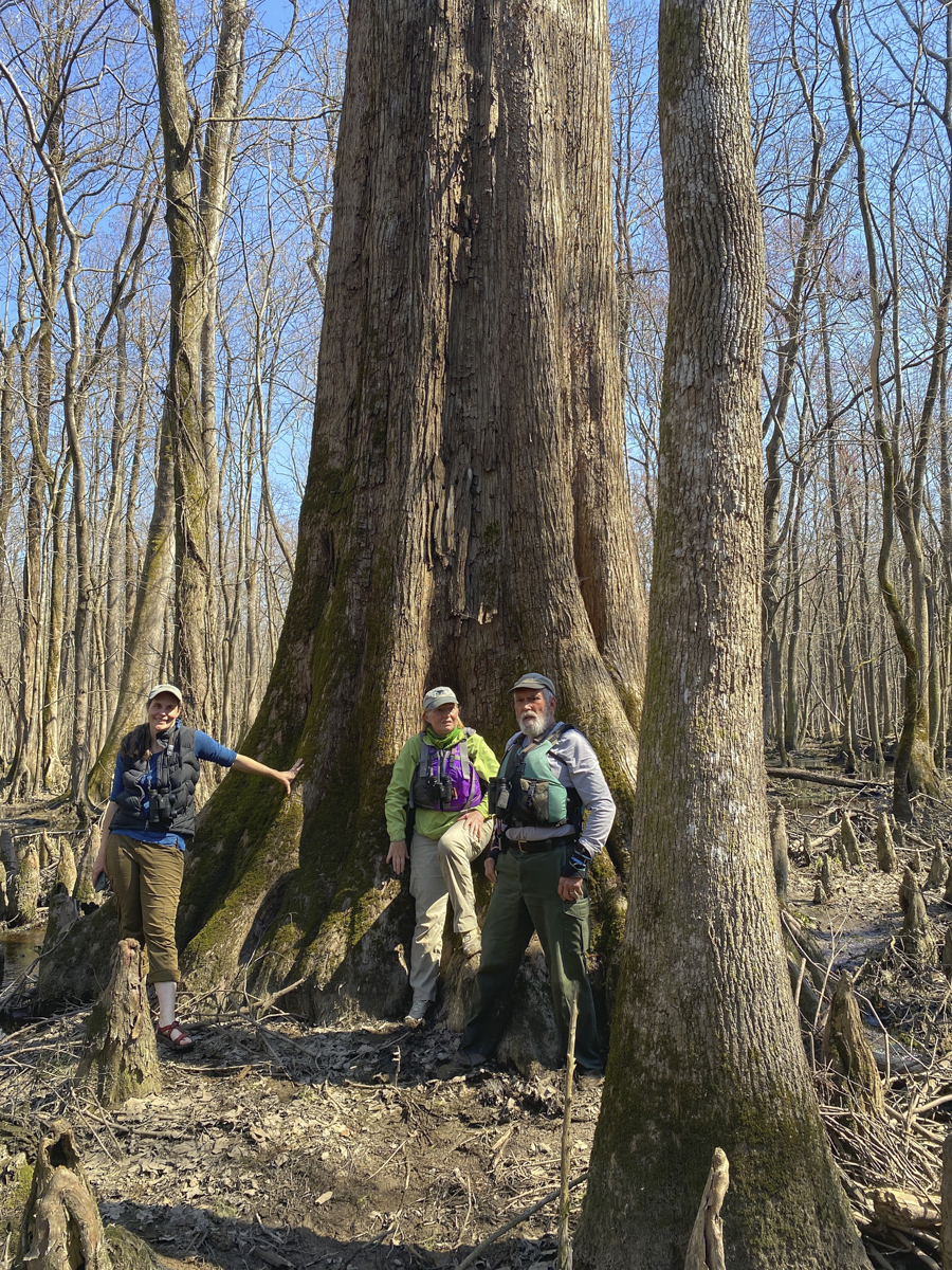
After a few hours of paddling, we started seeing some of the really big Bald Cypress scattered about the upper end of Lassiter Swamp. One of the big ones I remembered climbing inside years ago (9 people could stand inside the hollow base of the giant) had fallen victim to Hurricane Isabelle and lay covered in moss along the creek bank. But the matriarch of the swamp is still standing. This cypress was aged by the team that designated those well-known cypress along the Black River as the oldest known trees in the Eastern United States (one has been dated to be at least 2,624 years old). This tree is much larger than those on the Black River due to the nutrient-rich waters of this swamp and is estimated to be at least 1000 years old. It is humbling to stand next to one of these giants.
Standing next to an ancient sentinel of the swampThis Bald Cypress is estimated to be over 1000 years oldGolden light in the swamp
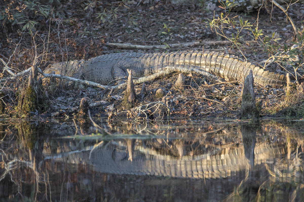
As we paddled back to the launch area, Melissa spotted a large Alligator basking in the late day sun. Floyd told us about the first confirmed Alligator sighting on the millpond back in 1996. Rumors of gators in the park had been around a couple of years, but, in 1996, a fisherman told Floyd he had seen one. In fact, he had caught it while fishing and had it in his boat (he didn’t know what to do with it and had brought it to shore hoping a ranger could help). After unhooking the ~3-foot gator, keeping it in an unused dog pen with a kiddie pool, and contacting wildlife officials, the decision was made to release it back into the millpond. There are now a few Alligators that call the millpond home, including one larger than the ~7-footer we observed.
Alligator sunning on the bank
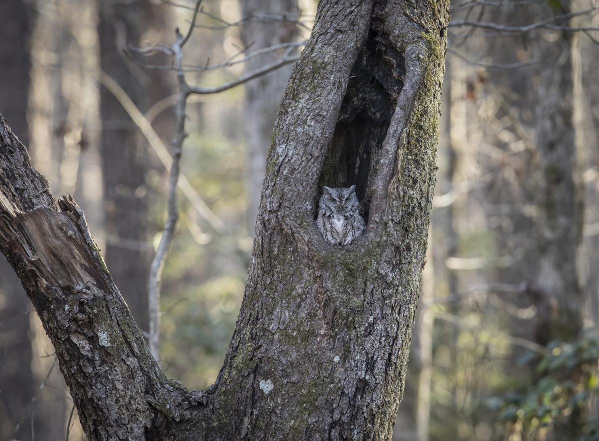
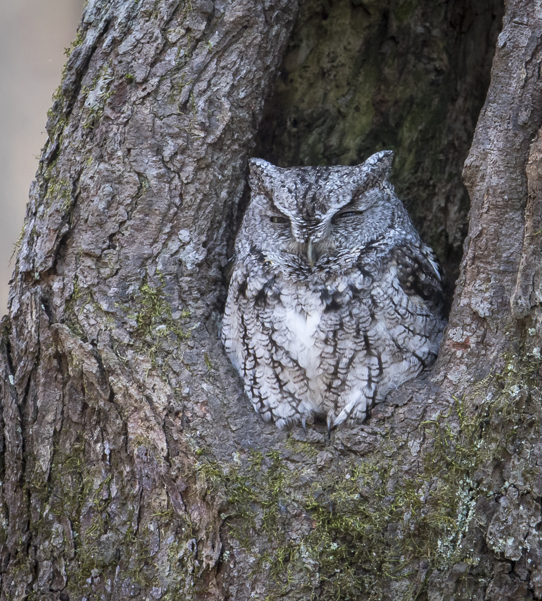
A highlight of the trip was one that did not occur on the millpond but on the uplands. Our friends shared the location of an Eastern Screech Owl roosting in a hollow tree, something I have been hoping to find for several years now (I have seen them, but only when I didn’t have a camera in hand). The owl did not disappoint. It is a gray phase (they can also be reddish in color) and has a perfect perch in the hollow of a tree. We checked the tree each time we drove in and out of the campground and it has a habit of disappearing down into the hollow and then reappearing so you never know when it will be visible. What a treat!
The screech owl treeA closer view of a sleepy Eastern Screech Owl
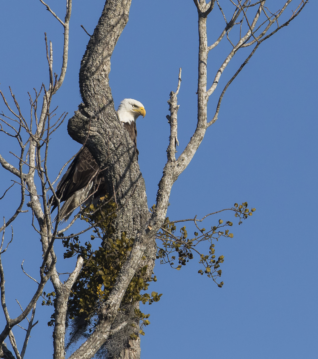
Another wonderful wildlife encounter was the Bald Eagle nest in a tall pine out on the millpond. The eagle is easily seen with binoculars and must be sitting on eggs still as she didn’t move much on either day we paddled.
The nest treeBald Eagle on nest (heavy crop of telephoto image)
On my last trip by the nest tree, the male eagle flew in and perched nearby, giving me the side eye from behind a tree trunk. I paddled on not wanting to disturb them.
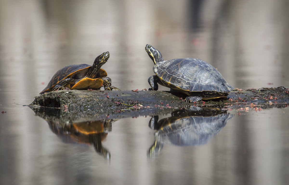
The male flew in and perched nearby as I was paddling back out of the millpondTurtles were basking on almost every log on Thursday (note the very long front claws on the male turtle on the left – used during courtship to stroke the necks of females)
Thursday was even warmer and turtles were everywhere on the millpond. Pickerel Frogs and the occasional Southern Leopard Frog were calling as I paddled solo up the pond to spend the day in the swamp (Melissa was with her co-workers planning the workshop). There is something magical about being in a swamp by yourself. The quiet, the sense of isolation, and yet a feeling of being wrapped in the arms of a living forest. You tend to become a part of the swamp and more in tune to your surroundings.
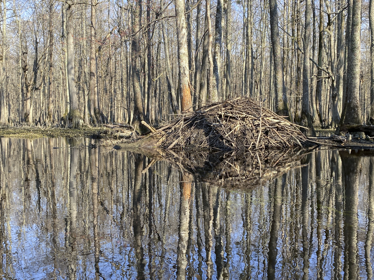
A large Beaver lodge in Lassiter Swamp
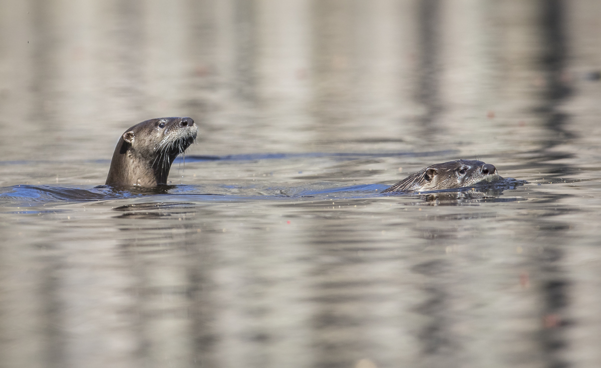
I passed the Raccoon tree and found it empty, but there were plenty of birds and signs of animals (otter scat, beaver lodges and cut trees, raccoon tracks in the mud) as I paddled. Finally, I saw a swirl in the water along one side of the creek and then some movement – otter! I stopped paddling and slowly drifted with camera in hand as the four River Otter realized there was something in their creek and swam out to get a better view. They bobbed up and down, snuffing and snorting as they tried to figure me out. I never got all four in the same field of view at once, but it was great spending a few minutes with these aquatic acrobats. They finally had enough of me and headed upstream.
Two River Otter swimming across the creekThree of the four otter pause to check me out
Two gorgeous male Wood Ducks graced me with their presence as I sat on a beech slope adjacent to the creek eating my lunch. Of course, the camera was in the kayak and as soon as I slowly tried to reach for it, one of the ducks spotted me and the game was over, off they went. On the way out, I paddled along the edge of Lassiter Swamp seeing plenty of Beaver sign and scaring up flocks of Wood Ducks and Ring-necked Ducks, along with a bunch of noisy pairs of Canada Geese.
A Spatterdock root jam swept by the wind into a cove in the upper end of the millpond
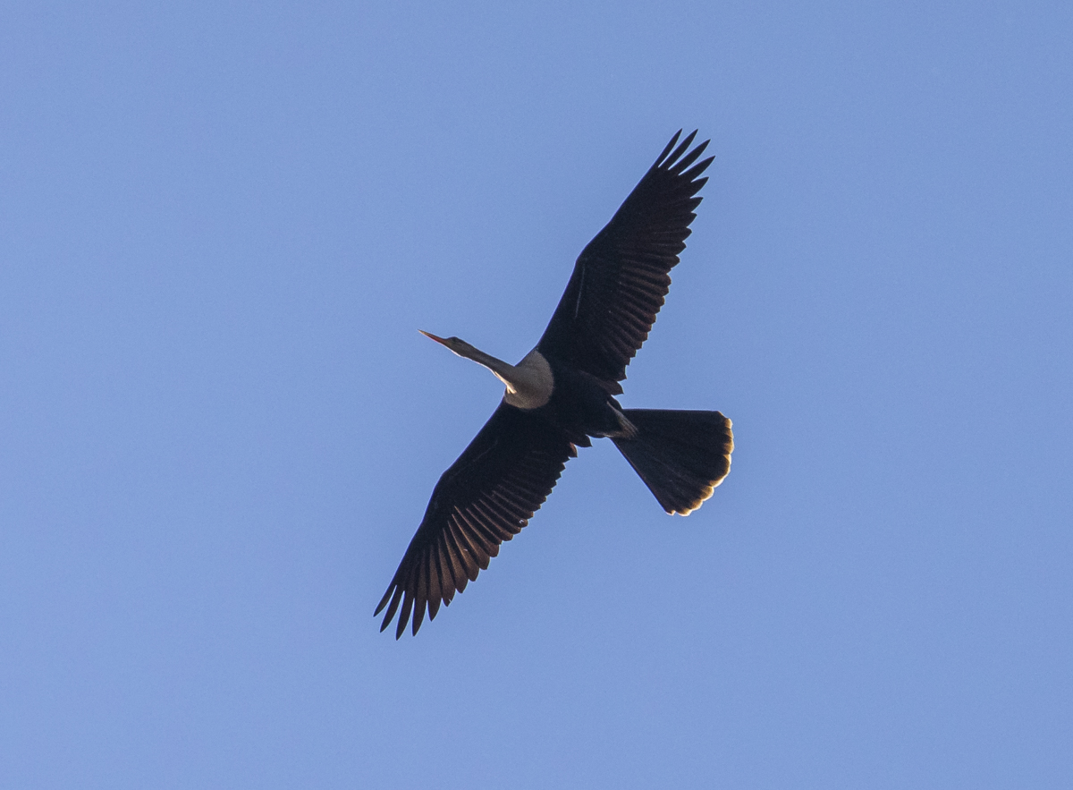
My last wildlife highlight of the day was an Anhinga, a symbol of swamps and black waters in the south. I now see them much more frequently than when I first started paddling the swamps of the Coastal Plain some 40 years ago, but it is always a treat.
An Anhinga flies overhead displaying its distinctive silhouette
Merchants Millpond remains one of my favorites places to spend time on the water. It has a rich history, amazing wildlife, beautiful scenery, great facilities and staff, and can provide you with a sense of being one with a wild place like few other places so close to home. And seeing our friends and knowing all they know and do for the park, it reminds me how much I truly appreciate people like Floyd and Signa that have given (and continue to give) so much to help conserve and make one special wild place available to plants, wildlife, and people. That is one of the things that makes North Carolina State Parks so special, the dedicated people that love and protect them.
For every day of loneliness we endure, we’ll spend a day in communion with the life around us until the loneliness passes away.
~Richard Louv
If you have read previous posts on this blog, you know that we are lucky to live in a beautiful wooded setting with abundant wildlife from insects to birds. But one of the things I have missed the most during this pandemic has been spending time with other wildlife, things we typically don’t see here at home. Yesterday, Melissa had to work (in one of her first in-person workshops in quite some time) so I decided to hit the road and visit some of my favorite spots – the wildlife refuges of Eastern North Carolina.
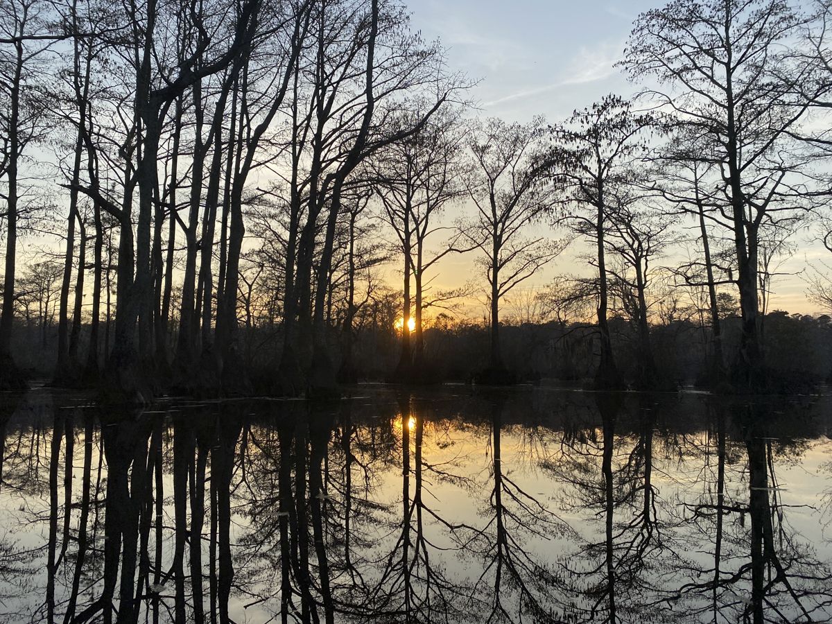
First stop, Pocosin Lakes (aka Pungo). I was surprised to see a few Snow Geese still around along with the usual late Tundra Swans. Several ducks (mainly Northern Shovelers) and four Bald Eagles were a good way to start. All were a bit too far off for photos, so I just watched though binoculars. Some roads are still closed due to the very wet weather and there were already 3 carloads of people at “Bear Road”, so I headed over to Lake Mattamuskeet to try my luck there.
I saw a post last week on Facebook about a Great Horned Owl nest out on the lake, and from the photo, I knew exactly which tree it was in – a small Bald Cypress out on the lake that had an old Osprey nest in it. Great Horned Owls don’t build their own nest, but often use broken snags or nests of other large birds. I had to look from the top of the car in order to get a clear view over the tall Phragmites that lines the lake, but you can clearly see the owls in the nest with binoculars or a spotting scope. My 500mm telephoto (plus 1.4x teleconverter) brings it all in a bit closer, but due to the great distance over water, there is a bit of atmospheric interference, which makes a sharp photo difficult. I saw two young plus an adult at one point but have heard there may be three young in the nest.
Great Horned Owls have taken over an old Osprey nest on Lake Mattamuseet (click photos to enlarge)An adult owl plus two (I think) young can be seen in this photo
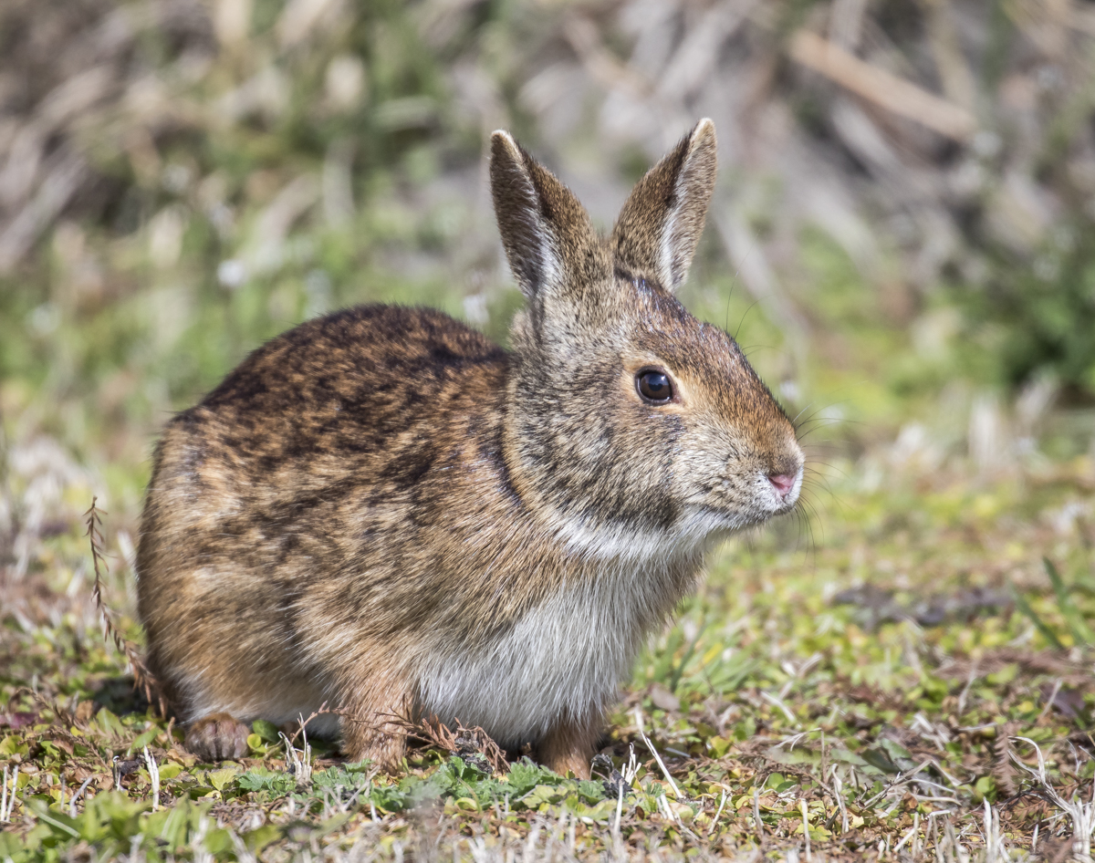
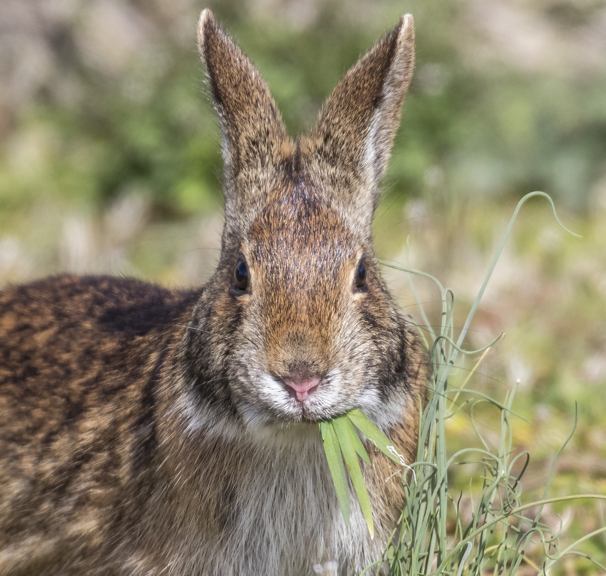
Since many of the waterfowl have headed north, I was hoping to see some other critters as I started down Wildlife Drive. A small, dark rabbit greeted me near the entrance and seemed unconcerned as I slowly pulled over across the road. My first thought was this was a Marsh Rabbit, Sylvilagus palustris. One of three species of rabbits found in NC (Eastern Cottontail and Appalachian Cottontail being the others), Marsh Rabbits are usually found in coastal regions near marshes and swamps. They tend to be slightly darker brown in color, have shorter ears, smaller eyes, and, most distinctly, lack the fluffy white underside to the tail that gives the more common and widespread cottontail its name (their tails are brownish underneath). Unfortunately, this little guy never showed me that part of its anatomy, but I’m still pretty sure its a Marsh Rabbit.
A rabbit out in the open along Wildlife DriveThe rabbit with a mouthful
I enjoyed watching it for several minutes and managed a quick video clip of its constant munching.
This is me with a plate of cookies or chips
I always enjoy the short hike along the New Holland Trail with its beautiful cypress swamp setting. The water levels are very high everywhere in our state right now and, for the first time I can remember, the walk to get to the boardwalk was slightly underwater. But that made for beautiful reflections in the swamp.
The boardwalk on the New Holland Trail at Mattamuskeet NWRRed Maple flowers signaling the arrival of springPlaying with post=processing settings on a phone photo of the cypress reflections along the boardwalk
The far end of Wildlife Drive was closed due to high water and the back side of the loop around the impoundment had the most water I have ever seen. That meant fewer wading birds although I did spy a couple of egrets squabbling over feeding territory.
A Great Egret flies to chase off another in its territory
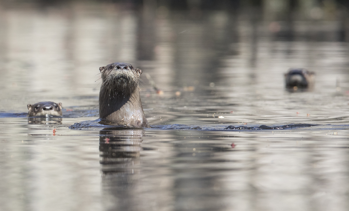
It was still fairly early when I finished my lunch, so I decided to head over to the last refuge for the day, Alligator River NWR. As soon as I drove in off Hwy 264, I spotted an otter in a roadside canal. I stopped to watch and it disappeared into the high water in the trees off the canal. It was the first of five River Otter I spotted in my couple of hours on the refuge. I ended up spending some time with one otter as it swam down a long canal. I would drive ahead and park on the opposite side of the road, then get out and use the vehicle as a blind and a support for my camera and snap a few photos as the otter swam by. Once it was down the canal a bit, I got back in and drove another hundred yards or so beyond the otter to watch it pass again. At one spot, there was an opportunity to get closer due to some trees and brush on my side of the canal. I sat and waited for quite some time and suddenly the otter was alongside me. I managed a couple of quick shots as it passed and then it slowed and turned to look back at me. I imagine the otter might not have been thinking the peaceful thoughts I was having, but it quickly continued on its way.
I spent some time with this River Otter traveling a canal at Alligator River NWRMy favorite photo of a day filled with much needed wildlife encounters
The opening quote above is from a wonderful book (Our Wild Calling) by Richard Louv on the value of human – wildlife interactions. It is the last line in part of a closing paragraph on something he says we should try to adopt in our relations with animal life – what he calls the reciprocity principle. The other parts of that principle are equally worthy of our attention:
For every moment of healing that humans receive from another creature, humans will provide an equal moment of healing for that animal and its kin. For every acre of wild habitat we take, we will preserve or create at least another acre for wildness. For every dollar we spend on classroom technology, we will spend at least another dollar creating chances for children to connect deeply with another animal plant, or person.
Our wildlife refuges go a long way toward meeting the goals of that principle. And I have been lucky to have a small chunk of woodlands to care-take and to have spent a career trying to provide outdoor experiences for a wide range of people. Now I guess I need to figure out how to repay that otter…
Science has never drummed up quite as effective a tranquilizing agent as a sunny spring day.
~W. Earl Hall
It’s coming. We can see it and hear it in our woods. The big change is near – the approach of spring in the Piedmont! The first warm days last weekend ushered in a host of other firsts – our first butterfly of the season (a Question Mark), the first Spring Peepers calling, the first sightings of the numerous Green Frogs in our disheveled water gardens, and so much more. This morning I see the long-range forecast calls for a string of sunny days ahead, something that seems like another first for this year, so I anticipate a lot of other noticeable changes in the coming days. Here are a few of the highlights of our woods wanderings last weekend. As in many of our recent walks, all photos were taken with my phone. At the bottom is a list of bird species we saw or heard on Sunday, a very good day for bird activity, especially raptors and woodpeckers.
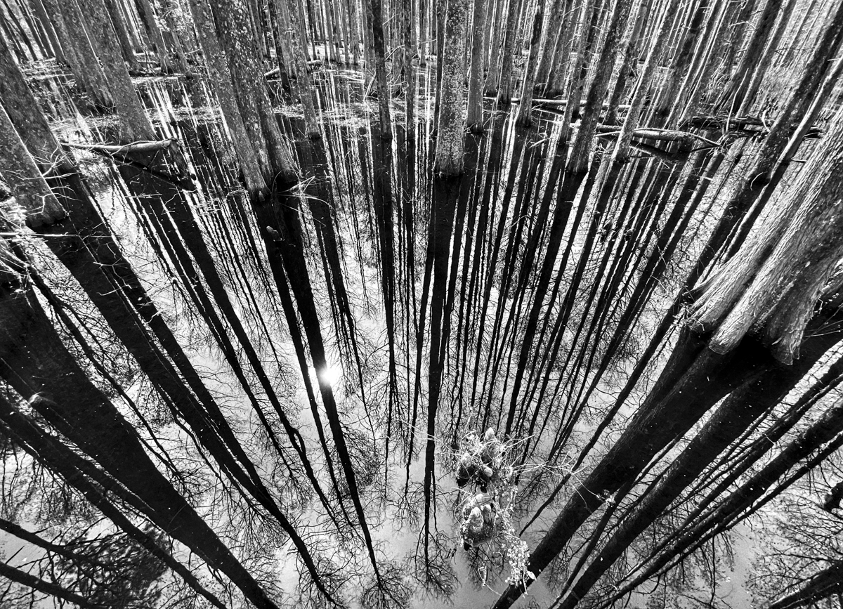
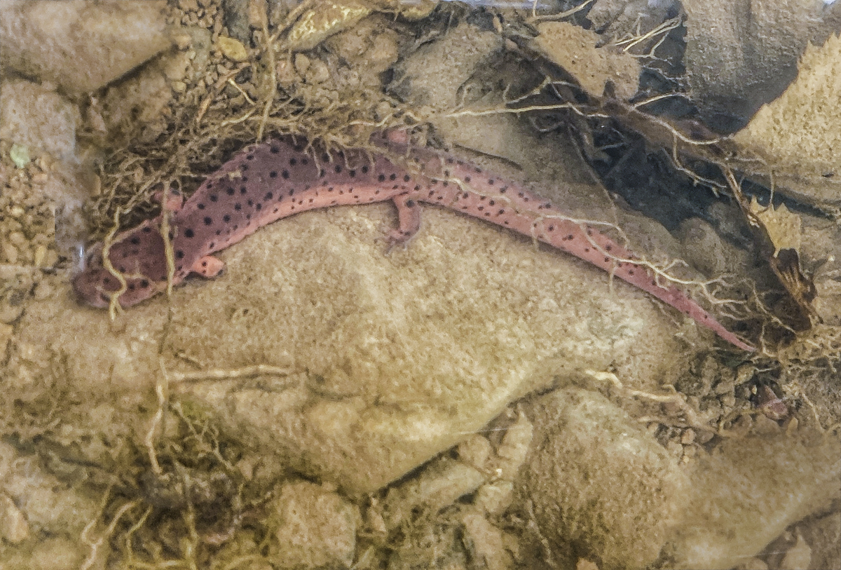
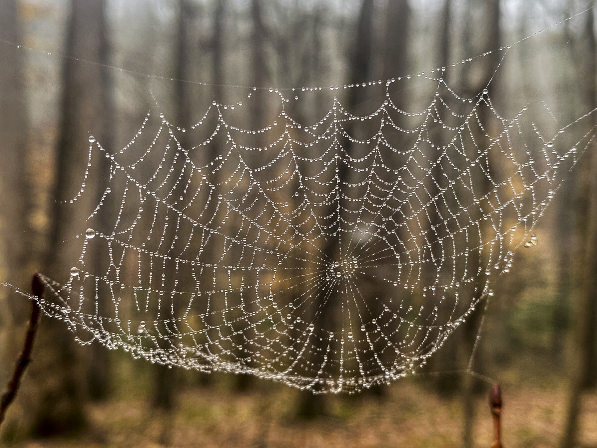
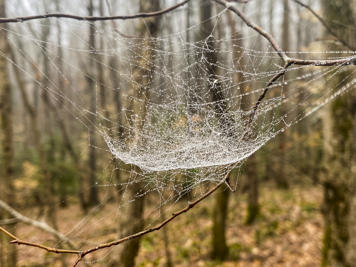
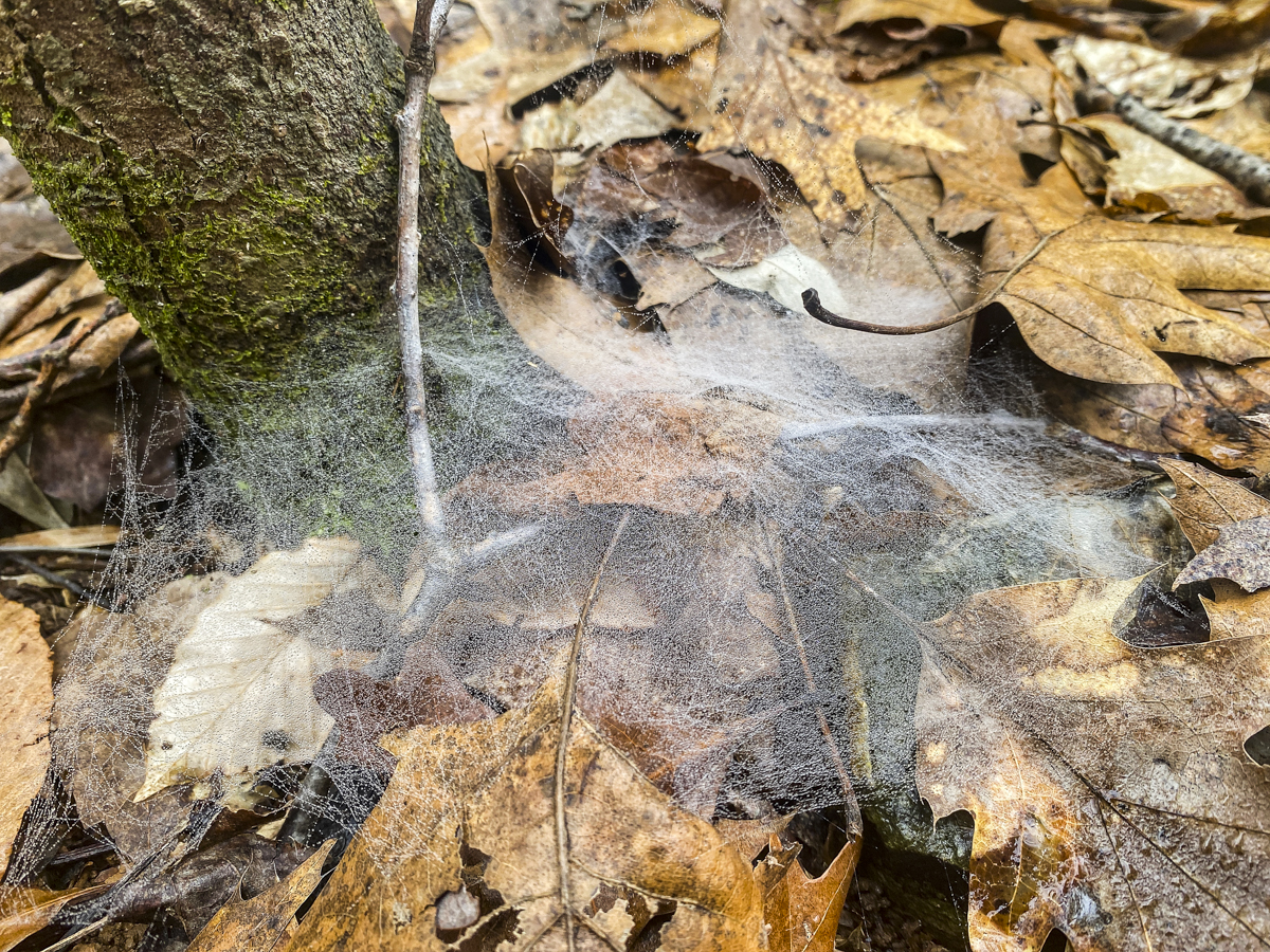
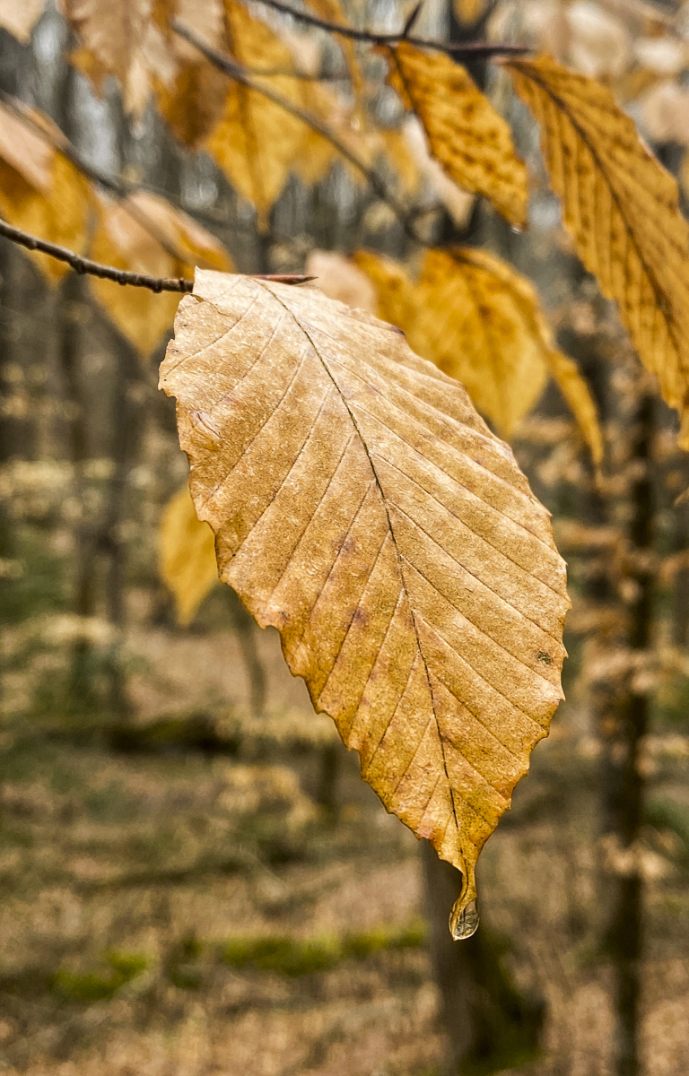
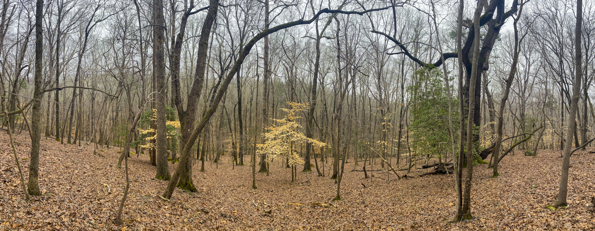
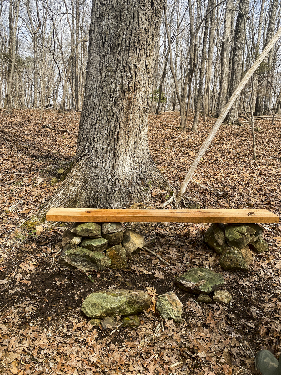
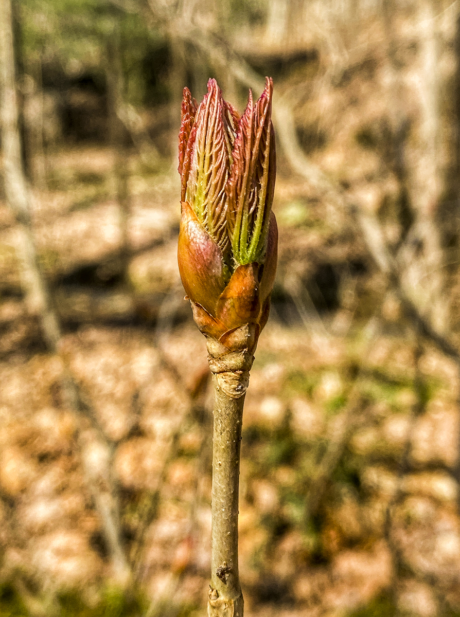
Melissa spotted this (we think it is a Mud Salamander, Pseudotriton montanus) in our little creek over the weekend, a first sighting for this species on our property. Unfortunately, this is our only pic, as one misstep (mine) caused a flood of muddy water to cascade over it and by the time it cleared, this beauty had vanished. (click photos to enlarge)The first spider webs of the season magically appeared on Sunday morning as the fog made their presence known throughout our woods – this one a tiny orb webA Bowl and Doily Spider web in the fogA sheet web on the forest floorAmerican Beech leaves continue to hang on and provide a canvas for the fog dropletsA view of our south slope woodlands across the creek and up the hill from the house (this area is much more open than the woods near our house, which is on the hill you see in the background) Our latest bench on the south slope (one of 4 currently in our patch of woods)One of the first plants to begin leaf out – Painted Buckeye (Aesculus sylvatica)Our first snake of the year, a Brown Snake (Storeria dekayi). These small, harmless snakes are common in the leaf litter in our woods and feed primarily on earthworms, slugs, and other small invertebrates.
Birds from our Sunday explorations in our woods:
Turkey Vulture, Cooper’s Hawk, Red-shouldered Hawk, Red-tailed Hawk, Barred Owl, Red-headed Woodpecker, Red-bellied Woodpecker, Hairy Woodpecker, Downy Woodpecker, Pileated Woodpecker, Northern Flicker, Yellow-bellied Sapsucker, Eastern Phoebe, American Crow, Carolina Chickadee, Tufted Titmouse, Winter Wren, Carolina Wren, Eastern Bluebird, Northern Cardinal, and the still usual suspects at our feeders – Evening Grosbeak, Purple Finch, Pine Siskin, American Goldfinch, Ruby-crowned Kinglet, Pine Warbler, White-breasted Nuthatch, Red-breasted Nuthatch, Dark-eyed Junco